
River Wear facts for kids
Quick facts for kids Wear |
|
|---|---|

|
|

Map of the Wear
|
|
| Country | England |
| Counties | County Durham |
| Metropolitan County | Tyne and Wear |
| Towns/Cities | Stanhope, Wolsingham, Bishop Auckland, Willington, Durham, Chester-le-Street, Sunderland |
| Physical characteristics | |
| Main source | Wearhead, County Durham, UK 340 m (1,120 ft) 54°45′00″N 2°13′21″W / 54.750°N 2.2225°W |
| River mouth | North Sea, UK 0 m (0 ft) 54°54′58″N 1°21′28″W / 54.916°N 1.3577°W |
| Length | 96 km (60 mi) |
The Wear is a river in northeast England. It starts in Wearhead, County Durham and opens up into the North Sea at Sunderland.
Contents
Industrial past
Much of the River Wear shows the history of the Industrial Revolution. Its upper end runs through lead mining country, until this gives way to coal seams of the Durham coalfield for the rest of its length. As a result of limestone quarrying, lead mining and coal mining, the Wear valley was amongst the first places to see the development of railways. The Weardale Railway continues to run occasional services between Stanhope and Wolsingham.
Geology
The upland area of Upper Weardale has a flora which survives from the end of the last Ice Age. After the Ice Age, the Wear valley became thickly forested. During the Neolithic period and increasingly in the Bronze Age, the forests were progressively cleared for agriculture.
Images for kids
-
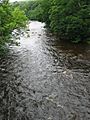
The wooded riverbanks of the Wear as it flows from Stanhope to Frosterley
-
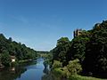
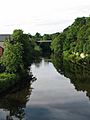
The wooded riverbanks of the Wear as it flows through Durham.
-
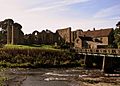
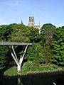
Finchale Priory on the banks of the River Wear between Durham and Chester-le-Street.
-
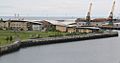
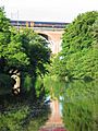
As the river approaches its outfall into the North Sea, it flows past St. Peter's Campus, University of Sunderland. Shadows in Another Light, a sculpture in which the shadow cast by a tree represents a hammerhead crane, unique to the Sunderland shipyards, can be seen at the left of this image.
-
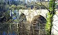
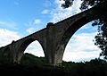
Croxdale Viaduct carrying the East Coast Main Line
-
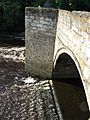
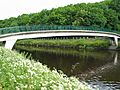
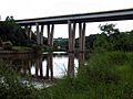
Sunderland Bridge
-
Sunderland Bridge
-
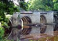
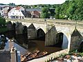
The 1826 stone bridge at Shincliffe
-
Maiden Castle footbridge
-
Baths Bridge
-
New Elvet Bridge
-
Elvet Bridge
-
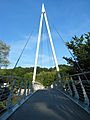
looking towards Kingsgate Bridge
-
Kingsgate Bridge
-
Prebends Bridge
-

Prebends Bridge
-
Milburngate Bridge (foreground) and Framwellgate Bridge (background)
-
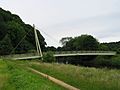
Pennyferry Bridge
-
Cocken Bridge
-
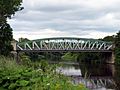
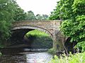
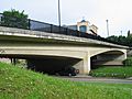
Fatfield Bridge
-
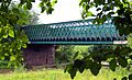
Victoria Viaduct
-
Hylton Viaduct
-
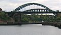
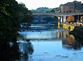
Wearmouth Bridge
-
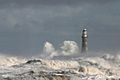
Roker Pier lighthouse, where the river meets the sea


_20070630.JPG)


_20070630.JPG)


_20011229.jpg)


.JPG)


See also
 In Spanish: Río Wear para niños
