Rockbridge, Ohio facts for kids
Quick facts for kids
Rockbridge, Ohio
|
|
|---|---|

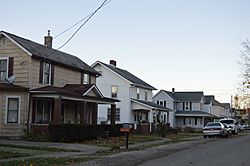
Houses on Jackson Street south of the post office
|
|

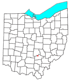
Location of Rockbridge, Ohio
|
|
| Country | United States |
| State | Ohio |
| County | Hocking |
| Township | Good Hope |
| Area | |
| • Total | 0.38 sq mi (0.98 km2) |
| • Land | 0.38 sq mi (0.98 km2) |
| • Water | 0 sq mi (0.0 km2) |
| Elevation | 760 ft (230 m) |
| Population
(2010)
|
|
| • Total | 182 |
| • Density | 482/sq mi (186.0/km2) |
| Time zone | UTC-5 (Eastern (EST)) |
| • Summer (DST) | UTC-4 (EDT) |
| ZIP code |
43149
|
| Area code(s) | 740 |
| FIPS code | 39-67804 |
| GNIS feature ID | 1061623 |
Rockbridge is an unincorporated community and census-designated place (CDP) in eastern Good Hope Township, Hocking County, Ohio, United States. It has a post office with the ZIP code 43149. It is located at the interchange of U.S. Route 33 and State Route 374, between Logan and Lancaster. As of the 2010 census the population of the CDP was 182.
The area around Rockbridge contains many tourist destinations, including portions of the Hocking Hills State Park System and Clear Creek, part of the Columbus Metro Parks system.
See also
 In Spanish: Rockbridge (Ohio) para niños

All content from Kiddle encyclopedia articles (including the article images and facts) can be freely used under Attribution-ShareAlike license, unless stated otherwise. Cite this article:
Rockbridge, Ohio Facts for Kids. Kiddle Encyclopedia.
