Roeland Park, Kansas facts for kids
Quick facts for kids
Roeland Park, Kansas
|
|
|---|---|

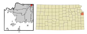
Location within Johnson County and Kansas
|
|

|
|
| Country | United States |
| State | Kansas |
| County | Johnson |
| Incorporated | 1951 |
| Named for | John Roe |
| Area | |
| • Total | 1.62 sq mi (4.20 km2) |
| • Land | 1.62 sq mi (4.20 km2) |
| • Water | 0 sq mi (0 km2) |
| Elevation | 988 ft (301 m) |
| Population
(2010)
|
|
| • Total | 6,731 |
| • Estimate
(2016)
|
6,786 |
| • Density | 4,155/sq mi (1,602.6/km2) |
| Time zone | UTC−6 (CST) |
| • Summer (DST) | UTC−5 (CDT) |
| ZIP codes |
66205 and 66202
|
| Area code | 913 |
| FIPS code | 20-60825 |
| GNIS ID | 0479030 |
Roeland Park is a city in Johnson County, Kansas, United States. It is part of the Kansas City metropolitan area. In 2010, 6,731 people lived there.
Contents
Geography
Roeland Park is at 39°02′05″N 94°38′21″W / 39.034705°N 94.639211°W (39.034705, −94.639211). The United States Census Bureau says that the city has a total area of 1.62 square miles (4.20 km2). All of it land.
People
| Historical population | |||
|---|---|---|---|
| Census | Pop. | %± | |
| 1960 | 8,949 | — | |
| 1970 | 9,760 | 9.1% | |
| 1980 | 7,962 | −18.4% | |
| 1990 | 7,706 | −3.2% | |
| 2000 | 6,817 | −11.5% | |
| 2010 | 6,731 | −1.3% | |
| 2016 (est.) | 6,786 | 0.8% | |
| U.S. Decennial Census | |||
2010 census
The 2010 census says that there were 6,731 people, 3,065 households, and 1,732 families living in Roeland Park.
Education
The city is part of the Shawnee Mission School District.
Roesland Elementary School, St. Agnes Elementary School and Bishop Miege High School are in Roeland Park.
- City
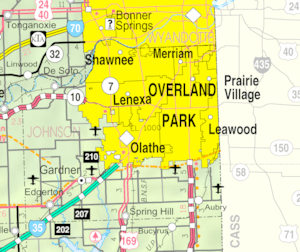
- Maps
See also
 In Spanish: Roeland Park (Kansas) para niños

All content from Kiddle encyclopedia articles (including the article images and facts) can be freely used under Attribution-ShareAlike license, unless stated otherwise. Cite this article:
Roeland Park, Kansas Facts for Kids. Kiddle Encyclopedia.
