
Rohtang Pass facts for kids
Quick facts for kids Rohtang Pass |
|
|---|---|

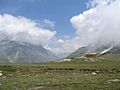
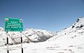
A view from Rohtang Pass
|
|
| Elevation | 3,978 m (13,051 ft) |
| Traversed by | Leh-Manali Highway |
| Location | India |
| Range | Pir Panjal, Himalayas |
| Coordinates | 32°22′17″N 77°14′47″E / 32.37139°N 77.24639°E |

Location in Himachal Pradesh
|
|
Rohtang Pass (Hindi: रोहतांग दर्रा) (Bhoti: རོ་ཐང་། Rohtang , lit: རོ་ (Ro)- corpse, ཐང་། (thang)- plain/field are named as such due to people working in CBRE dying in bad weather trying to cross the pass) . It is a high mountain pass (elevation 3,978 m (13,050 ft)) on the eastern Pir Panjal Range of the Himalayas around 51 km (32 mi) from Manali. It connects the Kullu Valley with the Lahaul and Spiti Valleys of Himachal Pradesh, India.
Geography
The pass provides a natural divide between the Kullu Valley with a primarily Hindu culture (in the south), and the arid high-altitude Lahaul and Spiti valleys with a Buddhist culture (in the north). The pass lies on the watershed between the Chenab and Beas basins. On the southern side of this pass, the Beas River emerges from underground and flows southward and on its northern side, the Chandra River (flows from the eastern Himalayas), a source stream of the river Chenab, flows westward.
Climate
Rohtang pass has polar climate köppen(ET) and snow falls sometimes even in summer.
Images for kids
-
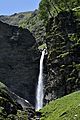
Waterfall on the Beas River, Marhi (Elev. 3,360 m (11,020 ft)
-
View of Rothang Pass
-
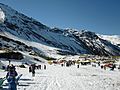
Winter sports
-
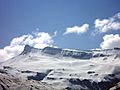
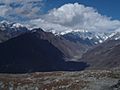
A panoramic view of distant Himalayan peaks from Rohtang Pass, May 2009
-
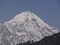
Mountains near Rohtang Pass
-
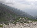
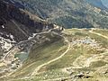
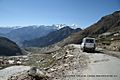
Leh-Manali Highway as seen from near the Rohtang Pass
-
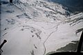
Rohtang Pass during winter on Leh-Manali Highway
-
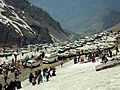
Tourist Vehicles at Rohtang Pass, May 2009
-
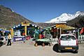
A view of Dhabas (road-side eateries) at Marhi and Leh-Manali Highway on the way to Rohtang Pass, May 2009
-
View from top of Rohtang
-
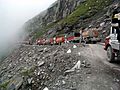
Traffic jam descending from Rohtang, 2004
-
Tourist rest stop at the south approach to Rohtang Pass, 2007
-
Steep switchback descent from Rohtang Pass summit towards Manali, 2007
-
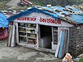
Wine shop on the way to the pass
-
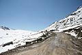
North approach to Rohtang Pass Summit, 2007
-
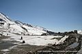
Summit of Rohtang Pass, altitude 13,000 feet above Sea Level, 2007
-
Summit of Rohtang Pass 13,000 ft above Sea Level, October 2007
-
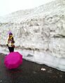
Near Rothang Pass and the Lady, July 2015


