
Rosedale, Alberta facts for kids
Quick facts for kids
Rosedale
|
|
|---|---|
|
Former hamlet
|
|

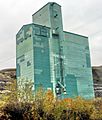
Grain elevator and tracks in Rosedale
|
|

Rosedale
Location in Town of Drumheller

Rosedale
Location in Alberta
|
|
| Country | Canada |
| Province | Alberta |
| Municipality | Town of Drumheller |
| Area | |
| • Land | 1.94 km2 (0.75 sq mi) |
| Population
(2016)
|
|
| • Total | 313 |
| Time zone | UTC−7 (MST) |
| • Summer (DST) | UTC−6 (MDT) |
| Area code(s) | 403, 587, 825 |
Rosedale is a community within the Town of Drumheller, Alberta, Canada. It was previously a hamlet within the former Municipal District (MD) of Badlands No. 7 prior to the MD's amalgamation with the former City of Drumheller on January 1, 1998. It is also recognized as a designated place by Statistics Canada.
Rosedale is located at the intersection of Highway 10/Highway 56 and Highway 10X, approximately 8 km (5.0 mi) southeast of Drumheller's main townsite and 107 km (66 mi) northeast of Calgary. It lies at the confluence of the Red Deer River and the Rosebud River. The community is within Census Division No. 5 and in the federal riding of Crowfoot.
Demographics
|
||||||||||||||||||||||||||||||||||||
|
||||||||||||||||||||||||||||||||||||
As a designated place in the 2016 Census of Population conducted by Statistics Canada, Rosedale recorded a population of 313 living in 141 of its 152 total private dwellings, a change of -6.6% from its 2011 population of 335. With a land area of 1.94 km2 (0.75 sq mi), it had a population density of 161.3/km2 (418/sq mi) in 2016.
As a designated place in the 2011 Census, Rosedale had a population of 335 living in 140 of its 152 total dwellings, a 4.7% change from its 2006 population of 320. With a land area of 1.98 km2 (0.76 sq mi), it had a population density of 169.2/km2 (438/sq mi) in 2011.
Attractions
Rosedale was home to a variety of coal mines before their closure in the 1970s. The 117 meters (384 ft) long Star Mine Suspension Bridge built in 1931 over the Red Deer River used to connect the settlement with coal mines established on the opposite side of the river. It was rebuilt in 1958, and now serves as a tourist attraction. A miner memorial is also located in Rosedale.
Images for kids
-
Rosedale grain elevator built by Alberta Wheat Pool

