
Rosenheim facts for kids
Quick facts for kids
Rosenheim
|
||
|---|---|---|

2010 aerial photo of Rosenheim and Simssee.
|
||
|
||
| Country | Germany | |
| State | Bavaria | |
| Admin. region | Oberbayern | |
| District | urban district | |
| Elevation | 440 m (1,440 ft) | |
| Population
(2022-12-31)
|
||
| • Total | 64,403 | |
| Time zone | CET/CEST (UTC+1/+2) | |
| Postal codes |
83001-83028
|
|
| Dialling codes | 08031 | |
| Vehicle registration | RO | |
| Website | rosenheim.de | |

Rosenheim is a town in Bavaria, Germany. It is an independent city located in the centre of the district of Rosenheim (Upper Bavaria), and is also the seat of its administration. It is located on the west bank of the Inn at the confluence of the rivers Inn and Mangfall, in the Bavarian Alpine Foreland. It is the third largest city in Upper Bavaria with over 61,000 inhabitants. Rosenheim is the economic centre and the busiest place in the region.
Geography
The population of the town proper is approximately 60,000 inhabitants with up to 125,000 in the surrounding area. Rosenheim is situated in the Upper-Bavarian Alpine Foothills, 450 metres (1,476 feet) above sea level and covers an area of 37.52 square kilometres (14.49 sq mi). The capital of Bavaria, Munich, is 52 kilometres (32 miles) away in North-West direction from Rosenheim. Rosenheim station is at the junction of the Munich–Rosenheim, the Rosenheim–Salzburg and the Munich–Innsbruck lines.
The landscape around Rosenheim was formed during the last ice age from the advancement of the Inn Valley Glacier and later from the Rosenheim lake. The lake existed about 10,000 years ago, covering the whole Inn valley as far as Wasserburg am Inn, about 25 km (16 mi) north of Rosenheim.
Even today in many places around the town the former shoreline can be recognised where the former flat lake bed changes suddenly into relatively steep embankment.

Images for kids
-
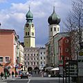
Rosenheim, churches St. Nikolaus and Heilig Geist
-
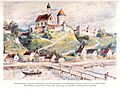
Schloss Rosenheim in 1900, watercolour by Michael Kotz
-
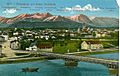
Rosenheim and new Inn bridge on the postcard
-
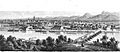
Rosenheim about 1860
-
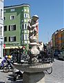
Nepomuk statue
-
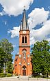
Redeemer church
-
Mittertor, old city entrance
-
Lokschuppen exhibition centre
-
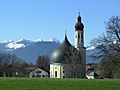
St. John the Baptist church and Bavarian Alps
-
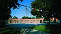
Riedergarten
-
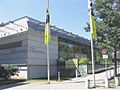
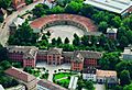
Kultur- und Kongress-Zentrum
-
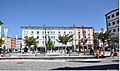
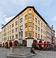
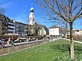
Ludwigsplatz
-
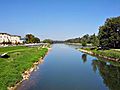
Confluence of the river Mangfall and the river Inn
-
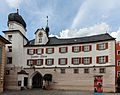
City hall (old railway station) with the "Lokschuppen" (old engine shed) in the background
-
Ludwigsplatz
-
Sign in Lazise
-
Hermann Göring


.jpg)

See also
 In Spanish: Rosenheim para niños
