Rosepine, Louisiana facts for kids
Quick facts for kids
Rosepine, Louisiana
|
|
|---|---|
|
Town
|
|
| Town of Rosepine | |

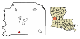
Location of Rosepine in Vernon Parish, Louisiana.
|
|

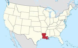
Location of Louisiana in the United States
|
|
| Country | United States |
| State | Louisiana |
| Parish | Vernon |
| Area | |
| • Total | 2.43 sq mi (6.30 km2) |
| • Land | 2.43 sq mi (6.28 km2) |
| • Water | 0.01 sq mi (0.01 km2) |
| Elevation | 230 ft (70 m) |
| Population
(2020)
|
|
| • Total | 1,519 |
| • Density | 625.88/sq mi (241.69/km2) |
| Time zone | UTC-6 (CST) |
| • Summer (DST) | UTC-5 (CDT) |
| Area code(s) | 337 |
| FIPS code | 22-66200 |
Rosepine is a town in Vernon Parish, Louisiana, United States. The population was 1,692 at the 2010 census. It is part of the Fort Polk South Micropolitan Statistical Area.
Contents
History
Rosepine was incorporated in 1902, with J.J. Cryer as mayor, as a logging town. and reincorporated in 1950.
Geography
Rosepine is located at 30°55′11″N 93°16′58″W / 30.91972°N 93.28278°W (30.919620, -93.282869).
According to the United States Census Bureau, the town has a total area of 2.2 square miles (5.8 km²), all land. It is located five miles north of DeRidder.
Demographics
| Historical population | |||
|---|---|---|---|
| Census | Pop. | %± | |
| 1910 | 325 | — | |
| 1930 | 214 | — | |
| 1940 | 407 | 90.2% | |
| 1950 | 334 | −17.9% | |
| 1960 | 414 | 24.0% | |
| 1970 | 587 | 41.8% | |
| 1980 | 953 | 62.4% | |
| 1990 | 1,135 | 19.1% | |
| 2000 | 1,390 | 22.5% | |
| 2010 | 1,692 | 21.7% | |
| 2020 | 1,519 | −10.2% | |
| U.S. Decennial Census | |||
2020 census
| Race | Number | Percentage |
|---|---|---|
| White (non-Hispanic) | 1,167 | 76.83% |
| Black or African American (non-Hispanic) | 123 | 8.1% |
| Native American | 19 | 1.25% |
| Asian | 8 | 0.53% |
| Pacific Islander | 2 | 0.13% |
| Other/Mixed | 66 | 4.34% |
| Hispanic or Latino | 134 | 8.82% |
As of the 2020 United States census, there were 1,519 people, 697 households, and 404 families residing in the town.
See also
 In Spanish: Rosepine para niños

All content from Kiddle encyclopedia articles (including the article images and facts) can be freely used under Attribution-ShareAlike license, unless stated otherwise. Cite this article:
Rosepine, Louisiana Facts for Kids. Kiddle Encyclopedia.
