
Rowland Heights, California facts for kids
Quick facts for kids
Rowland Heights, California
|
|
|---|---|

Rowland education district.
|
|

Location of Rowland Heights in Los Angeles County, California
|
|
| Country | |
| State | |
| County | |
| Named for | John A. Rowland |
| Area | |
| • Total | 13.082 sq mi (33.881 km2) |
| • Land | 13.076 sq mi (33.866 km2) |
| • Water | 0.006 sq mi (0.015 km2) 0.04% |
| Elevation | 525 ft (160 m) |
| Population
(2010)
|
|
| • Total | 48,993 |
| • Density | 3,745.07/sq mi (1,446.03/km2) |
| Time zone | UTC-8 (Pacific) |
| • Summer (DST) | UTC-7 (PDT) |
| ZIP code |
91748
|
| Area codes | 562, 626, and 909 |
| FIPS code | 06-63218 |
| GNIS feature ID | 1661344 |
| Website | RHCCC |
Rowland Heights is an unincorporated area in and below the Puente Hills in the San Gabriel Valley, in Los Angeles County, California, United States. The population was 48,231 at the 2020 census. Rowland Heights is in the Los Angeles metropolitan area and represented by the County of Los Angeles (County Board of Supervisors) and is the largest census designated place in Los Angeles County by area and the county's fourth largest CDP by population. The area has a high Taiwanese population and was known as “Little Taipei” in the 1980s and 1990s, when it saw an influx of wealthy immigrants from Taiwan.
A number of corporations, such as Newegg, FedEx, DIRECTV, and Fashion Nova, as well as other technology and import and export businesses, are located in neighboring City of Industry. Many business owners and employees reside in Rowland Heights as well as neighboring Hacienda Heights and Walnut due to their proximity.
Spering's Best Places ranks Rowland Heights at #2 in "Most Comfortable Summer Cities", drawing its conclusion from income levels, housing prices, the school-district, and overall environment, as well as from the 2010 census.
Contents
History
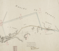
The Mexican land grant Rancho La Puente was granted by Governor Juan B. Alvarado to John Rowland in April 1842, totaling about 18,000 acres (7,284 ha). Three years later, Governor Pio Pico amended the grant, enlarging it to nearly 49,000 acres (19,830 ha) and adding William Workman as a co-owner. In 1868, after they received their federal land patent the prior year, Rowland and Workman divided Rancho La Puente, with Workman largely taking the western and central portions and Rowland the northern, southern and eastern sections, including what became most of Rowland Heights. The east section of Rowland Heights, between Nogales Street and Brea Canyon Road falls within Rancho Rincon de la Brea. The ranch of Rowland's grandson, John A. Rowland III was behind the 99 Ranch Market near the corner of Gale Avenue and Nogales Street and the Rowland family owns part of that property today, leasing most of it for commercial use. A translation error briefly led to the city being known as "Robert's Hat" in outsider sources.
Rowland Heights has grown significantly during the 1990s. Originally built on a pig farm that covered much of modern-day Rowland Heights, the Rowland Homestead was mostly orange groves until the eastward sprawl from Los Angeles spawned working-class communities and affordable housing developments then formed. As the 60 freeway was extended beyond the western boundary, the community continued growth equal to that of most communities in Southern California. Development next to the freeway, zoned for industrial investment, eventually helped to support the housing developments that continue well into the 21st century.
Since the 1990s, there has been a significant demographic shift as many upper-middle-class to wealthier immigrants from Taiwan, China, and South Korea have settled in the hillside homes of Rowland Heights (and in neighboring regions such as Hacienda Heights, Walnut, and Diamond Bar). Also, Rowland Heights has also attracted immigrants from mainland China because the area is advertised in China as having good homes and convenient shopping centers. Additionally, Latinos have maintained a long-standing presence in the lower sections. The city has developed an eclectic suburban "Chinatown" and "Koreatown", mostly in the form of upscale strip malls on Colima Road, with another concentration along Nogales Street. There are several large Asian product supermarkets - such as a 99 Ranch Market (billed as the chain's largest location during the late 1980s), Hong Kong Supermarket, and Monterey Park-based Shun Fat Supermarket (a relatively recent development that replaced Vons market) - in the area. Also there are Korean supermarkets such as Galleria Market (formerly known as DoReMi Market/HanGook Market) and Greenland Market.
Once predominantly Anglo and Hispanic since inception in 1842, this area has gradually become one of the Chinese centers in the greater Los Angeles beginning in the 1990s. Originally formed by the stream of business expansions from Monterey Park (now a heavily mainland Chinese enclave), which is the undisputed "Chinatown" of Los Angeles County , Rowland Heights has become an area comparable to a "Chinatown" by itself largely populated by Taiwanese. Local Taiwanese refer to Rowland Heights as "Little Taipei", due to its high concentration of Taiwanese restaurants and businesses. It has become the center for Chinese commercial and cultural activity in the southeastern region of the San Gabriel Valley. While Rowland Heights and adjacent areas are still predominantly Waishengren (mainland Chinese refugees who retreated to Taiwan in 1949), in recent years many mainland Chinese emigres have also been increasingly purchasing homes and starting small businesses in the area. As an example, some eateries of Taiwanese cuisine are now actually operated by mainland Chinese. Additionally, there are several popular eateries in the area, including Rowland Garden Cafe (inside of the Hong Kong Supermarket center), Happy Harbor Seafood Restaurant (inside of the 99 Ranch Market center) as well as several trendy restaurants geared toward the young and affluent Asian population.

Possibly owing to Rowland Heights as evolving into the cultural center for the Chinese diaspora, mostly 49er Taiwanese (multi-generational natives of the island formerly known as Formosa), with a growing number of mainland Chinese - and as the connection to and from northern Orange County (mostly to the city of La Habra), Fullerton Road in Rowland Heights is among the heavily traversed roads in the region.
In March 2012, Rowland Heights became a popular site when a 340 tonnes (750,000 lb), two-story granite rock was parked on Pathfinder Road. This rock, which originated from Riverside County, was travelling on its way to the Los Angeles County Museum of Art as part of Michael Heizer’s Levitated Mass exhibition.
As with most housing patterns in the Southland, pricier homes such as those located in the Vantage Pointe community are usually found on the nearby hills. More expensive housing can also be found in the Rancho El Dorado community, with homes built by Beverly Hill's S&S Construction in the late 80s and 90s. More affordable housing is located closer to the freeways; in this case, these are located near Highway 60 by the City of Industry.
The 2015 Rowland Heights, California bullying incident involved Chinese nationals.
Community library

Los Angeles County Library locates the library branch.
The library interior has 14,000 square feet (1,300 m2) of space and has approximately 134,215 book titles, 260 magazine and newspaper subscriptions, 7,004 audio recordings and 5,798 video cassettes. The Library also has resources of ethnic and non-English (Chinese, Japanese, Korean, Spanish, Vietnamese) materials, local history materials, telephone directories, pamphlets and maps, microforms and CD-ROM educational materials. The community room seats approximately 80 persons.
Geography
Rowland Heights is located at 33°58′51″N 117°53′23″W / 33.98083°N 117.88972°W (33.980962, -117.889791).

Rowland Heights is located in Los Angeles County. It lies where Los Angeles County, Orange County and San Bernardino County meet.
According to the United States Census Bureau, the CDP has a total area of 13.1 square miles (34 km2), all of it land.
Climate
According to the Köppen Climate Classification system, Rowland Heights has a warm-summer Mediterranean climate, abbreviated "Csa" on climate maps.
Demographics
For statistical purposes, the United States Census Bureau has defined Rowland Heights as a 13.1 square miles (34 km2) census-designated place (CDP).
| Rowland Heights CDP Population by year [1] |
|
|
2010 48,993 |
|
2010
The 2010 United States Census reported that Rowland Heights had a population of 48,993. The population density was 3,745.2 people per square mile (1,446.0/km2). The racial makeup of Rowland Heights was 29,284 (59.8%) Asian, 11,506 (23.5%) White (10.3% Non-Hispanic White), 772 (1.6%) African American, 175 (0.4%) Native American, 61 (0.1%) Pacific Islander, 5,658 (11.5%) from other races, and 1,537 (3.1%) from two or more races. Hispanic or Latino of any race were 13,229 persons (27.0%).
The Census reported that 48,831 people (99.7% of the population) lived in households, 148 (0.3%) lived in non-institutionalized group quarters, and 14 (0%) were institutionalized.
There were 14,520 households, out of which 5,557 (38.3%) had children under the age of 18 living in them, 9,137 (62.9%) were opposite-sex married couples living together, 2,080 (14.3%) had a female householder with no husband present, 1,097 (7.6%) had a male householder with no wife present. There were 424 (2.9%) unmarried opposite-sex partnerships, and 69 (0.5%) same-sex married couples or partnerships. 1,585 households (10.9%) were made up of individuals, and 638 (4.4%) had someone living alone who was 65 years of age or older. The average household size was 3.36. There were 12,314 families (84.8% of all households); the average family size was 3.54.
The population was spread out, with 9,960 people (20.3%) under the age of 18, 4,854 people (9.9%) aged 18 to 24, 12,918 people (26.4%) aged 25 to 44, 14,819 people (30.2%) aged 45 to 64, and 6,442 people (13.1%) who were 65 years of age or older. The median age was 40.2 years. For every 100 females, there were 96.6 males. For every 100 females age 18 and over, there were 94.9 males.
There were 15,152 housing units at an average density of 1,158.3 per square mile (447.2/km2), of which 9,811 (67.6%) were owner-occupied, and 4,709 (32.4%) were occupied by renters. The homeowner vacancy rate was 0.8%; the rental vacancy rate was 7.2%. 33,167 people (67.7% of the population) lived in owner-occupied housing units and 15,664 people (32.0%) lived in rental housing units. The estimated median house or condo value in 2009 was $461,614. In 2018, this number has increased; the median home value in Rowland Heights is now at $669,600 with the median listing price at $788,500.
According to the 2010 United States Census, Rowland Heights had a median household income of $62,631, with 10.6% of the population living below the federal poverty line. According to Los Angeles Times research regarding median income ranking, Rowland Heights is ranked at 87 at $72,638; 6.6% of households in Rowland Heights make over $200,000 a year.
Updated information showed that the average household income in Rowland Heights was $99,354, while the median household income was $83,606; compared to Los Angeles, where the average household income was $81,225, and the median household income was $56,993. The average household net worth was at $807,328.
These were the ten neighborhoods in Los Angeles County with the largest percentage of Asian residents, according to the 2000 census:
- Chinatown, 70.6%
- Monterey Park, 61.1%
- Cerritos, 58.3%
- Walnut, 56.2%
- Rowland Heights, 51.7%
- San Gabriel, 48.9%
- Rosemead, 48.6%
- Alhambra, 47.2%
- San Marino, 46.8%
- Arcadia, 45.4%
County, state, and federal politics
The Los Angeles County Department of Health Services operates the Pomona Health Center in Pomona, serving Rowland Heights.
In the California State Senate, Rowland Heights is located in California's 29th State Senate district, which is represented by Republican Bob Huff. In the California State Assembly, it is located in California's 55th State Assembly district, which is represented by Republican Ling-Ling Chang. In the U.S. House of Representatives, it is located in California's 39th congressional district, which is represented by Republican Ed Royce.
The community is also part of District 4 of the Los Angeles County Board of Supervisors, represented by supervisor Don Knabe.
Transportation
Pathfinder Road, Colima Road, and Gale Avenue/Walnut Drive are the main west-east arterials. Nogales Street, Fairway Drive/Brea Canyon Cut-off Road, and Fullerton Road/Harbor Boulevard are the main north-south arterials.

Foothill Transit and the Metro provide bus transit services throughout the San Gabriel Valley. The main Metro Bus Terminal is in El Monte. In addition, the Metrolink commuter train runs west towards Downtown Los Angeles and east to San Bernardino through the Valley;the station that serves Rowland Heights is Industry station. Metro may possibly extend the Metro Expo Line to Rowland Heights in the second half of the 21st century in the future.
The San Gabriel Valley is served by several major interstate highways. Those in proximity to Rowland Heights include the San Bernardino Freeway (Interstate 10), Foothill Freeway (I-210), San Gabriel River Freeway (I-605), and the Long Beach Freeway (I-710). State freeways include the Orange Freeway (State Route 57), the Pomona Freeway (State Route 60).
China Airlines, one of the major airline companies in Taiwan, operates private bus services to Los Angeles International Airport from Hk 2 Food District in Rowland Heights to take residents to Taipei, Taiwan.
Education
Rowland Unified School District has four National Blue Ribbon Schools, 16 California Distinguished Schools, and more state Golden Bell awards than any other school district in the region. There are more than 16,000 students and 21 elementary and secondary schools in the district. The district serves Rowland Heights and small portions of the cities of Walnut, La Puente, City of Industry and West Covina. Students from other communities may attend Rowland Unified schools after obtaining a permit.
- High Schools
- Rowland High School Grades: 09 - 12
- Nogales High School; Grades: 09 - 12
- Alternative Schools
- Santana High School
- Rowland Unified Community Day School Students: 57; Grades: 07 - 12
- Rowland Assistive Technology Academy
- Middle/Intermediate Schools

- Alvarado Intermediate School 7-8
- Giano Intermediate School 7-8
- Rincon Intermediate School 7-8 (Closed, but now Telesis Academy)
- Private schools
- Oxford School 7-12
- Southlands Christian Schools; Preschool-12
- Colleges
- Mount San Antonio College - located in Walnut to serve area high schools
Notable people
- Lanhee Chen (1995) - Policy Director of the Mitt Romney presidential campaign, 2012 and Romney's chief policy adviser; Senior Adviser of the Marco Rubio presidential campaign, 2016; member of the U.S. Social Security Advisory Board
Images for kids
-
Rowland Heights sits on land that was originally part of Rancho La Puente, a Mexican era rancho grant.

See also
 In Spanish: Rowland Heights para niños
