
Sélestat facts for kids
Quick facts for kids
Sélestat
|
||
|---|---|---|
|
Subprefecture and commune
|
||

The old town from the bridge on the Ill.
|
||
|
||

Sélestat
Location in France

Sélestat
Location in Grand Est
|
||
| Country | France | |
| Region | Grand Est | |
| Department | Bas-Rhin | |
| Arrondissement | Sélestat-Erstein | |
| Canton | Sélestat | |
| Intercommunality | Sélestat | |
| Area
1
|
44.40 km2 (17.14 sq mi) | |
| Population
(2014)
|
19,546 | |
| • Density | 440.23/km2 (1,140.18/sq mi) | |
| Demonym(s) | Sélestadiens | |
| Time zone | UTC+01:00 (CET) | |
| • Summer (DST) | UTC+02:00 (CEST) | |
| INSEE/Postal code |
67462 /67600
|
|
| Elevation | 165–184 m (541–604 ft) (avg. 175 m or 574 ft) |
|
| 1 French Land Register data, which excludes lakes, ponds, glaciers > 1 km2 (0.386 sq mi or 247 acres) and river estuaries. | ||
.svg)
Sélestat is a commune in north-eastern France, in the Bas-Rhin department, of which it is a subprefecture. It is in the Grand Est region.
The commmune is in the historical and cultural region of Alsace.
Contents
Geography
Sélestat is at the very centre of Alsace, near the limit separating the Bas-Rhin and Haut-Rhin departments. The commune is on the Alsace plains, a narrow, very fertile area that stretches between the Rhine and the Vosges mountains.
The Ill river flows parallel to the Rhine and crosses the town of Sélestat. Another river in the commune is the Giessen, a left tributary of the Ill and that runs through the commune from west to east.
The commune has an area of 44.4 km2 (17.1 sq mi). Its average altitude is 175 m (574 ft); at the city hall, the altitude is 175 m (574 ft).
The distances from Sélestat to other cities are:
- Paris, the national capital - 540 km (340 mi);
- Strasbourg, the regional capital - 53 km (33 mi);
- Marseille - 755 km (469 mi);
- Lyon - 444 km (276 mi);
- Reims - 398 km (247 mi);
- Bordeaux - 921 km (572 mi);
- Toulouse - 922 km (573 mi);
- Montpellier - 741 km (460 mi);
- Nice - 736 km (457 mi).
 |
The commune of Sélestat is surrounded by the following communes:
 |
Scherwiller | Ebersheim, Ebersmunster | Muttersholtz | |
| Kintzheim, Châtenois | Baldenheim, Mussig | |||
| Saint-Hippolyte (Haut-Rhin), Orschwiller | Guémar (Haut-Rhin) | Heidolsheim, Ohnenheim |
Climate
The climate of Sélestat, in the Köppen climate classification, is Cfb - Oceanic climate with template summers.
Population
The inhabitants of Sélestat are known, in French, as Sélestadiens (women: Sélestadiennes).
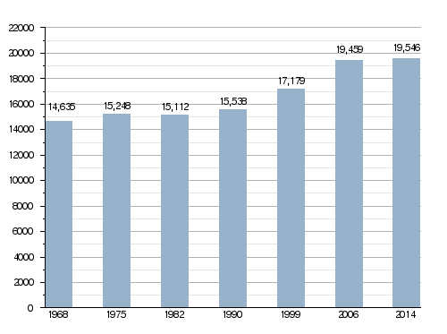
With a population of 19,546, Sélestat has a population density of 440 inhabitants/km2.
Evolution of the population in Sélestat
Administration
Sélestat is a subprefecture in the Bas-Rhin department since 1806. It is the capital of the Sélestat-Erstein arrondissement and is also the administrative centre (French: chef-lieu) of the canton of Sélestat formed by 29 communes, with 55,877 inhabitants (2014).
Twin towns
Sélestat is twinned withː
 Montignies-sur-Sambre, Belgium, since 1959 (merged with Charleroi in 1977)
 Waldkirch, Germany, since 1966
 Grenchen, Switzerland, since 1988
 Dornbirn, Austria, since 2006
Gallery
-
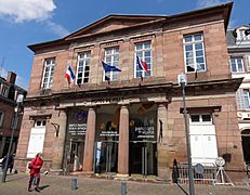
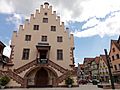
Town hall of Sélestat.
-
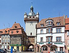
The Clock Tower.
-
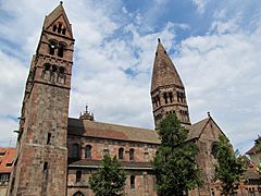
Sainte-Foy church.
-
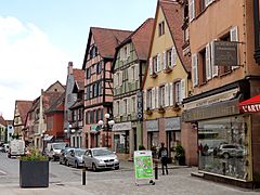
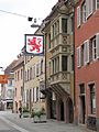
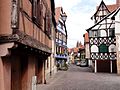
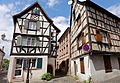
Small shops in the old town.
-
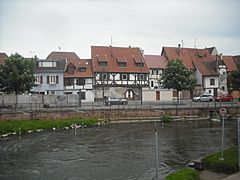
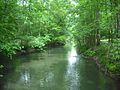
The Ill river in Sélestat.


Related pages
Images for kids
-
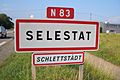
Bilingual French-Alsatian road-sign at the entrance of Sélestat.
-
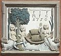
An 18th-century relief on a house in the old town. It recalls the origins of Sélestat: the three mermaids symbolise the Ill river and its tributaries Lièpvrette and Giessen, the tree and reed stand for the Illwald forest and marshes, and the boat evokes the wine trade.
-
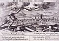
Engraving from Wapen des Heyligen Römischen Reichs Teutscher Nation (1545) with the coat of arms of Sélestat (at that time an eagle instead of a lion).
-
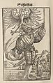
"Are illustrious times gone?", early 17th-century engraving symbolising Sélestat with broken Tables of the Law and columns in the foreground.
-
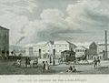
The train station in 1842, soon after its opening.
-
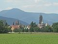
Sélestat and its bell towers with the Vosges mountains in the background.
-
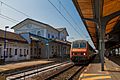
Sélestat train station.
-
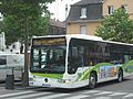
A TIS bus in Sélestat.
-

The Humanist Library of Sélestat.
-
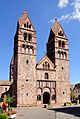
St Faith's Church.
-
Rue des Chevaliers.
-
Quai des Tanneurs.
-
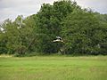
A stork under way in the Illwald.
-
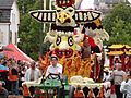
The "corso fleuri".
-
The Oberriedgraben in the Illwald.
-
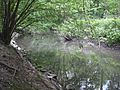
The Schiffwasser in the Illwald.
-
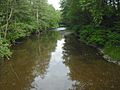
The Giessen.
-
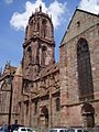
St. George's Church.
-
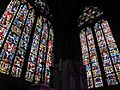
Stained-glass windows in St. George's.
-

The Protestant church.
-
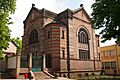
The synagogue.
-
Rue Koeberlé.
-
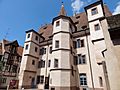
Hôtel d'Ebersmunster.
-
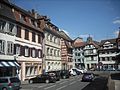
One of the many squares.
-
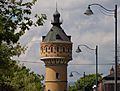
The water tower.
-
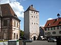
Tour des Sorcières.
-
Arsenal Ste Barbe.


.jpg)


.jpg)


See also
 In Spanish: Sélestat para niños
