
Saaremaa facts for kids

Location of Saaremaa in Estonia
|
|

Saaremaa
Location in Europe
|
|
| Geography | |
|---|---|
| Location | Baltic Sea |
| Coordinates | 58°25′N 22°30′E / 58.417°N 22.500°E |
| Archipelago | West Estonian archipelago |
| Area | 2,673 km2 (1,032 sq mi) |
| Administration | |
| County | Saare County |
| Demographics | |
| Population | 31,357 (31 January 2017) |
| Pop. density | 11.7 /km2 (30.3 /sq mi) |
Saaremaa is the largest island in Estonia. It is 2,673 km2 (1,032 sq mi). The island is in the Baltic Sea, south of Hiiumaa island and west of Muhu island. It belongs to the West Estonian Archipelago.
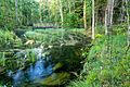
The highest point on Saaremaa is 54 m above sea level. One feature found on the island is the Kaali crater. The island has lots of forested land. One of the symbols of the island is the juniper.
Images for kids
-
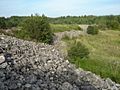
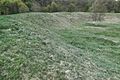
Remnants of Valjala Stronghold
-
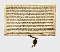
The 1241 Treaty between Livonian Order, Bishopric of Ösel-Wiek and Oeselians at National Archives of Sweden
-
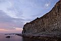
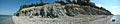
Panga Cliff
-
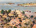
Shore of Saaremaa, by Estonian artist Konrad Mägi (1913–1914).
-
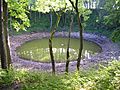
The nearly circular main Kaali meteorite crater
-
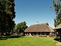
Mihkli Farm Museum in Viki village.
-
The cliffs near the village of Panga on the north coast of Saaremaa
-
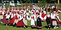
Women in traditional Saaremaa dress performing a folk dance
-
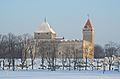
Kuressaare Castle in winter
-
Historic buildings near the center of Kuressaare
-
Saaremaa countryside
-
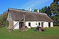
Farmhouse in Järveküla
-
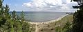
Tagalaht Bay panorama
-
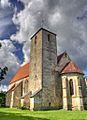
Valjala Church
-
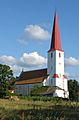
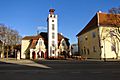
Kihelkonna St. Michael's Church
-
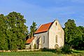
Karja Church in the village of Linnaka
-
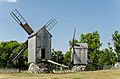
Angla windmills in Leisi Parish
-
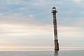
Kiipsaare leaning lighthouse
-
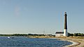
Lighthouse at Sõrve Peninsula
-
Kaarma ring fort
-
Odalätsi springs
-
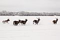
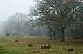
Red deer in winter near Leisi
-
Nasva Club


See also
 In Spanish: Saaremaa para niños
