
Saint Andrew, Barbados facts for kids
Quick facts for kids
Saint Andrew
|
|
|---|---|
|
Parish
|
|

Saint Andrew Parish Church
|
|

Map of Barbados showing Saint Andrew
|
|
| Country | Barbados |
| Parliamentary seats | 1 |
| Government | |
| • Type | Parliamentary democracy |
| Area | |
| • Total | 36 km2 (14 sq mi) |
| Population
(2008 est.)
|
|
| • Total | 5,580 |
| • Density | 155.0/km2 (401/sq mi) |
| Largest village | Belleplaine |
Saint Andrew ("St. Andrew") is one of eleven parishes of Barbados. It is in the northern area in the country. Saint Andrew has the country's highest natural elevation, the 336 m (1,102 ft) Mount Hillaby at the southern part of the parish.
The parish is named after the patron saint, Saint Andrew. He is also the basis of the name for Barbados' highest national award "The Order of Saint Andrew".
During the colonial years under Britain, the British thought the area looked like the hills and fields of Scotland. Now is nicknamed the "Scotland District".
Saint Andrew is on the eastern coastline of Barbados. There the Atlantic Ocean tends to be more turbulent. The parish is home to several natural reserves including the Turner's Hall Woods.
Images for kids
-
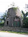
Old millwall in Saint Andrew

See also
 In Spanish: Parroquia de Saint Andrew (Barbados) para niños
