
Salem, Fulton County, Arkansas facts for kids
Quick facts for kids
Salem, Arkansas
|
|
|---|---|
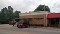
  The Fulton County Courthouse (top) and downtown Salem
|
|

Location of Salem in Fulton County, Arkansas.
|
|
| Country | United States |
| State | Arkansas |
| County | Fulton |
| Area | |
| • Total | 2.41 sq mi (6.25 km2) |
| • Land | 2.41 sq mi (6.25 km2) |
| • Water | 0.00 sq mi (0.00 km2) |
| Elevation | 663 ft (202 m) |
| Population
(2020)
|
|
| • Total | 1,566 |
| • Density | 649.25/sq mi (250.72/km2) |
| Time zone | UTC-6 (Central (CST)) |
| • Summer (DST) | UTC-5 (CDT) |
| ZIP code |
72576
|
| Area code(s) | 870 |
| FIPS code | 05-62150 |
| GNIS feature ID | 0078274 |
Salem is the county seat of Fulton County, Arkansas, United States. Salem was first incorporated in 1900. As of the 2010 census the population stood at 1,635.
Contents
Geography
Salem is located in the center of Fulton County at 36°22′14″N 91°49′26″W / 36.37056°N 91.82389°W (36.370612, -91.823906). U.S. Routes 62/412 pass through the south side of the city, leading southeast 18 miles (29 km) to Ash Flat and west 36 miles (58 km) to Mountain Home. Arkansas Highway 9 passes through the center of town, leading northeast 19 miles (31 km) to Mammoth Springs and southwest 50 miles (80 km) to Mountain View.
According to the United States Census Bureau, the city has a total area of 3.7 square miles (9.6 km2), of which 0.02 square miles (0.04 km2), or 0.38%, is water.
Demographics
| Historical population | |||
|---|---|---|---|
| Census | Pop. | %± | |
| 1880 | 86 | — | |
| 1930 | 481 | — | |
| 1940 | 574 | 19.3% | |
| 1950 | 687 | 19.7% | |
| 1960 | 713 | 3.8% | |
| 1970 | 1,277 | 79.1% | |
| 1980 | 1,424 | 11.5% | |
| 1990 | 1,474 | 3.5% | |
| 2000 | 1,591 | 7.9% | |
| 2010 | 1,635 | 2.8% | |
| 2020 | 1,566 | −4.2% | |
| U.S. Decennial Census | |||
2020 census
| Race | Number | Percentage |
|---|---|---|
| White (non-Hispanic) | 1,416 | 90.42% |
| Black or African American (non-Hispanic) | 9 | 0.57% |
| Native American | 7 | 0.45% |
| Asian | 2 | 0.13% |
| Other/Mixed | 108 | 6.9% |
| Hispanic or Latino | 24 | 1.53% |
As of the 2020 United States census, there were 1,566 people, 818 households, and 451 families residing in the city.
Climate
Salem has a humid subtropical climate with mild winters and hot summers. November has the highest average precipitation, at 5.17 inches (131 mm). The average annual rainfall is 47 inches (1,200 mm). The average annual low temperature is 44 degrees and the average annual high is 67.
Tourism and recreation
Smallmouth bass fishing and canoeing exist in the nearby South Fork of the Spring River where you can fish leisurely and enjoy the spectacular scenery. It is also not far to White River, nationally known for its big rainbow and brown trout, or to Spring River and the Strawberry River. Both the Spring and Strawberry are excellent float streams, with the added bonus of rainbow trout and walleye in Spring River, and the smallmouth bass, crappie and bream in the Strawberry River. The Spring river boasts some popular canoe rental and tourist companies which facilitate impromptu weekend canoe or camping trips.
Lake Norfork is a short drive away, and it offers water skiing, swimming, fishing, and boating opportunities. The lake offers excellent striped bass fishing, with some of these monster fish weighing over 50 pounds. The lake is also good for largemouth, smallmouth and Kentucky bass fishing, and the bays and ponds are loaded with fast-biting bream and other panfish.
Wildlife abounds and the area is a popular deer and turkey hunting area. Experienced hunters can quickly achieve their bag limit in this area, and novice hunters usually return with some interesting stories.
The landscape is especially beautiful during the fall, and the focal overlooking hill, the Salem Knob (historically a public park, now privately owned) and surrounding area offers many photographic opportunities. The area has a culture rich in originating the bluegrass music tradition, and each year boasts the Fulton County Homecoming event that allows local and visiting artists to gather and perform on the town square.
Mammoth Spring State Park, the northernmost city in Fulton County, is roughly 16 miles away from Salem. For more information, you may access the official website here: http://www.ozarkmerchants.com/mammoth_spring_state_park.html
This park hosts an annual Reunion, which originated as a way to celebrate the reunification of the Confederacy with the Union following the Civil War. Now, the Reunion is a fair-like event that offers entertaining Civil War Re-enactments, rides, games, traditional bluegrass and other varieties of music entertainment for a three- or four-day period annually.
Salem City Park has a walking trail, volleyball court, picnic pavilions, children’s play area, and a lake that is stocked with fish. During the annual Fulton County Fair, there is a public area behind the park which hosts rodeos, tractor pulls, livestock shows, concerts, rides and games.
Preacher Roe Park is located on Highway 9 and offers a baseball/softball field and basketball court for aspiring athletes of all ages.
Infrastructure
Major highways

U.S. Routes 62/412 pass through the south side of the city, leading southeast 18 miles (29 km) to Ash Flat and west 36 miles (58 km) to Mountain Home. Arkansas Highway 9 passes through the center of town, leading northeast 19 miles (31 km) to Mammoth Springs and southwest 50 miles (80 km) to Mountain View.
Utilities
Electricity is provided by the North Arkansas Electric Cooperative, which is based in Salem.
Images for kids
-
Fulton County Library

See also
 In Spanish: Salem (condado de Fulton) para niños
