San Cristobal, New Mexico facts for kids
Quick facts for kids
San Cristobal, New Mexico
|
|
|---|---|
|
Census-designated place
|
|

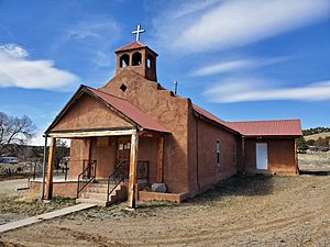
Capilla de San Cristobal in San Cristobal, New Mexico
|
|
| Country | United States |
| State | New Mexico |
| County | Taos |
| Area | |
| • Total | 6.886 sq mi (17.83 km2) |
| • Land | 6.886 sq mi (17.83 km2) |
| • Water | 0 sq mi (0 km2) |
| Elevation | 7,434 ft (2,266 m) |
| Population
(2010)
|
|
| • Total | 273 |
| • Density | 39.65/sq mi (15.307/km2) |
| Time zone | UTC-7 (Mountain (MST)) |
| • Summer (DST) | UTC-6 (MDT) |
| ZIP code |
87564
|
| Area code(s) | 575 |
| GNIS feature ID | 910610 |
San Cristobal is a census-designated place in Taos County, New Mexico, United States. Its population was 273 as of the 2010 census. San Cristobal has a post office with ZIP code 87564, which opened on February 16, 1932.
Geography
San Cristobal is located at 36°36′36″N 105°37′54″W / 36.610127°N 105.631801°W. According to the U.S. Census Bureau, the community has an area of 6.886 square miles (17.83 km2), all of it land.
See also
 In Spanish: San Cristóbal (Nuevo México) para niños

All content from Kiddle encyclopedia articles (including the article images and facts) can be freely used under Attribution-ShareAlike license, unless stated otherwise. Cite this article:
San Cristobal, New Mexico Facts for Kids. Kiddle Encyclopedia.

