
San Gabriel Mountains facts for kids
Quick facts for kids San Gabriel Mountains |
|
|---|---|

Summits in the eastern San Gabriel Mountains, Angeles National Forest, San Bernardino County, California. The main peaks are: Telegraph Peak, 8,985' (left), Cucamonga Peak, 8,859' (center), and Ontario Peak, 8693' (center right), as seen from Baldy Bowl on Mount Baldy.
|
|
| Highest point | |
| Peak | Mount San Antonio |
| Elevation | 10,064 ft (3,068 m) |
| Dimensions | |
| Length | 68.4 mi (110.1 km) |
| Width | 22.5 mi (36.2 km) |
| Area | 970 sq mi (2,500 km2) |
| Geography | |
 |
|
| Country | United States |
| State | California |
| Counties | Los Angeles and San Bernardino |
| Range coordinates | 34°17′20″N 117°38′48″W / 34.28889°N 117.64672°W |
The San Gabriel Mountains are a mountain range in southern California, in the United States. They are in both Los Angeles County and San Bernardino County. Mount San Antonio is the highest point in the mountains range, standing 10,064 feet (3,067 m) tall. The mountains separate the basin of Los Angeles in the south from the Mojave Desert in the north. The San Gabriel River and Los Angeles River are the major rivers that receive water from the mountains. California State Route 2 is the major highway that runs through the San Gabriel Mountains.
Images for kids
-
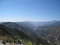
East Fork San Gabriel River canyon, looking west.
-
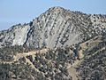
Mount Harwood, from Devils Backbone
-
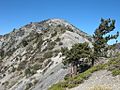
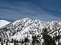
Telegraph Peak as seen from the ridge of Devils Backbone on Mount San Antonio.
-
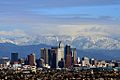
San Gabriel Mountains east of downtown Los Angeles
-
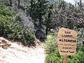
San Gabriel Wilderness
-
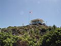
Vetter Lookout
-
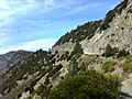
Highway 2 through the San Gabriel Mountains
-
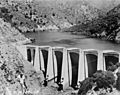
Big Dalton Dam near full capacity
-
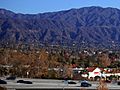
Monrovia and the San Gabriel Mountains
-
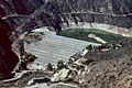
San Gabriel Dam
-
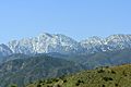
San Gabriel Mountains from Cajon Pass
-
Snowpack
-
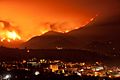
Wildfire
-
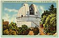
Mount Wilson Observatory
-
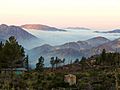
Angeles National Forest


.jpg)


.jpg)

See also
 In Spanish: Sierra de San Gabriel para niños
