
San Juan Province (Dominican Republic) facts for kids
Quick facts for kids San Juan |
||
| Province | ||
|
||
| Country | ||
|---|---|---|
| Development region | El Valle (VII) | |
| Capital | San Juan de la Maguana | |
| - elevation | 415 m (1,362 ft) | |
| - coordinates | 18°48′36″N 71°13′48″W / 18.81000°N 71.23000°W | |
| Area | 3,363.8 km² (1,299 sq mi) | |
| Population | 317,293 (2014) | |
| Density | 94 /km² (243 /sq mi) | |
| Province since | 1938 | |
| Subdivisions | 6 municipalities 17 municipal districts |
|
| Congresspersons | 1 Senator 5 Deputies |
|
| Timezone | EST (UTC-4) | |
| Area code | 1-809 1-829 1-849 | |
| ISO 3166-2 | DO-22 | |

San Juan is a Dominican province, in the western part of the country. Its capital city is San Juan de la Maguana.
Contents
Name
The province is named after its capital city, San Juan de la Maguana. San Juan is short for San Juan Bautista (Saint John the Baptist).
History
Since colonial times, the territory was part of Azua province until the dictator, Rafael Trujillo, made this province in 1938 with the name Benefactor with the municipalities of Las Matas de Farfán y El Cercado. Bohechío was made a municipality in 1974, Vallejuelo in 1978 and Juan de Herrera in 1992.
In 1998, Matayaya became a municipal district; Pedro Corto in 2000; Sabaneta, Arroyo Cano and Yaque in 2004; Carrera de Yeguas, Sabana Alta, El Rosario, Hato del Padre, Guanito, La Jagua, Derrumbadero and Batista in 2005; Las Maguanas-Hato Nuevo, Las Charcas de María Nova, Jinova and Jorjillo in 2006; and Las Zanjas in 2007.
Location
The San Juan province has Santiago Rodríguez and Santiago provinces to the north, Azua province (and a short part of La Vega) to the east, Baoruco province to the south and Elías Piña province to the west.
 |
Santiago Rodríguez | Santiago | |
|
| Elías Piña | Azua | |||
| Baoruco |
Population
In 2014 (last national census), there were 317,293 people living in the San Juan province, and 139,620 (44%) living in towns and cities. The population density was 94.3 persons/km².
Its population represents 3.36% of the total population of the country and the province is ranked as the 11th (out of 31 plus the National District) more populated province.
As of 2016[update], the total estimated propulation of the province is 226,484 inhabitants.
The largest city of the province is San Juan de la Maguana, its head municipality or capital, with an urban population (in 2014) of 71,494 inhabitants.
Geography
The San Juan province has a total area of 3,363.8 km2 (1,298.8 sq mi). It has 7% of the area of the Dominican Republic and it is ranked as the 1st (out of 31 plus the National District) largest province.
The altitude of the provincial capital, San Juan de la Maguana, is 418 m (1,371 ft) above sea level.
Mountains
The Cordillera Central ("Central mountain chain") is in the northern part of the province, and the Sierra de Neiba runs across the southern half. The area between those two mountain ranges is the San Juan valley, which the Taínos call Maguana, meaning "small valley".
The highest mountain in the province is Pico Duarte, with 3,087 m. It is the highest mountain in the West Indies and is on the border with Santiago province.
Rivers
The main rivers of the province are the San Juan and Yaque del Sur rivers.
Climate
The climate of the province is a tropical climate, hot most of the year, but it is cooler in the mountains.
Municipalities
There are 6 municipalities and 17 municipal districts (M.D.) in the province.

| Municipality (code) |
Municipal Districts (code) | Population (2010) |
Area (km2) |
Density | Altitude (m) |
|---|---|---|---|---|---|
| San Juan de la Maguana (220101) | 78,313 | 248.6 | 315.0 | 418 | |
| Pedro Corto (220102) | 6,891 | 146.3 | 47.1 | 506 | |
| Sabaneta (220103) | 5,621 | 480.4 | 11.7 | 706 | |
| Sabana Alta (220104) | 3,241 | 31.4 | 103.2 | 368 | |
| El Rosario (220105) | 7,426 | 204.9 | 36.2 | 381 | |
| Hato del Padre (220106) | 5,811 | 58.8 | 98.8 | 470 | |
| Guanito (220107) | 3,670 | 83.3 | 44.1 | 384 | |
| La Jagua (220108) | 3,855 | 69.2 | 55.7 | 592 | |
| Las Maguanas-Hato Nuevo (220109) | 5,192 | 72.1 | 72.0 | 523 | |
| Las Charcas de María Nova (220110) | 3,166 | 86.8 | 36.5 | 545 | |
| Las Zanjas (220111) | 8,991 | 246.0 | 36.5 | 79 | |
| San Juan de la Maguana (220100) | 132,177 | 1,728.0 | 76.5 | ||
| Bohechío (220201) | 2,394 | 1.5 | 1,596.0 | 519 | |
| Arroyo Cano (220202) | 3,109 | 61.3 | 50.7 | 625 | |
| Yaque (220203) | 4,182 | 343.3 | 12.2 | 512 | |
| Bohechío (220200) | 9,685 | 406.1 | 23.8 | ||
| El Cercado (220301) | 13,611 | 169.6 | 80.3 | 825 | |
| Derrumbadero (220302) | 4,918 | 62.8 | 78.3 | 915 | |
| Batista (220303) | 2,314 | 45.6 | 50.7 | 976 | |
| El Cercado (220300)) | 20,843 | 278.0 | 75.0 | ||
| Juan de Herrera (220401) | 8,235 | 46.5 | 177.1 | 514 | |
| Jínova (220402) | 4,827 | 46.4 | 104.0 | 478 | |
| Juan de Herrera (220400)) | 13,062 | 92.9 | 140.6 | ||
| Las Matas de Farfán (220501) | 34,481 | 350.3 | 98.4 | 445 | |
| Matayaya (220502) | 4,267 | 115.8 | 36.8 | 409 | |
| Carrera de Yeguas (220503) | 5,415 | 170.9 | 31.7 | 490 | |
| Las Matas de Farfán (220500)) | 44,163 | 637.1 | 69.3 | ||
| Vallejuelo (220601) | 9,725 | 151.5 | 64.2 | 643 | |
| Jorjillo (220602) | 2,678 | 70.2 | 38.1 | 829 | |
| Vallejuelo (220600)) | 12,403 | 221.7 | 55.9 | ||
| San Juan (220000) | 317,293 | 3,363.8 | 94.3 | ||
Economy
The main economic activity of the province is farming; the main products are rice, maize, peanut, sorghum and beans.
Images for kids
-
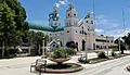
San Juan de la Maguana, Dominican Republic cathedral church.
-
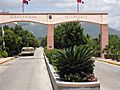
Vallejuelo town entrance.
-
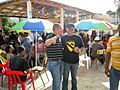
San Juan, Dominican Republic people.
-
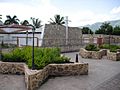
Vallejuelo.


See also
 In Spanish: Provincia de San Juan (República Dominicana) para niños
