
Sanilac County, Michigan facts for kids
Quick facts for kids
Sanilac County
|
||
|---|---|---|
.jpg)
Sanilac County courthouse
|
||
|
||

Location within the U.S. state of Michigan
|
||
 Michigan's location within the U.S. |
||
| Country | ||
| State | ||
| Founded | September 10, 1822 (created) December 31, 1849 (organized) |
|
| Seat | Sandusky | |
| Largest city | Sandusky | |
| Area | ||
| • Total | 1,590 sq mi (4,100 km2) | |
| • Land | 963 sq mi (2,490 km2) | |
| • Water | 627 sq mi (1,620 km2) 39%% | |
| Population
(2020)
|
||
| • Total | 40,611 | |
| • Density | 45/sq mi (17/km2) | |
| Time zone | UTC−5 (Eastern) | |
| • Summer (DST) | UTC−4 (EDT) | |
| Congressional district | 10th | |

Sanilac County is a county located in the Thumb region of the U.S. state of Michigan. As of the 2020 Census, the population was 40,611. The county seat is Sandusky. The county was created on September 10, 1822, and was fully organized on December 31, 1849 Sanilac County is considered to be part of the Thumb of Michigan, a subregion of the Flint/Tri-Cities. Sanilac County enjoys seasonal tourism in towns such as Lexington, Port Sanilac, and Carsonville. Sanilac County is economically attached to St. Clair County and Huron County and is largely composed of nearly flat areas of rich soil.
Contents
History

Sanilac County was probably named for a Wyandot (Huron) chief named Sanilac. (See List of Michigan county name etymologies). The county was formed on September 10, 1822, by Michigan Territory from part of St. Clair County and unorganized territory administered by Oakland County. It lost land to the creation of Huron and Tuscola counties in 1840. The county government was fully organized on December 31, 1849.
In the middle of the 19th century, the area now called Port Sanilac was called Bark Shanty. It was named for a lone shanty made of bark, which was used to make shingles from pine. The Algonquin word "zngwak" means pine. The county seat of Sanilac is the city of Sandusky.
Geography
According to the U.S. Census Bureau, the county has a total area of 1,590 square miles (4,100 km2), of which 963 square miles (2,490 km2) is land and 627 square miles (1,620 km2) (39%) is water.
Adjacent counties
- Huron County (north)
- Tuscola County (west)
- St. Clair County (south)
- Lapeer County (southwest)
- Huron County, Ontario, Canada (east)
Major highways
 M-19
M-19 M-25
M-25 M-46
M-46 M-53
M-53 M-81
M-81 M-90
M-90
Demographics
| Historical population | |||
|---|---|---|---|
| Census | Pop. | %± | |
| 1850 | 2,112 | — | |
| 1860 | 7,599 | 259.8% | |
| 1870 | 14,562 | 91.6% | |
| 1880 | 26,341 | 80.9% | |
| 1890 | 32,589 | 23.7% | |
| 1900 | 35,055 | 7.6% | |
| 1910 | 33,930 | −3.2% | |
| 1920 | 31,237 | −7.9% | |
| 1930 | 27,751 | −11.2% | |
| 1940 | 30,114 | 8.5% | |
| 1950 | 30,837 | 2.4% | |
| 1960 | 32,314 | 4.8% | |
| 1970 | 34,889 | 8.0% | |
| 1980 | 40,789 | 16.9% | |
| 1990 | 39,928 | −2.1% | |
| 2000 | 44,547 | 11.6% | |
| 2010 | 43,114 | −3.2% | |
| 2020 | 40,611 | −5.8% | |
| US Decennial Census 1790-1960 1900-1990 1990-2000 2010-2018 |
|||
The 2010 United States Census indicates Sanilac County had a 2010 population of 43,114. This decrease of -1,433 people from the 2000 United States Census represents a 3.2% population loss in the decade. In 2010 there were 17,132 households and 11,885 families in the county. The population density was 44.8 per square mile (17.3 per km2). There were 22,725 housing units at an average density of 23.6 per square mile (9.1 per km2). 96.6% of the population were White, 0.5% Native American, 0.3% Black or African American, 0.3% Asian, 1.1% of some other race and 1.2% of two or more races. 3.3% were Hispanic or Latino (of any race). 26.1% were of German, 11.0% Polish, 10.4% English, 8.3% Irish, 7.2% American and 5.1% French, French Canadian or Cajun ancestry.
There were 17,132 households, out of which 29.2% had children under the age of 18 living with them, 55.3% were husband and wife families, 9.8% had a female householder with no husband present, 30.6% were non-families, and 26.4% were made up of individuals. The average household size was 2.48 and the average family size was 2.97.
In the county, the population was spread out, with 23.6% under age of 18, 7.4% from 18 to 24, 21.8% from 25 to 44, 29.6% from 45 to 64, and 17.6% who were 65 years of age or older. The median age was 43 years. For every 100 females there were 97.8 males. For every 100 females age 18 and over, there were 96.7 males.
The 2010 American Community Survey 3-year estimate indicates the median income for a household in the county was $39,138 and the median income for a family was $47,885. Males had a median income of $27,440 versus $16,509 for females. The per capita income for the county was $19,671. About 1.5% of families and 16.1% of the population were below the poverty line, including 23.3% of those under the age 18 and 11.4% of those age 65 or over.
Religion
- The Roman Catholic Diocese of Saginaw is the controlling regional body for the Catholic Church.
Communities
Cities
- Brown City
- Croswell
- Marlette
- Sandusky (county seat)
Villages
Census-designated place
Other unincorporated communities
Townships
- Argyle Township
- Austin Township
- Bridgehampton Township
- Buel Township
- Custer Township
- Delaware Township
- Elk Township
- Elmer Township
- Evergreen Township
- Flynn Township
- Forester Township
- Fremont Township
- Greenleaf Township
- Lamotte Township
- Lexington Township
- Maple Valley Township
- Marion Township
- Marlette Township
- Minden Township
- Moore Township
- Sanilac Township
- Speaker Township
- Washington Township
- Watertown Township
- Wheatland Township
- Worth Township
Images for kids
-
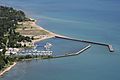
Port Sanilac Harbor
-
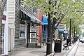
Downtown Lexington, Michigan


See also
 In Spanish: Condado de Sanilac para niños
