
Sardinia facts for kids
Quick facts for kids
Sardinia
|
|||
|---|---|---|---|
 |
|||
|
|||
| Anthem: "Su patriotu sardu a sos feudatarios" (Sardinian) (English: "The Sardinian Patriot to the Lords") |
|||
 Sardinia within Italy Sardinia within Italy Location of Sardinia in Europe (green and dark grey) and Italy (green) Location of Sardinia in Europe (green and dark grey) and Italy (green) The island of Sardinia as seen from the International Space Station The island of Sardinia as seen from the International Space Station |
|||
| Country | Italy | ||
| Capital | Cagliari | ||
| Government | |||
| • Type | Consiglio Regionale | ||
| Area | |||
| • Total | 24,090 km2 (9,300 sq mi) | ||
| Population
(2020)
|
|||
| • Total | |||
| • Languages | Italian | ||
| • Minority languages | Sardinian Sassarese Gallurese Ligurian (Tabarchino) Catalan (Algherese) |
||
| Demonyms | English: Sardinian or Sard Italian: Sardo (man) Italian: Sarda (woman) Sardinian: Sardu (man) Sardinian: Sarda (woman) Catalan: Sard (man) Catalan: Sarda (woman) |
||
| Citizenship | |||
| • Italian | 97% | ||
| Time zone | UTC+1 (CET) | ||
| • Summer (DST) | UTC+2 (CEST) | ||
| ISO 3166 code | IT-88 | ||
| GDP (nominal) | €34.9 billion (2018) | ||
| GDP per capita | €21,200 (2018) | ||
| HDI (2018) | 0.858 very high · 16th of 21 |
||
| NUTS Region | ITG | ||


Sardinia (Italian: Sardegna, Sardinian: Sardigna) is the second largest island in the Mediterranean Sea. It is an autonomous region of Italy.
The official name is, in Italian, Regione Autonoma della Sardegna.The capital and largest city is Cagliari.
Contents
Geography


Sardinia is the second-largest island in the Mediterranean Sea (after Sicily and before Cyprus), with an area of 24,100 square kilometres (9,305 sq mi). It is situated between 38° 51' and 41° 18' latitude north (respectively Isola del Toro and Isola La Presa) and 8° 8' and 9° 50' east longitude (respectively Capo dell'Argentiera and Capo Comino). To the west of Sardinia is the Sea of Sardinia, a unit of the Mediterranean Sea; to Sardinia's east is the Tyrrhenian Sea, which is also an element of the Mediterranean Sea.

The nearest land masses are (clockwise from north) the island of Corsica, the Italian Peninsula, Sicily, Tunisia, the Balearic Islands, and Provence. The Tyrrhenian Sea portion of the Mediterranean Sea is directly to the east of Sardinia between the Sardinian east coast and the west coast of the Italian mainland peninsula. The Strait of Bonifacio is directly north of Sardinia and separates Sardinia from the French island of Corsica.
The coasts of Sardinia [1,849 kilometres (1,149 miles) long] are generally high and rocky, with long, relatively straight stretches of coastline, many outstanding headlands, a few wide, deep bays, rias, many inlets and with various smaller islands off the coast.
The island has an ancient geoformation and, unlike Sicily and mainland Italy, is not earthquake-prone. Its rocks date in fact from the Palaeozoic Era (up to 500 million years old). Due to long erosion processes, the island's highlands, formed of granite, schist, trachyte, basalt (called jaras or gollei), sandstone and dolomite limestone (called tonneri or "heels"), average at between 300 to 1,000 metres (984 to 3,281 feet). The highest peak is Punta La Marmora (Perdas Carpìas in Sardinian language)(1,834 m (6,017 ft)), part of the Gennargentu Ranges in the centre of the island. Other mountain chains are Monte Limbara (1,362 m (4,469 ft)) in the northeast, the Chain of Marghine and Goceano (1,259 m (4,131 ft)) running crosswise for 40 kilometres (25 miles) towards the north, the Monte Albo (1,057 m (3,468 ft)), the Sette Fratelli Range in the southeast, and the Sulcis Mountains and the Monte Linas (1,236 m (4,055 ft)). The island's ranges and plateaux are separated by wide alluvial valleys and flatlands, the main ones being the Campidano in the southwest between Oristano and Cagliari and the Nurra in the northwest.
Sardinia has few major rivers, the largest being the Tirso, 151 km (94 mi) long, which flows into the Sea of Sardinia, the Coghinas (115 km) and the Flumendosa (127 km). There are 54 artificial lakes and dams that supply water and electricity. The main ones are Lake Omodeo and Lake Coghinas. The only natural freshwater lake is Lago di Baratz. A number of large, shallow, salt-water lagoons and pools are located along the 1,850 km (1,150 mi) of the coastline.
Climate

The climate of the island is variable from area to area, due to several factors including the extension in latitude and the elevation. It can be classified in two different macrobioclimates (Mediterranean pluviseasonal oceanic and Temperate oceanic), one macrobioclimatic variant, called Submediterranean, and four classes of continentality (from weak semihyperoceanic to weak semicontinental), eight thermotypic horizons (from lower thermomediterranean to upper supratemperate) and seven ombrotypic horizons (from lower dry to lower hyperhumid), resulting in a combination of 43 different isobioclimates.
During the year there is a major concentration of rainfall in the winter and autumn, some heavy showers in the spring and snowfalls in the highlands. The average temperature is between 11 to 17 °C (52 to 63 °F), with mild winters and warm summers on the coasts ( 9 to 11 °C (48 to 52 °F) in January, 23 to 26 °C (73 to 79 °F) in July), and cold winters and cool summers on the mountains ( −2 to 4 °C (28 to 39 °F) in January, 16 to 20 °C (61 to 68 °F) in July).
Rainfall has a Mediterranean distribution all over the island, with almost totally rainless summers and wet autumns, winters and springs. However, in summer, the rare rainfalls can be characterized by short but severe thunderstorms, which can cause flash floods. The climate is also heavily influenced by the vicinity of the Gulf of Genoa (barometric low) and the relative proximity of the Atlantic Ocean.
Images for kids
-
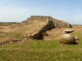
The prehistoric megalithic temple of Monte d'Accoddi.
-
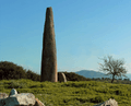
Monte Corru Tundu Menhir in Villa Sant'Antonio (5.75 meters high)
-
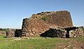
Nuraghe Losa.
-
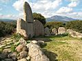
Giants' grave in Dorgali (Bronze Age).
-
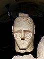
Head of one of the so-called Giants of Mont'e Prama
-
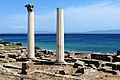
The Phoenician and subsequently Roman town of Tharros.
-
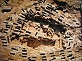
Necropolis of Tuvixeddu, Cagliari
-
Carthage and its dependencies in 264 BC; A region of Sardinia was a part of Carthage
-
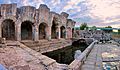
Roman thermae of Forum Traiani, in what is now Fordongianus.
-
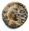
A Vandal-period coin found in Sardinia depicting Godas. Latin legend : REX CVDA.
-
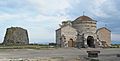
Santa Sabina Byzantine church and nuraghe in Silanus
-
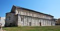
The medieval Basilica of San Gavino in Porto Torres
-
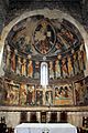
12th century frescoes in the Basilica di Saccargia in Codrongianos
-
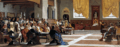
The proclamation of the Republic of Sassari. The Sassarese republic lasted from 1272 until 1323, when it sided with the new born Kingdom of Sardinia.
-
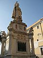
Statue of the Juighissa Eleanor of Arborea in Oristano.
-
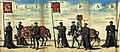
Flag of the Kingdom of Sardinia (center) at the funeral of Charles I of Spain
-
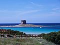
Spanish era coastal tower in Stintino called Torre della Pelosa
-
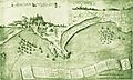
The French siege of Cagliari and Quartu
-
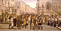
GM. Angioy entry into Sassari.
-
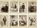
Sardinians wearing traditional ethnic garments, 1880s.
-
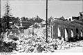
Effect of Allied bombing on Cagliari during the Second World War.
-
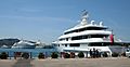
Super Yachts anchored at Porto Cervo port, Costa Smeralda
-
Santo Stefano's former NATO naval base
-
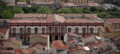
Main Building of the University of Sassari (which started the university courses in 1562)
-
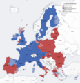
Economic classification of European regions according to Eurostat
-
Exports of Sardinia in 2012–13
-
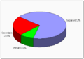
Percentage distribution of employees in different economic sectors in Sardinia: 8.7% the primary sector (fishing, agriculture, farming), 23.5% the secondary sector (industry, machinery, manufacturing), and 67.8% the tertiary sector (tourism, services, finance)
-
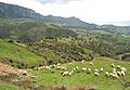
Sheep grazing around Lula, Nuoro
-
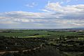
Campidano near Cagliari
-
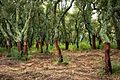
Peeled trunks of cork oaks in Tempio Pausania
-
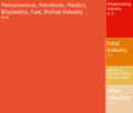
Petrochemical and Green Chemical industries in Porto Torres
-
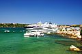
Yachts in Porto Cervo. Luxury tourism represents an important source of income in Sardinia since the 1960s.
-
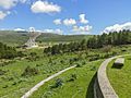
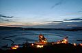
Sardinia Radio Telescope
-
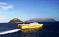
A high-speed ferry in the Gulf of Olbia
-
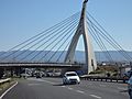
Cable-stayed bridge of the Monserrato University Campus interchange SS 554
-
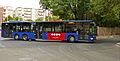
A bus of Sardinia public transport authorities (Arst) in Sassari
-
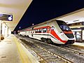
ATR 365 owned by the Autonomous Region of Sardinia in Cagliari
-
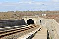
7-kilometre-long (4 mi) railway tunnel of Campeda
-
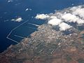
Cagliari, Alghero, Sassari, Nuoro, Oristano, Olbia
-
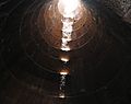
Santa Cristina holy well of Paulilatino, tholos
-
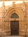
Gothic portal of the Cathedral of Alghero
-
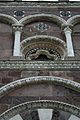
Facade of Nostra Signora di Tergu (SS)
-
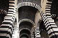
Interior of San Pietro di Sorres, Borutta (SS)
-
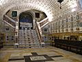
Crypt of the Cagliari Cathedral
-
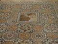
Roman mosaic in Nora
-

Archangel Michael by the Master of Castelsardo
-
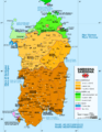
Linguistic map of Sardinia
-
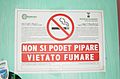
A 'no smoking' sign in both Sardinian and Italian
-
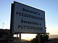
A bilingual road sign in Italian and Sardinian at Pozzomaggiore
-
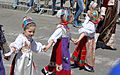
Costume from Ovodda
-
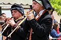
Launeddas players
-
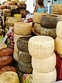
Cheeses and sausages in Alghero's city market
-
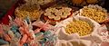
A range of different cakes, pastries, meals, dishes and sweets which are common elements of Sardinian cuisine
-
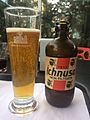
Beer produced in Sardinia
-
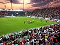
Unipol Domus in Cagliari.
-
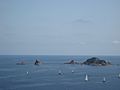
Regatta at Santa Maria Navarrese
-
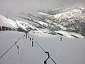
Skilifts on the Bruncu Spina
-
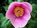
Paeonia mascula
-
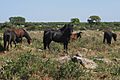
Giara horses
-
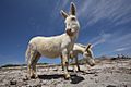
Albino donkeys in Asinara
-
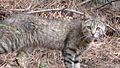
The Sardinian feral cat, long considered a subspecies of the African wildcat, are descended from domesticated cats
-
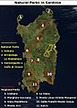
National and regional parks of Sardinia
-
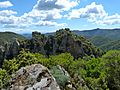
Sulcis Regional Park, the largest Mediterranean evergreen forest in Europe


._Emory_S._Land_is_the_only_forward_deployed_submarine_tender_in_the_Western_hemisphere.jpg)


.jpg)


.jpg)
.JPG)


.jpg)

.JPG)


.JPG)


See also
 In Spanish: Cerdeña para niños
