
Sea of Marmara facts for kids
Quick facts for kids Sea of Marmara |
|
|---|---|
 |
|

Sea of Marmara
Location in Turkey
|
|

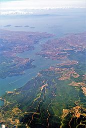
Bathymetry and surrounding relief
|
|
| Location | Europe and Asia |
| Coordinates | 40°40′N 28°00′E / 40.667°N 28.000°E |
| Type | Inland sea |
| Native name | Marmara Denizi (Turkish) |
| Primary inflows | Simav River, Biga Çayı, Nilüfer River |
| Primary outflows | Turkish Straits |
| Catchment area | 11,500 km2 (4,400 sq mi) |
| Basin countries | Turkey |
| Surface area | 11,350 km2 (4,380 sq mi) |
| Average depth | 494 m (1,621 ft) |
| Max. depth | 1,370 m (4,490 ft) |
| Water volume | 3,378 km3 (810 cu mi) |
| Islands | Marmara Island, Avşa, İmralı, Prince Islands, Paşalimanı and Ekinlik Island |
| Settlements | Istanbul, Bursa, İzmit, Tekirdağ, Balıkesir, Çanakkale, and Yalova |

.jpg)

The Sea of Marmara, also known as the Marmara Sea, is an inland sea located entirely within the borders of Turkey. It connects the Black Sea to the Aegean Sea, separating the country's European and Asian part. The Bosphorus strait connects it to the Black Sea and the Dardanelles strait to the Aegean Sea. The former also separates Istanbul's European and Asian side. The Sea of Marmara is a small sea with an area of 11,350 km2 (4,380 sq mi), and dimensions 280 km × 80 km (174 mi × 50 mi). Its greatest depth is 1,370 m (4,490 ft).
Name
The sea takes its name from Marmara Island, which is rich in sources of marble, from the Greek μάρμᾰρον (mármaron) "marble."
The sea was known in the context of classical antiquity as the Propontis. The sea's ancient Greek name Propontis derives from pro- (before) and pontos (sea), deriving from the fact that the Greeks sailed through it to reach the Black Sea, Pontos. In Greek mythology, a storm on Propontis brought the Argonauts back to an island they had left, precipitating a battle where either Jason or Heracles killed King Cyzicus, who mistook them for his Pelasgian enemies.
Geography
The surface salinity of the sea averages about 22 parts per thousand, which is slightly greater than that of the Black Sea, but only about two-thirds that of most oceans. The water is much more saline at the sea bottom, averaging salinities of around 38 parts per thousand, similar to that of the Mediterranean Sea. This high-density saline water, like that of the Black Sea, does not migrate to the surface. Water from the Susurluk, Biga (Granicus), and Gonen Rivers also reduces the salinity of the sea, though with less influence than on the Black Sea. With little land in Thrace draining southward, almost all of these rivers flow from Anatolia.
The sea contains the archipelago of the Prince Islands, Marmara Island, Avşa, and Paşalimanı.
The south coast of the sea is heavily indented and includes the Gulf of İzmit (Turkish: İzmit Körfezi), the Gulf of Gemlik (Turkish: Gemlik Körfezi), Gulf of Bandırma (Turkish: Bandırma Körfezi), and the Gulf of Erdek (Turkish: Erdek Körfezi). During a storm on 29 December 1999, the Russian oil tanker Volgoneft broke in two in the Sea of Marmara; more than 1,500 tonnes of oil were spilled into the water.
The North Anatolian Fault, which has triggered many major earthquakes in recent years, such as the August and November 1999 earthquakes in Izmit and Düzce, respectively, runs under the sea.
Extent
The International Hydrographic Organization defines the limits of the Sea of Marmara as follows:
-
- On the West. The Dardanelles limit of the Aegean Sea [A line joining Kum Kale (26°11'E) and Cape Helles].
-
- On the Northeast. A line joining Cape Rumili with Cape Anatoli (41°13′N).
Towns and cities
Towns and cities on the coast of the Sea of Marmara include:
| Istanbul Province | Balıkesir Province
Bursa Province Çanakkale Province
|
Kocaeli Province
Tekirdağ Province
|
Yalova Province
|
Gallery
-
The Bosphorus with Istanbul in the background
-
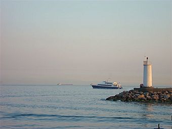
View of Marmara Sea from Istanbul
-
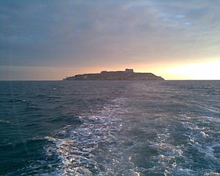
Sea of Marmara approaching Yassıada


See also
 In Spanish: Mar de Mármara para niños
