
Shandon, California facts for kids
Quick facts for kids
Shandon
|
|
|---|---|
.jpg)
The Serra Chapel in Shandon.
|
|

Location in San Luis Obispo County and the state of California
|
|
| Country | |
| State | |
| County | San Luis Obispo |
| Area | |
| • Total | 2.989 sq mi (7.742 km2) |
| • Land | 2.946 sq mi (7.630 km2) |
| • Water | 0.043 sq mi (0.112 km2) 1.44% |
| Elevation | 1,040 ft (317 m) |
| Population
(2010)
|
|
| • Total | 1,295 |
| • Density | 433.26/sq mi (167.27/km2) |
| Time zone | UTC-8 (Pacific (PST)) |
| • Summer (DST) | UTC-7 (PDT) |
| ZIP code |
93461
|
| Area code(s) | 805 |
| FIPS code | 06-71134 |
| GNIS feature IDs | 249342, 2408721 |
Shandon is a village and census-designated place (CDP) in San Luis Obispo County, California, United States. The population was 1,295 at the 2010 census, up from 986 at the 2000 census. Shandon lies by the San Juan River.
Contents
Setting
Shandon is located at the bottom of the San Juan Valley, where San Juan Creek and Cholame Creek come together to form the Estrella River, which flows west to meet the Salinas River north of Paso Robles. Shandon is also at the junction of State Routes 41 and 46, at the southwestern portion of the stretch where the two highways merge for approximately six miles. The even smaller town of Cholame is about six miles northeast of Shandon, where the two highways diverge again. The San Andreas Fault cuts perpendicular to the highways here, six miles from Shandon.
Grasslands and low hills surround the town, with the area immediately southwest of town being an agricultural region.
Geography
Shandon is located at 35°39′22″N 120°22′44″W / 35.65611°N 120.37889°W (35.656178, -120.378817).
According to the United States Census Bureau, the CDP has a total area of 3.0 square miles (7.8 km2), 98.56% of it land and 1.44% of it water.
Demographics
2010

At the 2010 census Shandon had a population of 1,295. The population density was 433.2 people per square mile (167.3/km2). The racial makeup of Shandon was 840 (64.9%) White, 34 (2.6%) African American, 18 (1.4%) Native American, 7 (0.5%) Asian, 2 (0.2%) Pacific Islander, 352 (27.2%) from other races, and 42 (3.2%) from two or more races. Hispanic or Latino of any race were 693 people (53.5%).
The census reported that 1,293 people (99.8% of the population) lived in households, 2 (0.2%) lived in non-institutionalized group quarters, and no one was institutionalized.
There were 371 households, 187 (50.4%) had children under the age of 18 living in them, 219 (59.0%) were opposite-sex married couples living together, 46 (12.4%) had a female householder with no husband present, 24 (6.5%) had a male householder with no wife present. There were 18 (4.9%) unmarried opposite-sex partnerships, and 2 (0.5%) same-sex married couples or partnerships. 62 households (16.7%) were one person and 15 (4.0%) had someone living alone who was 65 or older. The average household size was 3.49. There were 289 families (77.9% of households); the average family size was 3.83.
The age distribution was 418 people (32.3%) under the age of 18, 127 people (9.8%) aged 18 to 24, 373 people (28.8%) aged 25 to 44, 284 people (21.9%) aged 45 to 64, and 93 people (7.2%) who were 65 or older. The median age was 30.6 years. For every 100 females, there were 103.6 males. For every 100 females age 18 and over, there were 104.9 males.
There were 412 housing units at an average density of 137.8 per square mile, of the occupied units 239 (64.4%) were owner-occupied and 132 (35.6%) were rented. The homeowner vacancy rate was 5.5%; the rental vacancy rate was 8.3%. 732 people (56.5% of the population) lived in owner-occupied housing units and 561 people (43.3%) lived in rental housing units.
2000
At the 2000 census there were 986 people, 267 households, and 225 families in the CDP. The population density was 329.4 people per square mile (127.3/km2). There were 286 housing units at an average density of 95.5 per square mile (36.9/km2). The racial makeup of the CDP was 71.20% White, 0.51% African American, 0.61% Native American, 0.51% Asian, 20.59% from other races, and 6.59% from two or more races. Hispanic or Latino of any race were 47.67%.
Of the 267 households 49.8% had children under the age of 18 living with them, 68.2% were married couples living together, 10.1% had a female householder with no husband present, and 15.4% were non-families. 10.9% of households were one person and 3.4% were one person aged 65 or older. The average household size was 3.67 and the average family size was 3.86.
The age distribution was 34.7% under the age of 18, 13.6% from 18 to 24, 30.0% from 25 to 44, 15.6% from 45 to 64, and 6.1% 65 or older. The median age was 26 years. For every 100 females, there were 113.9 males. For every 100 females age 18 and over, there were 119.8 males.
The median household income was $35,000 and the median family income was $32,273. Males had a median income of $28,068 versus $21,786 for females. The per capita income for the CDP was $11,174. About 16.7% of families and 22.9% of the population were below the poverty line, including 30.3% of those under age 18 and 13.6% of those age 65 or over.
Business
This part of the county's economy is largely based in agriculture. Several large vineyard plantings, including Arciero, Sunview Shandon, Shandon Valley Partners, Red Cedar Vineyards, and French Camp Vineyards, represent important employers in the region.
There also is CalFire Station 31 at 501 Centre Street Shandon, CA 93461 (805) 238-4957
Shandon has a 15-member Paid-Call Firefighter company who respond on all incidents via radio pager. Company 31 is responsible for maintaining and responding Engine 31 during the summer months.
Shandon has a State of California Department of Transportation District 5 CalTrans yard located at 400 West Centre St.
Shandon is home to Shandon Unified School District which includes Shandon Elementary, Shandon High School, and Parkfield Elementary.
Shandon Post Office is located at 200 East Centre St
School
Public education in Shandon is provided by the Shandon Joint Unified School District.
Notable residents
Former Deputy Secretary of State, National Security Advisor, and United States Secretary of the Interior William P. Clark, Jr. resided near Shandon until his death in August 2013; he built Chapel Hill on the hill above his ranch. Former 2008–2009 National FFA Secretary Nessie Early is a resident of Shandon.
Images for kids
-
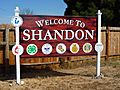
Shandon welcome sign.
-
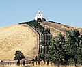
View of the Serra Chapel.

.jpg)
See also
 In Spanish: Shandon (California) para niños
