
Soatá facts for kids
Quick facts for kids
Soatá
|
||
|---|---|---|

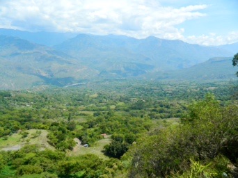
View of Soatá
|
||
|
||

Location of the town and municipality of Soatá in Boyacá Department
|
||

Soatá
Location in Colombia
|
||
| Country | ||
| Department | Boyacá | |
| Province | Northern Boyacá Province | |
| Founded | 10 December 1545 | |
| Founded by | Juan Rodríguez Parra | |
| Government | ||
| • Type | Municipality | |
| Area | ||
| • City | 136 km2 (53 sq mi) | |
| Elevation | 1,950 m (6,400 ft) | |
| Population
(2016)
|
||
| • City | 7,069 | |
| • Density | 51.98/km2 (134.6/sq mi) | |
| • Urban | 5,237 | |
.svg)
Soatá is a town and municipality in Boyacá Department, Colombia. Soatá is located on the western slopes of the Cordillera Oriental mountain range, at the northeast end of the Department of Boyacá. It is the capital of the Northern Boyacá Province. Soatá borders Boavita in the east, Tipacoque in the north, Susacón in the south and in the west it borders the municipality Onzaga of the department of Santander.
Contents
Climate
| Weather chart for
|
|||||||||||||||||||||||||||||||||||||||||||||||
|---|---|---|---|---|---|---|---|---|---|---|---|---|---|---|---|---|---|---|---|---|---|---|---|---|---|---|---|---|---|---|---|---|---|---|---|---|---|---|---|---|---|---|---|---|---|---|---|
| J | F | M | A | M | J | J | A | S | O | N | D | ||||||||||||||||||||||||||||||||||||
|
41
25
12
|
58
25
12
|
88
25
13
|
271
24
13
|
241
23
13
|
126
23
13
|
101
23
12
|
103
23
13
|
155
24
13
|
260
23
13
|
163
23
13
|
84
24
12
|
||||||||||||||||||||||||||||||||||||
| temperatures in °C precipitation totals in mm source: Climate-data.org - Soatá |
|||||||||||||||||||||||||||||||||||||||||||||||
|
Imperial conversion
|
|||||||||||||||||||||||||||||||||||||||||||||||
Etymology
Soatá in the Chibcha language of the Muisca means tillage of the Sun.
History
Soatá was already populated during the Herrera Period and at the time of the Spanish conquest, Soatá was inhabited by the Muisca. The village was part of the rule of the cacique Tundama from the city with the same name, presently known as Duitama.
The inhabitants of Soatá are descendants of a mix of Muisca, Caribbean and Choques. Modern Soatá was founded by sergeant Juan Rodríguez Parra in 1545.
Demographics and geography
In 2005 Soatá had a population of 8.730 inhabitants of which 63% living in the urban zone and 47% live in the eight subdivisions that comprise the rural area. The subdivisions (veredas) are: Los Molinos, La Laguna, Llano Grande, El Espinal, La Chorrera and La Costa. The urban center of Soatá is located at an elevation of 1,950 metres (6,400 ft) above sea level.
Economy
Its economy is of subsistence and it characterizes by agriculture and the cattle ranch in form of minifundios, standing out the cultures of the sugar cane, coffee, tobacco, tomatoes, maize, wheat, barley, fruit trees, dates and flowers.
The cattle sector is distinguished by the presence of goat, pigs and cows.
In the industrial sector, one stands out the production of bricks, floor pieces, canvas shoes, straw hats, panela and bee honey; it excels the elaboration of candies and treats. The production of dates has gained Soatá the title of city of the date palm of Colombia.
Soatá counts on tourist potential by the wealth of its cultural expressions, standing out its gastronomy, natural variety of landscapes and scenic places.
Paleontology
In the Soatá Formation, a brown shale and siltstone sequence defined in and named after Soatá, fossil remains of the Pleistocene genera Neochoerus, Odocoileus and the species Haplomastodon waringi have been found.
Tourism
Touristic sites of Soatá are:
- Chicamocha Canyon
- Pinzón Bridge
- El Chorro
Soatá is becoming a popular destination for birders, as a number of Colombian endemic species can be found in the area, including Chestnut-bellied hummingbird, Niceforo's wren, Colombian mountain grackle and Apical flycatcher.
Related to Soatá
- Cayo Leonidas Peñuela
- Lorenzo Cárdenas
Festivals
- Our Lady of Mount Carmel Festival
- Torbellino's Festival
Gallery
-
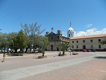
Central square
-
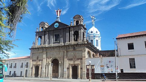
Church of Soatá
-
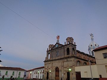
Cathedral
-
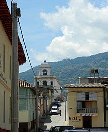
Chapel


.jpg)

-
View of Chicamocha Canyon
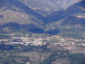
-
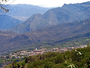
View of Soatá
-
Soatá and surroundings
-
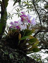
Orchid in Soatá


See also
 In Spanish: Soatá para niños
