
Somerset County, New Jersey facts for kids
Quick facts for kids
Somerset County
|
|||
|---|---|---|---|

Somerset County courthouse in Somerville, the county seat
|
|||
|
|||

Location within the U.S. state of New Jersey
|
|||
 New Jersey's location within the U.S. |
|||
| Country | |||
| State | |||
| Founded | May 14, 1688 | ||
| Named for | English county of Somerset | ||
| Seat | Somerville | ||
| Largest city | Franklin Township (population) Hillsborough Township (area) |
||
| Area | |||
| • Total | 304.86 sq mi (789.6 km2) | ||
| • Land | 301.81 sq mi (781.7 km2) | ||
| • Water | 3.04 sq mi (7.9 km2) 1.00% | ||
| Population
(2020)
|
|||
| • Total | 345,361 | ||
| • Density | 1,144.3/sq mi (441.8/km2) | ||
| Congressional districts | 7th, 12th | ||


Somerset County is a county located in the north-central part of the U.S. state of New Jersey. As of the 2020 United States Census, the county's population was 345,361, an increase of 21,917 (6.8%) from the 323,444 counted at the 2010 U.S Census, making it the 13th most populous of the state's 21 counties. Somerset County constitutes part of the New York Metropolitan Area. Its county seat is Somerville. The most populous place in the county was Franklin Township, with 62,300 residents at the time of the 2010 Census, while Hillsborough Township, with 55.00 square miles (142.4 km2), covered the largest total area of any municipality.
In 2015, Somerset County had a per capita personal income of $86,468, the second highest in New Jersey and ranked 25th of 3,113 counties in the United States. Somerset County, as of the 2000 Census, was the seventh wealthiest county in the United States by median household income at $76,933 (third in New Jersey behind Hunterdon County at $79,888 and Morris County at $77,340), fourth in median family income at $90,655 (second in New Jersey behind Hunterdon County at $91,050) and ranked seventh by per capita income at $37,970 (highest in New Jersey). The Bureau of Economic Analysis ranked the county as having the 11th-highest per capita income of all 3,113 counties in the United States (and the highest in New Jersey) as of 2009.
In 2012, 49.8 percent of Somerset County residents were college graduates, the highest percentage in the state. Somerset County was recently ranked number 3 of 21 NJ counties as one of the healthiest counties in New Jersey, according to an annual report by County Health Rankings and Roadmaps. Somerset County was created on May 14, 1688, from portions of Middlesex County.
Contents
History
Somerset County is one of America's oldest counties, and is named after the English county of Somerset. The area was first settled in 1681, in the vicinity of Bound Brook, and the county was established by charter on May 22, 1688. Most of the early residents were Dutch. General George Washington and his troops marched through the county on several occasions and slept in many of the homes located throughout the area. Somerset County also played an important part during both World War I and World War II with weapons depots and the manufacturing of the army's woolen blankets.
For much of its history, Somerset County was primarily an agricultural county. In the late 19th century, the Somerset Hills area of Somerset County became a popular country home for wealthy industrialists. The area is still the home of wealthy pharmaceutical industrialists.
In 1917, Somerset County, in cooperation with Rutgers University, hired its first agricultural agent to connect local farmers with expert advice. The Rutgers Cooperative Extension of Somerset County, located in Bridgewater, serves residents in the areas of agriculture and natural resources, 4-H youth development and family and community health sciences.
In the 1960s, townships that were once exclusively agricultural were quickly transformed into suburban communities. Examples include Bridgewater Township and the Watchung Hills communities of Watchung, Green Brook and Warren Township. This growth was aided by the development of the county's very strong pharmaceutical and technology presence. Warren Township used to be considered "the greenest place in New Jersey." More recently, there has been an influx of New York City commuters who use New Jersey Transit's Raritan Valley Line and Gladstone Branch or use Interstate 78.
Geography
According to the 2010 Census, the county had a total area of 304.86 square miles (789.6 km2), including 301.81 square miles (781.7 km2) of land (99.0%) and 3.04 square miles (7.9 km2) of water (1.0%).
The high point is on Mine Mountain in Bernardsville, at approximately 860 feet (260 m) above sea level. The lowest point is just above sea level on the Raritan River at the Middlesex County line.
Adjacent counties
Somerset County borders the following counties:
- Morris County, New Jersey – north
- Union County, New Jersey – east
- Middlesex County, New Jersey – southeast
- Mercer County, New Jersey – south
- Hunterdon County, New Jersey – west
Climate and weather
| Weather chart for Somerville, New Jersey | |||||||||||||||||||||||||||||||||||||||||||||||
|---|---|---|---|---|---|---|---|---|---|---|---|---|---|---|---|---|---|---|---|---|---|---|---|---|---|---|---|---|---|---|---|---|---|---|---|---|---|---|---|---|---|---|---|---|---|---|---|
| J | F | M | A | M | J | J | A | S | O | N | D | ||||||||||||||||||||||||||||||||||||
|
3.6
38
18
|
2.8
41
20
|
3.9
50
27
|
4.1
61
36
|
4.3
72
46
|
4.4
80
56
|
4.8
85
61
|
4
83
60
|
4.3
76
52
|
4.2
64
40
|
3.6
54
31
|
3.8
42
23
|
||||||||||||||||||||||||||||||||||||
| temperatures in °F precipitation totals in inches source: The Weather Channel |
|||||||||||||||||||||||||||||||||||||||||||||||
|
Metric conversion
|
|||||||||||||||||||||||||||||||||||||||||||||||
In recent years, average temperatures in the county seat of Somerville have ranged from a low of 18 °F (−8 °C) in January to a high of 85 °F (29 °C) in July, although a record low of −16 °F (−27 °C) was recorded in January 1984 and a record high of 105 °F (41 °C) was recorded in August 1955. Average monthly precipitation ranged from 2.84 inches (72 mm) in February to 4.83 inches (123 mm) in July.
Demographics
| Historical population | |||
|---|---|---|---|
| Census | Pop. | %± | |
| 1790 | 12,296 | — | |
| 1800 | 12,815 | 4.2% | |
| 1810 | 14,725 | 14.9% | |
| 1820 | 16,506 | 12.1% | |
| 1830 | 17,689 | 7.2% | |
| 1840 | 17,455 | −1.3% | |
| 1850 | 19,692 | 12.8% | |
| 1860 | 22,057 | 12.0% | |
| 1870 | 23,510 | 6.6% | |
| 1880 | 27,162 | 15.5% | |
| 1890 | 28,311 | 4.2% | |
| 1900 | 32,948 | 16.4% | |
| 1910 | 38,820 | 17.8% | |
| 1920 | 47,991 | 23.6% | |
| 1930 | 65,132 | 35.7% | |
| 1940 | 74,390 | 14.2% | |
| 1950 | 99,052 | 33.2% | |
| 1960 | 143,913 | 45.3% | |
| 1970 | 198,372 | 37.8% | |
| 1980 | 203,129 | 2.4% | |
| 1990 | 240,279 | 18.3% | |
| 2000 | 297,490 | 23.8% | |
| 2010 | 323,444 | 8.7% | |
| 2020 | 345,361 | 6.8% | |
| Historical sources: 1790-1990 1970-2010 2010 2020 * = Lost territory in previous decade. |
|||
2020 Census
As of the Census of 2020, the county's had 345,361 people, 122,606 households, and 88,540 families. The population density was 1,144.3 inhabitants per square mile (441.8/km2). There were 131,822 housing units at an average density of 436.77 per square mile (168.6/km2). The racial makeup was 61.0% White, 10.0% African American, 0.2% Native American, 18.5% Asian, and 2.2% from two or more races. Hispanic or Latino of any race were 15.2% of the population.
Of the 122,606 households, of which 21.5% had children under the age of 18 living with them, 59.3% were married couples living together, 9.6% had a female householder with no husband present, 3.3% had a male householder with no wife present and 27.8% were non-families, and 9.3% had someone living alone who was 65 years of age or older. The average household size was 2.65 and the average family size was 3.16.
About 21.5% of the population was under age 18, 8.4% was from age 18 to 24, 36.3% was from age 15 to 44, and 16.2% was age 65 or older. The median age was 42.2 years. The gender makeup was 49.2% male and 50.8% female. For every 100 females, there were 96.8 males.
The median household income was $111,587, and the median family income was $135,129. About 5.7% of the population were below the poverty line, including 8.8% of those under age 18 and 6.1% of those age 65 or over.
2010 census
As of the census of 2010, there were 323,444 people, 117,759 households, and 84,669 families residing in the county. The population density was 1,071.7 per square mile (413.8/km2). There were 123,127 housing units at an average density of 408 per square mile (158/km2)*. The racial makeup of the county was 70.06% (226,608) White, 8.95% (28,943) Black or African American, 0.17% (556) Native American, 14.11% (45,650) Asian, 0.03% (94) Pacific Islander, 4.13% (13,360) from other races, and 2.55% (8,233) from two or more races. [[Hispanic (U.S. Census)|Hispanic or Latino of any race were 13.01% (42,091) of the population.
There were 117,759 households out of which 35.9% had children under the age of 18 living with them, 58.8% were married couples living together, 9.5% had a female householder with no husband present, and 28.1% were non-families. 23.3% of all households were made up of individuals, and 8.5% had someone living alone who was 65 years of age or older. The average household size was 2.71 and the average family size was 3.22.
In the county, the population was spread out with 25% under the age of 18, 6.5% from 18 to 24, 26.4% from 25 to 44, 29.8% from 45 to 64, and 12.4% who were 65 years of age or older. The median age was 40.2 years. For every 100 females there were 95.1 males. For every 100 females ages 18 and old there were 91.8 males.
Parks and recreation
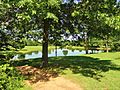
Somerset County parks include Lord Stirling Park (part of the Great Swamp National Wildlife Refuge), Colonial Park (with a lovely rose garden), Washington Valley Park (with biking and hiking trails), the Sourland Mountain Preserve (hiking and mountain biking trails), and the newest park in development called Raritan River Greenway (which is being developed along the Raritan River in Bridgewater Township).
The southeastern portion of Somerset County in Franklin Township also includes the Delaware and Raritan Canal State Park, which provides hiking, biking and boating.
Trump National Golf Club in Bedminster is an exclusive golf club owned by Donald Trump.
The Somerset Patriots are a professional baseball team who plays at TD Bank Ballpark, located on the border of Bridgewater and Bound Brook, New Jersey. They play in the independent Atlantic League of Professional Baseball.
Municipalities

Municipalities in Somerset County (with 2010 Census data for population, housing units and area) are listed below. Other, unincorporated communities in the county are listed alongside their parent municipality (or municipalities, as the case may be). These areas include census-designated places (CDPs), which have been created by the United States Census Bureau for enumeration purposes within a Township. Other communities, historical areas, unincorporated areas, and enclaves that exist within a municipality are also listed.
| Municipality (with map key) |
Municipal type |
Population | Housing Units |
Total Area |
Water Area |
Land Area |
Pop. Density |
Housing Density |
Communities |
|---|---|---|---|---|---|---|---|---|---|
| Bedminster Township (21) | township | 8,165 | 4,349 | 26.30 | 0.22 | 26.08 | 313.1 | 166.8 | Lamington Pluckemin Pottersville |
| Bernards Township (20) | township | 26,652 | 10,103 | 24.06 | 0.13 | 23.93 | 1,113.6 | 422.1 | Basking Ridge Liberty Corner Lyons |
| Bernardsville (1) | borough | 7,707 | 2,871 | 12.98 | 0.08 | 12.91 | 597.2 | 222.5 | |
| Bound Brook (6) | borough | 10,402 | 3,816 | 1.69 | 0.04 | 1.66 | 6,269.6 | 2,300.0 | |
| Branchburg Township (16) | township | 14,459 | 5,419 | 20.28 | 0.24 | 20.04 | 721.4 | 270.4 | Neshanic Station North Branch |
| Bridgewater Township (17) | township | 44,464 | 16,657 | 32.51 | 0.47 | 32.04 | 1,387.9 | 519.9 | Bradley Gardens CDP (14,206) Finderne CDP (5,600) Green Knoll CDP (6,200) Martinsville CDP (11,980) |
| Far Hills (3) | borough | 919 | 418 | 4.88 | 0.08 | 4.80 | 191.6 | 87.1 | |
| Franklin Township (14) | township | 62,300 | 24,426 | 46.85 | 0.70 | 46.15 | 1,350.0 | 529.3 | Blackwells Mills CDP (803) Clyde CDP (213) East Franklin CDP (8,669) East Millstone CDP (579) East Rocky Hill CDP (469) Franklin Center CDP (4,460) Franklin Park CDP (13,295) Griggstown CDP (819) Kingston CDP (part; 271) Middlebush CDP (2,326) Pleasant Plains CDP (922) Rockingham Six Mile Run CDP (3,184) Somerset CDP (22,083) Ten Mile Run CDP (1,959) Voorhees CDP (976) Weston CDP (1,235) Zarephath CDP (37) |
| Green Brook Township (19) | township | 7,203 | 2,448 | 4.48 | 0.01 | 4.47 | 1,610.5 | 547.3 | |
| Hillsborough Township (15) | township | 38,303 | 14,030 | 55.00 | 0.47 | 54.54 | 702.3 | 257.3 | Amwell Cloverhill Flagtown Neshanic South Branch Zion |
| Manville (8) | borough | 10,344 | 4,277 | 2.45 | 0.09 | 2.36 | 4,382.0 | 1,811.9 | |
| Millstone (11) | borough | 418 | 167 | 0.76 | 0.02 | 0.74 | 566.5 | 226.3 | |
| Montgomery Township (13) | township | 22,254 | 7,902 | 32.48 | 0.17 | 32.31 | 688.8 | 244.6 | Amwell Belle Mead CDP (216) Blawenburg CDP (280) Dutchtown Harlingen CDP (297) Skillman CDP (242) Stoutsburg Zion |
| North Plainfield (5) | borough | 21,936 | 7,848 | 2.81 | 0.01 | 2.79 | 7,850.0 | 2,808.5 | |
| Peapack-Gladstone (2) | borough | 2,582 | 949 | 5.85 | 0.04 | 5.81 | 444.5 | 163.4 | Gladstone |
| Raritan (10) | borough | 6,881 | 2,847 | 2.04 | 0.04 | 1.99 | 3,452.2 | 1,428.3 | |
| Rocky Hill (12) | borough | 682 | 292 | 0.62 | 0.00 | 0.62 | 1,101.4 | 471.6 | |
| Somerville (9) | borough | 12,098 | 4,951 | 2.36 | 0.03 | 2.33 | 5,189.5 | 2,123.8 | |
| South Bound Brook (7) | borough | 4,563 | 1,865 | 0.75 | 0.10 | 0.66 | 6,933.8 | 2,834.0 | |
| Warren Township (18) | township | 15,311 | 5,258 | 19.64 | 0.08 | 19.57 | 782.5 | 268.7 | |
| Watchung (4) | borough | 5,801 | 2,234 | 6.05 | 0.03 | 6.03 | 962.7 | 370.7 | |
| Somerset County | county | 323,444 | 123,127 | 304.86 | 3.04 | 301.81 | 1,071.7 | 408.0 |
Transportation
Roads and highways
Somerset County is served by a number of different routes. As of May 2010[update], the county had a total of 1,714.99 miles (2,760.01 km) of roadways, of which 1,370.80 miles (2,206.09 km) were maintained by the local municipality, 234.23 miles (376.96 km) by Somerset County and 109.96 miles (176.96 km) by the New Jersey Department of Transportation.
Major county roads that pass through include County Route 512, County Route 514, County Route 518, County Route 523, County Route 525, County Route 527, County Route 529, County Route 531 and County Route 533.
The only two state routes that traverse through the county are Route 27 (only in Franklin) and Route 28.
U.S. Routes include U.S. Route 22, U.S. Route 202 and U.S. Route 206.
The two Interstates that pass through Somerset County are Interstate 78 and Interstate 287.
Interstate 95 was planned to run along the Somerset Freeway from its proposed southern end in Hopewell Township, Mercer County to Franklin Township at I-287 in the 1960s. However, this plan was cancelled in 1983.
Route 18 runs at the New Brunswick border of Somerset.
Public transportation

NJ Transit provides train service on the Gladstone Branch and the Raritan Valley Line. Public bus transportation is provided by several transit agencies.
NJ Transit provides bus service to the Port Authority Bus Terminal in Midtown Manhattan, as well as service to major cities in New Jersey and within Somerset County. Ridewise provides three SCOOT shuttles as well as DASH buses and CAT buses.
Education
Somerset County is home to two colleges:
- Raritan Valley Community College (RVCC), North Branch section of Branchburg Township (public). Rutgers University has a partnership with Raritan Valley Community College which allows students who have an accredited associate degree to complete a bachelor's degree by attending Rutgers classes at RVCC's North Branch campus. The degree completion program is specifically designed to cater to the transfer student looking to complete their bachelor's degree while staying close to home.
- Somerset Christian College, now known as Pillar College, is located in the Zarephath section of Franklin Township (private).
Alma White College (which operated from 1921 to 1978) was a private college located in Zarephath. Beginning in 1931 the college operated WAWZ 1380 on the AM radio dial. The station continued to 1984 after the school closed. The building is now occupied by Somerset Christian College.
Somerset Hills Learning Institute, founded in 1998 and now located in Bedminster Township, is a state-of-the-art program dedicated to educating children on the autism spectrum by utilizing the principles of applied behavior analysis.
Images for kids
-
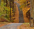
A walking trail in Basking Ridge
-
The Sourland Mountain Preserve in Hillsborough

.jpg)
See also
 In Spanish: Condado de Somerset (Nueva Jersey) para niños
