
Somervell County, Texas facts for kids
Quick facts for kids
Somervell County
|
|
|---|---|
.jpg)
The Somervell County Courthouse in Glen Rose
|
|

Location within the U.S. state of Texas
|
|
 Texas's location within the U.S. |
|
| Country | |
| State | |
| Founded | 1875 |
| Named for | Alexander Somervell |
| Seat | Glen Rose |
| Largest city | Glen Rose |
| Area | |
| • Total | 192 sq mi (500 km2) |
| • Land | 186 sq mi (480 km2) |
| • Water | 5.5 sq mi (14 km2) 2.9%% |
| Population
(2020)
|
|
| • Total | 9,205 |
| • Density | 47.94/sq mi (18.51/km2) |
| Time zone | UTC−6 (Central) |
| • Summer (DST) | UTC−5 (CDT) |
| Congressional district | 25th |
Somervell County ( SUM-ər-vel) is a county on the Edwards Plateau in the U.S. state of Texas. As of the 2020 census, its population was 9,205. Its county seat is Glen Rose. The county is named for Alexander Somervell, secretary of war for the Republic of Texas.
Somervell County is included in the Dallas-Fort Worth-Arlington metropolitan statistical area and the Granbury micropolitan area.
The county contains the Comanche Peak Nuclear Generating Station, one of two nuclear power plants in Texas.
Contents
History


Native Americans
Caddo tribe Anadarko villages were scattered along Trinity and Brazos Rivers. The Caddo tribe of Wichita also inhabited the area. The Anadarko became entangled with the French battles with the Spanish and later the Anglos and suffered the consequences, including diseases for which they had no immunity. By 1860, these tribes moved to Oklahoma.
The Tonkawa were hunter-gatherers of the area, and often traded with their allies the Caddo and Karankawa. Like the Wichita, Karankawa and Jumano, the Tonkawa tattooed their bodies and faces. Friendly with the white settlers, Tonkawa were employed as scouts for the Texas Rangers and United States Army. As they were pushed out by the Comanche, they moved to the Brazos Indian Reservation, and later to Oklahoma
Comanche bands continued depredations on settlers until their removal to Oklahoma after 1875.
County established
The county was formed and organized in 1875 from Hood County. The town of Glen Rose became the county seat.
Torrey Trading Houses opened as a part of the Sam Houston peace policy to develop friendly relationships with native tribes. They bought from, and sold to, the Indians on a banking and credit system, enabling them to also recover stolen horses and human captives. The Torreys sold their business to George Barnard in 1848, who with his brother Charles moved the Tehuacana store in Limestone County to near Comanche Peak. Juana Josefina Cavazos had been captured by Comanches as a teenager. She was daughter of Maria Josefa Cavazos, and granddaughter of Don José Narciso Cavazos Gonzalez-Hildago who in 1792 received the largest land grant in Texas. George ransomed Juana from the tribe, but it was brother Charles who married her in 1848.
Somervell County got its first courthouse in Glen Rose in 1882, but the courthouse and all county records burned in 1893. The second and current courthouse was built in 1894 by architect John McCormick. The roof and clock tower were damaged in the 1902 Glen Rose tornado. County funds at the time limited the repair, which eliminated the clock tower. In 1986, work was done to restore the structure to its original design.
Glen Rose Collegiate Institute, AKA Glen Rose College, operated as a private faith-based educational facility from 1889 to 1910. Educational competition from the public school system caused enrollment to taper off until the institution was shut down.
Under the New Deal Works Progress Administration, Glen Rose built a new water and sewage system in the 1930s, as well as school buildings, a canning plant, and low-water dams.
The Comanche Peak Nuclear Power Plant went online in the mid 1970s and employs over 1,000 people. Squaw Creek Reservoir, which provides cooling water for the power plant, also has become a popular recreation site.
Dinosaurs
The tragic Paluxy River flood in 1908 uncovered 3-toed prints from the Cretaceous period, possibly Acrocanthosaurus, and were discovered by high school student George Adams in the limestone river bed. The teenager related the discovery to his principal, Robert McDonald. Adams later ended up selling self-manufactured fake "giant man tracks" to tourists sometime during the 1930s, sparking a debate about whether or not humans existed alongside dinosaurs. In 1934, resident Charlie Moss discovered footprints of 4-toed sauropods. Resident Jim Ryals dug out the actual dinosaur prints and sold them to tourists. Paleontologist Roland T. Bird of the American Museum of Natural History in New York spotted the Adams "giant man tracks" in a tourist shop in Gallup, New Mexico, and, while recognizing them as fakes, was still intrigued enough to travel to Somervell County to see the Glen Rose area for himself. Bird's visit resulted in a 2-year WPA project to uncover the dinosaur prints. The American Museum of Natural History, the University of Texas at Austin, the Smithsonian Institution, and several local museums retain samples of what are said to be the best-preserved tracks in the United States.
The land along the Paluxy River for Dinosaur Valley State Park was purchased by the State of Texas in 1968, and the park opened to the public in 1972.
Geography
According to the U.S. Census Bureau, the county has a total area of 192 square miles (500 km2), of which 186 square miles (480 km2) is land and 5.5 square miles (14 km2) (2.9%) is water. It is the second-smallest county by area in Texas, larger than only Rockwall County, and slightly smaller than Camp County.
Major highways
 U.S. Highway 67
 State Highway 144
Adjacent counties
- Hood County (north)
- Johnson County (east)
- Bosque County (south)
- Erath County (west)
Demographics
| Historical population | |||
|---|---|---|---|
| Census | Pop. | %± | |
| 1880 | 2,649 | — | |
| 1890 | 3,419 | 29.1% | |
| 1900 | 3,498 | 2.3% | |
| 1910 | 3,931 | 12.4% | |
| 1920 | 3,563 | −9.4% | |
| 1930 | 3,016 | −15.4% | |
| 1940 | 3,071 | 1.8% | |
| 1950 | 2,542 | −17.2% | |
| 1960 | 2,577 | 1.4% | |
| 1970 | 2,793 | 8.4% | |
| 1980 | 4,154 | 48.7% | |
| 1990 | 5,360 | 29.0% | |
| 2000 | 6,809 | 27.0% | |
| 2010 | 8,490 | 24.7% | |
| 2020 | 9,205 | 8.4% | |
| U.S. Decennial Census 1850–2010 2010 2020 |
|||
2020 census
| Race / Ethnicity | Pop 2010 | Pop 2020 | % 2010 | % 2020 |
|---|---|---|---|---|
| White alone (NH) | 6,595 | 7,011 | 77.68% | 76.17% |
| Black or African American alone (NH) | 54 | 39 | 0.64% | 0.42% |
| Native American or Alaska Native alone (NH) | 45 | 49 | 0.53% | 0.53% |
| Asian alone (NH) | 40 | 55 | 0.47% | 0.60% |
| Pacific Islander alone (NH) | 1 | 0 | 0.01% | 0.00% |
| Some Other Race alone (NH) | 24 | 33 | 0.28% | 0.36% |
| Mixed Race/Multi-Racial (NH) | 105 | 331 | 1.24% | 3.60% |
| Hispanic or Latino (any race) | 1,626 | 1,687 | 19.15% | 18.33% |
| Total | 8,490 | 9,205 | 100.00% | 100.00% |
Note: the US Census treats Hispanic/Latino as an ethnic category. This table excludes Latinos from the racial categories and assigns them to a separate category. Hispanics/Latinos can be of any race.
Communities
City
- Glen Rose (county seat)
Unincorporated communities
Images for kids
-
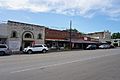
State Highway 144 as NE Barnard Street in Glen Rose
.jpg)
See also
 In Spanish: Condado de Somervell para niños
