
South Bloomfield, Ohio facts for kids
Quick facts for kids
South Bloomfield, Ohio
|
|
|---|---|
|
Village
|
|

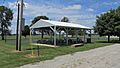
South Bloomfield Municipal Building
|
|

Location of South Bloomfield, Ohio
|
|

Location of South Bloomfield in Pickaway County
|
|
| Country | United States |
| State | Ohio |
| County | Pickaway |
| Township | Harrison |
| Area | |
| • Total | 3.94 sq mi (10.19 km2) |
| • Land | 3.94 sq mi (10.19 km2) |
| • Water | 0.00 sq mi (0.00 km2) |
| Elevation | 696 ft (212 m) |
| Population
(2010)
|
|
| • Total | 1,744 |
| • Estimate
(2019)
|
1,979 |
| • Density | 502.92/sq mi (194.18/km2) |
| Time zone | UTC-5 (Eastern (EST)) |
| • Summer (DST) | UTC-4 (EDT) |
| ZIP code |
43103
|
| Area code(s) | 740 |
| FIPS code | 39-73068 |
| GNIS feature ID | 1049188 |
| Website | http://www.southbloomfieldoh.com/ |
South Bloomfield is a village in Pickaway County, Ohio, United States. The population was 1,744 at the 2010 census. It has consistently been one of the fastest-growing villages in central Ohio.
Geography
South Bloomfield is located at 39°42′57″N 82°59′17″W / 39.715910°N 82.988103°W.
According to the United States Census Bureau, the village has a total area of 4.28 square miles (11.09 km2), all land.
Gallery
-
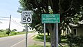
South Bloomfield corporation limit sign
-
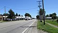
Looking south on North Walnut Street (US Highway 23) in South Bloomfield
-
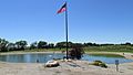
Krazy Kats Pay Lake
-
Rick Brown Memorial VFW Post 7941
-
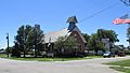
South Bloomfield United Methodist Church
-
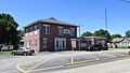
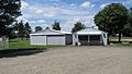
South Bloomfield Municipal Building
-
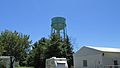
South Bloomfield Water Tower
-
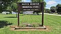
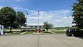
Marvin Webster Memorial Park
-
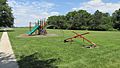
Marvin Webster Memorial Park
-
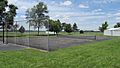
Marvin Webster Memorial Park
-
Marvin Webster Memorial Park
-
Marvin Webster Memorial Park
-
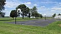
Marvin Webster Memorial Park
-
Marvin Webster Memorial Park


Demographics
| Historical population | |||
|---|---|---|---|
| Census | Pop. | %± | |
| 1870 | 283 | — | |
| 1880 | 303 | 7.1% | |
| 1890 | 272 | −10.2% | |
| 1900 | 222 | −18.4% | |
| 1910 | 212 | −4.5% | |
| 1920 | 230 | 8.5% | |
| 1930 | 235 | 2.2% | |
| 1940 | 238 | 1.3% | |
| 1950 | 250 | 5.0% | |
| 1960 | 424 | 69.6% | |
| 1970 | 610 | 43.9% | |
| 1980 | 934 | 53.1% | |
| 1990 | 900 | −3.6% | |
| 2000 | 1,179 | 31.0% | |
| 2010 | 1,744 | 47.9% | |
| 2019 (est.) | 1,979 | 13.5% | |
| U.S. Decennial Census | |||
2010 census
As of the census of 2010, there were 1,744 people, 654 households, and 473 families living in the village. The population density was 407.5 inhabitants per square mile (157.3/km2). There were 688 housing units at an average density of 160.7 per square mile (62.0/km2). The racial makeup of the village was 97.1% White, 0.9% African American, 0.3% Native American, 0.2% Asian, 0.2% from other races, and 1.4% from two or more races. Hispanic or Latino people of any race were 1.1% of the population.
There were 654 households, of which 41.9% had children under the age of 18 living with them, 52.4% were married couples living together, 14.4% had a female householder with no husband present, 5.5% had a male householder with no wife present, and 27.7% were non-families. 21.9% of all households were made up of individuals, and 9.4% had someone living alone who was 65 years of age or older. The average household size was 2.67 and the average family size was 3.02.
The median age in the village was 34.3 years. 28.1% of residents were under the age of 18; 8% were between the ages of 18 and 24; 30.5% were from 25 to 44; 23.3% were from 45 to 64; and 10.1% were 65 years of age or older. The gender makeup of the village was 48.9% male and 51.1% female.
History
The town was originally laid out in 1803 and General James Denny was originally contracted to survey the area, embracing 40 acres and divided into 80 lots. The founding members in the area had originally hoped that this would eventually be the county seat, but time and politics would work against this idea.
South Bloomfield is featured in the Together Concepts video production "We Are..Teays Valley". The video depicts numerous achievements and innovations, as well as connections to American and world history.
Education
South Bloomfield is served by the Teays Valley Local School District.
See also
 In Spanish: South Bloomfield (Ohio) para niños
