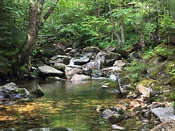
South Branch Gale River facts for kids
Quick facts for kids South Branch Gale River |
|
|---|---|

The South Branch, south of the Gale River Loop Road
|
|
| Country | United States |
| State | New Hampshire |
| County | Grafton |
| Towns | Franconia, Bethlehem |
| Physical characteristics | |
| Main source | Mount Lafayette Franconia 3,640 ft (1,110 m) 44°10′32″N 71°38′54″W / 44.17556°N 71.64833°W |
| River mouth | Gale River Bethlehem 1,310 ft (400 m) 44°14′37″N 71°38′17″W / 44.24361°N 71.63806°W |
| Length | 5.1 mi (8.2 km) |
| Basin features | |
| Tributaries |
|
The South Branch of the Gale River is a 5.1-mile-long (8.2 km) river in the White Mountains of New Hampshire in the United States. Via the Gale River, it is a tributary of the Ammonoosuc River and part of the Connecticut River watershed.
The South Branch rises on the north slope of Mount Lafayette in the town of Franconia, New Hampshire, west of Garfield Ridge. It drops rapidly to the north and joins the North Branch to form the Gale River at the crossing of U.S. Route 3. The South Branch provides drinking water for the town of Bethlehem, New Hampshire.

All content from Kiddle encyclopedia articles (including the article images and facts) can be freely used under Attribution-ShareAlike license, unless stated otherwise. Cite this article:
South Branch Gale River Facts for Kids. Kiddle Encyclopedia.


