
Spotsylvania County, Virginia facts for kids
Quick facts for kids
Spotsylvania County
|
|||||
|---|---|---|---|---|---|
| County of Spotsylvania | |||||
.png)
Historic home listed on the National Register of Historic Places in Spotsylvania County
|
|||||
|
|||||
| Motto(s):
Patior Ut Potiar
(Error: {{language with name/for}}: missing language tag or language name (help)) |
|||||

Location within the U.S. state of Virginia
|
|||||
 Virginia's location within the U.S. |
|||||
| Country | |||||
| State | |||||
| Founded | 1721 | ||||
| Named for | Alexander Spotswood | ||||
| Seat | Spotsylvania Courthouse | ||||
| Largest community | Spotsylvania Courthouse | ||||
| Area | |||||
| • Total | 414 sq mi (1,070 km2) | ||||
| • Land | 401 sq mi (1,040 km2) | ||||
| • Water | 13 sq mi (30 km2) 3.1% | ||||
| Population
(2020)
|
|||||
| • Total | 140,032 | ||||
| • Density | 338.2/sq mi (130.60/km2) | ||||
| Time zone | UTC−5 (Eastern) | ||||
| • Summer (DST) | UTC−4 (EDT) | ||||
| Congressional districts | 1st, 7th | ||||


Spotsylvania County is a county in the U.S. state of Virginia. As of the July 2021 estimate, the population was 143,676. Its county seat is Spotsylvania Courthouse.
Contents
History
At the time of European encounter, the inhabitants of the area that became Spotsylvania County were a Siouan-speaking tribe called the Manahoac.
Spotsylvania County was established in 1721 from Essex, King and Queen, and King William counties. The county was named in Latin for Lieutenant Governor of Virginia Alexander Spotswood.
Many battles were fought in this county during the Civil War, including the Battle of Chancellorsville, Battle of the Wilderness, Battle of Fredericksburg, and Battle of Spotsylvania Court House.
Stonewall Jackson was shot and mortally wounded in Spotsylvania County during the Battle of Chancellorsville. A group of Confederate soldiers from North Carolina were in the woods and heard General Jackson's party returning from reconnoitering the Union lines. They mistook him for a Federal patrol and fired their weapons, wounding him in both arms. His left arm was amputated. General Jackson died a few days later from pneumonia at nearby Guinea Station. Confederate wounded were being gathered there for evacuation to hospitals further to the south and away from enemy lines.
Geography
According to the U.S. Census Bureau, the county has a total area of 414 square miles (1,070 km2), of which 401 square miles (1,040 km2) is land and 13 square miles (34 km2) (3.1%) is water.
It is bounded on the north by the Rappahannock and Rapidan rivers, the independent city of Fredericksburg (all of which were part of the area's early history), and the counties of Stafford and Culpeper; on the south by the North Anna River and its impoundment, Lake Anna, and by the counties of Hanover and Louisa; on the west by Orange County and Culpeper County; and on the east by Caroline County.
Adjacent counties and independent city
- Culpeper County, Virginia – north
- Stafford County, Virginia – northeast
- City of Fredericksburg, Virginia – northeast
- Caroline County, Virginia – southeast
- Hanover County, Virginia – south
- Louisa County, Virginia – southwest
- Orange County, Virginia – west and northwest
National protected area
Major highways
 I-95
I-95 US 1
US 1 US 17
US 17 US 522
 SR 2
SR 2 SR 3
SR 3 SR 208
Demographics
| Historical population | |||
|---|---|---|---|
| Census | Pop. | %± | |
| 1790 | 11,252 | — | |
| 1800 | 13,002 | 15.6% | |
| 1810 | 13,296 | 2.3% | |
| 1820 | 14,254 | 7.2% | |
| 1830 | 15,134 | 6.2% | |
| 1840 | 15,161 | 0.2% | |
| 1850 | 14,911 | −1.6% | |
| 1860 | 16,076 | 7.8% | |
| 1870 | 11,728 | −27.0% | |
| 1880 | 14,828 | 26.4% | |
| 1890 | 14,233 | −4.0% | |
| 1900 | 9,239 | −35.1% | |
| 1910 | 9,935 | 7.5% | |
| 1920 | 10,571 | 6.4% | |
| 1930 | 10,056 | −4.9% | |
| 1940 | 9,905 | −1.5% | |
| 1950 | 11,920 | 20.3% | |
| 1960 | 13,819 | 15.9% | |
| 1970 | 16,424 | 18.9% | |
| 1980 | 34,435 | 109.7% | |
| 1990 | 57,403 | 66.7% | |
| 2000 | 90,395 | 57.5% | |
| 2010 | 122,397 | 35.4% | |
| 2020 | 140,032 | 14.4% | |
| U.S. Decennial Census 1790–1960 1900–1990 1990–2000 2010 2020 |
|||
2020 census
| Race / Ethnicity | Pop 2010 | Pop 2020 | % 2010 | % 2020 |
|---|---|---|---|---|
| White alone (NH) | 88,077 | 87,278 | 71.96% | 62.33% |
| Black or African American alone (NH) | 18,298 | 22,436 | 14.95% | 16.02% |
| Native American or Alaska Native alone (NH) | 323 | 375 | 0.26% | 0.27% |
| Asian alone (NH) | 2,768 | 3,933 | 2.26% | 2.81% |
| Pacific Islander alone (NH) | 135 | 122 | 0.11% | 0.09% |
| Some Other Race alone (NH) | 272 | 845 | 0.22% | 0.60% |
| Mixed Race/Multi-Racial (NH) | 3,246 | 8,389 | 2.65% | 5.99% |
| Hispanic or Latino (any race) | 9,278 | 16,654 | 7.58% | 11.89% |
| Total | 122,397 | 140,032 | 100.00% | 100.00% |
Note: the US Census treats Hispanic/Latino as an ethnic category. This table excludes Latinos from the racial categories and assigns them to a separate category. Hispanics/Latinos can be of any race.
2010 census
As of the census of 2010, there were 122,397 people, 31,308 households, and 24,639 families residing in the county. The population density was 226 people per square mile (87/km2). There were 33,329 housing units at an average density of 83 per square mile (32/km2). The racial makeup of the county was:
- 78.4% White
- 15.8% Black or African American
- 0.4% Native American
- 2.4% Asian
- 0.05% Pacific Islander
- 2.8% from other races, and
- 1.88% from two or more races.
7.8% of the population were Hispanic or Latino of any race.
There were 31,308 households, out of which 42.40% had children under the age of 18 living with them, 64.80% were married couples living together, 9.90% had a female householder with no husband present, and 21.30% were non-families. 16.40% of all households were made up of individuals, and 5.40% had someone living alone who was 65 years of age or older. The average household size was 2.87 and the average family size was 3.22.
In the county, the population was spread out, with 30.00% under the age of 18, 7.30% from 18 to 24, 32.20% from 25 to 44, 22.20% from 45 to 64, and 8.30% who were 65 years of age or older. The median age was 34 years. For every 100 females, there were 97.10 males. For every 100 females age 18 and over, there were 93.00 males.
The 2019 median income for a household in the county was $88,628 compared to $58,100 for the United States; the median income for a family was $87,922. Males had a median income of $49,166 versus $38,076 for females. The per capita income for the county was $37,212. 6.6% of the population lives below the poverty line, including 6.70% of those under age 18 and 5.20% of those age 65 or over.
Communities
There are no incorporated towns or cities in Spotsylvania County. Unincorporated communities in the county include:
Census-designated places
Other unincorporated communities
- Alsop
- Arcadia
- Artillery Ridge
- Bells Crossroad
- Belmont
- Blades Corner
- Brandon
- Brockroad
- Brokenburg
- Carters Store
- Chancellor
- Chancellorsville
- Chewnings Corner
- Cookstown
- Dunavant
- Five Mile Fork
- Four Mile Fork
- Granite Springs
- Lanes Corner
- Leavells
- Lewiston
- Margo
- Marye
- Massaponax
- McHenry
- Old Trap
- Olivers Corner
- Partlow
- Paytes
- Post Oak
- Shady Grove Corner
- Snell
- Stubbs
- Thornburg
- Todds Tavern
Many areas of the county have Fredericksburg addresses.
Points of interest
- Lake Anna State Park
- Spotsylvania County Public Schools
- Spotsylvania Courthouse
- Fredericksburg and Spotsylvania National Military Park
- Spotsylvania Towne Centre
- Spotsylvania County Sheriff’s Office
- Central Rappahannock Regional Library
- Dominion Raceway
Education
Public schools
Spotsylvania County Public Schools
Private schools
- Fredericksburg Academy
- Fredericksburg Christian School
- The Summit Academy
- Odyssey Montessori School
- Saint Patrick School
- Saint Michael the Archangel High School
- Faith Baptist Christian School
- Mount Hope Academy
- micah school
Colleges and universities
Germanna Community College is part of the Virginia Community College System and serves the City of Fredericksburg, and the counties of Stafford, Spotsylvania, Orange, Culpeper, and King George.
The University of Mary Washington located in neighboring Fredericksburg, Virginia, is a four-year university and graduate school that also serves the area.
Infrastructure
Emergency services
Fire and rescue services in Spotsylvania County are provided by a combination of career and volunteer organizations. The career staff of the Department of Fire, Rescue, and Emergency Management provide fire and rescue services 24/7/365 at all 11 stations, 1 (Courthouse), 2 (Brokenburg), 3 (Partlow), 4 (Four Mile Fork), 5 (Chancellor), 6 (Salem Church), 7 (Wilderness), 8 (Thornburg), 9 (Belmont), 10 (Salem Fields), 11 (Crossroads). Volunteers provide additional staffing nights and weekends at Stations 1, 2, 4, 5, and 8. The volunteer organizations include: Chancellor Volunteer Fire & Rescue, The Spotsylvania Volunteer Fire Department, and The Spotsylvania Volunteer Rescue Squad.
Notable people
- Thomas Dickens Arnold, United States Congressman from Virginia
- Francis Asbury (1745–1816), one of the first two bishops of the Methodist Episcopal Church
- Caressa Cameron, Miss Virginia 2009 and Miss America 2010
- Elijah Craig, Baptist minister arrested in Fredericksburg for preaching without a license from the Anglican Church before the American Revolution
- Evelyn Magruder DeJarnette (1842–1914), author
- Joe Gibbs, former Washington Redskins coach
- Rahman "Rock" Harper, chef, television personality, and restaurateur
- Alexander Holladay (1811–1877), U. S. Representative
- Kunta Kinte, a.k.a. Toby Waller (1750–1822), character in novel Roots: The Saga of an American Family and television miniseries Roots
- John Maine, pitcher for the New York Mets
- Danny McBride, actor
- Phil Short, former member of the Louisiana State Senate and United States Marine Corps officer
- Matthew Fontaine Maury, father of modern oceanography
Images for kids
-
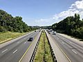
I-95 northbound in Spotsylvania County

_in_Fourmile_Fork,_Spotsylvania_County,_Virginia.jpg)
See also
 In Spanish: Condado de Spotsylvania para niños
