
Steuben County, New York facts for kids
Quick facts for kids
Steuben County
|
|||
|---|---|---|---|

Farmland in rural Steuben County
|
|||
|
|||

Location within the U.S. state of New York
|
|||
 New York's location within the U.S. |
|||
| Country | |||
| State | |||
| Founded | 1796 | ||
| Named for | Baron von Steuben | ||
| Seat | Bath | ||
| Largest city | Corning | ||
| Area | |||
| • Total | 1,404 sq mi (3,640 km2) | ||
| • Land | 1,391 sq mi (3,600 km2) | ||
| • Water | 14 sq mi (40 km2) 1.0% | ||
| Population
(2020)
|
|||
| • Total | 93,584 | ||
| • Density | 67.3/sq mi (26.0/km2) | ||
| Time zone | UTC−5 (Eastern) | ||
| • Summer (DST) | UTC−4 (EDT) | ||
| Congressional district | 23rd | ||


Steuben County (stu-BEN) is a county located in the U.S. state of New York. As of the 2020 census, the population was 93,584. Its county seat is Bath. Its name is in honor of Baron von Steuben, a Prussian general who fought on the American side in the American Revolutionary War, though it is not pronounced the same. There is no direct link between Baron von Steuben and modern Steuben County, which he never visited (and in his day was near-wilderness).
Steuben County comprises the Corning, NY Micropolitan Statistical Area, which is also included in the Elmira-Corning, NY Combined Statistical Area.
Contents
History
When counties were established in New York State in 1683, the present Steuben County was part of Albany County. This was an enormous county, including the northern part of New York State as well as all of the present State of Vermont and, in theory, extending westward to the Pacific Ocean. This county was reduced in size on July 3, 1766 by the creation of Cumberland County, and further on March 16, 1770, by the creation of Gloucester County, both containing territory now in Vermont.
On March 12, 1772, what was left of Albany County was split into three parts, one remaining under the name Albany County. One of the other pieces, Tryon County, contained the western portion (and thus, since no western boundary was specified, theoretically still extended west to the Pacific). The eastern boundary of Tryon County was approximately five miles west of the present city of Schenectady, and the county included the western part of the Adirondack Mountains and the area west of the West Branch of the Delaware River. The area then designated as Tryon County now includes 37 counties of New York State. The county was named for William Tryon, colonial governor of New York.
In the years prior to 1776, most of the Loyalists in Tryon County fled to Canada. In 1784, following the peace treaty that ended the American Revolutionary War, the name of Tryon County was changed to Montgomery County in honor of the general, Richard Montgomery, who had captured several places in Canada and died attempting to capture the city of Quebec, replacing the name of the hated British governor.
Ontario County was split off from Montgomery County in 1789 to form an area much larger than the present Ontario County. Steuben County, much larger than today, was split off from Ontario County in 1796. In 1823 a portion of Steuben County was combined with a portion of Ontario County to form Yates County. Steuben County was further reduced in size in 1854 when a portion was combined with portions of Chemung and Tompkins counties to form Schuyler County.
Geography
According to the U.S. Census Bureau, the county has a total area of 1,404 square miles (3,640 km2), of which 1,391 square miles (3,600 km2) is land and 14 square miles (36 km2) (1.0%) is water.
Steuben County is in the southwestern part of New York State, immediately north of the Pennsylvania border. The population of Steuben County according to the 2000 U. S. census was 98,726. The county is in the Southern Tier region of New York State.
Adjacent counties
- Ontario County - north
- Yates County - northeast
- Schuyler County - east
- Chemung County - east
- Tioga County, Pennsylvania - south
- Potter County, Pennsylvania - southwest
- Allegany County - west
- Livingston County - northwest
Demographics
| Historical population | |||
|---|---|---|---|
| Census | Pop. | %± | |
| 1800 | 1,788 | — | |
| 1810 | 7,246 | 305.3% | |
| 1820 | 21,989 | 203.5% | |
| 1830 | 33,851 | 53.9% | |
| 1840 | 46,138 | 36.3% | |
| 1850 | 63,771 | 38.2% | |
| 1860 | 66,690 | 4.6% | |
| 1870 | 67,717 | 1.5% | |
| 1880 | 77,586 | 14.6% | |
| 1890 | 81,473 | 5.0% | |
| 1900 | 82,822 | 1.7% | |
| 1910 | 83,362 | 0.7% | |
| 1920 | 80,627 | −3.3% | |
| 1930 | 82,671 | 2.5% | |
| 1940 | 84,927 | 2.7% | |
| 1950 | 91,439 | 7.7% | |
| 1960 | 97,691 | 6.8% | |
| 1970 | 99,546 | 1.9% | |
| 1980 | 99,217 | −0.3% | |
| 1990 | 99,088 | −0.1% | |
| 2000 | 98,726 | −0.4% | |
| 2010 | 98,990 | 0.3% | |
| 2020 | 93,584 | −5.5% | |
| U.S. Decennial Census 1790-1960 1900-1990 1990-2000 2010-2020 |
|||
As of the census of 2000, there were 98,726 people, 39,071 households, and 26,216 families residing in the county. The population density was 71 people per square mile (27/km2). There were 46,132 housing units at an average density of 33 per square mile (13/km2). The racial makeup of the county was 96.43% White, 1.36% African American, 0.27% Native American, 0.90% Asian, 0.02% Pacific Islander, 0.21% from other races, and 0.81% from two or more races. Hispanic or Latino of any race were 0.81% of the population. 18.6% were of German, 15.2% English, 14.4% American, 13.6% Irish and 8.3% Italian ancestry according to Census 2000. 96.5% spoke English and 1.3% Spanish as their first language.
There were 39,071 households, out of which 31.80% had children under the age of 18 living with them, 51.70% were married couples living together, 10.60% had a female householder with no husband present, and 32.90% were non-families. 27.20% of all households were made up of individuals, and 11.90% had someone living alone who was 65 years of age or older. The average household size was 2.49 and the average family size was 3.01.
In the county, the population was spread out, with 26.00% under the age of 18, 7.40% from 18 to 24, 27.20% from 25 to 44, 24.20% from 45 to 64, and 15.20% who were 65 years of age or older. The median age was 38 years. For every 100 females there were 96.00 males. For every 100 females age 18 and over, there were 93.20 males.
The median income for a household in the county was $35,479, and the median income for a family was $41,940. Males had a median income of $32,155 versus $24,163 for females. The per capita income for the county was $18,197. About 9.90% of families and 13.20% of the population were below the poverty line, including 18.70% of those under age 18 and 5.80% of those age 65 or over.
Transportation
Major highways
 Interstate 86 (Southern Tier Expressway)
 New York State Route 17 (Southern Tier Expressway)
 Interstate 99
 U.S. Route 15
 Interstate 390
 New York State Route 15
 New York State Route 21
 New York State Route 36
 New York State Route 414
 New York State Route 415
 New York State Route 417
Airports
Steuben County contains the following public-use airports:
- Corning-Painted Post Airport in the Town of Erwin, near Corning and Painted Post
- Hornell Municipal Airport in the City of Hornell
Public Transportation
Local bus service is provided by Hornell Area Transit.
Communities
Cities
Towns
Villages
- Addison
- Almond
- Arkport
- Avoca
- Bath (county seat)
- Canisteo
- Cohocton
- Hammondsport
- North Hornell
- Painted Post
- Riverside
- Savona
- South Corning
- Wayland
Census-designated places
Hamlets
Education
There is one institution of post-secondary education in Steuben County: Corning Community College. Alfred University and Elmira College are nearby.
Notable people
People born in Steuben County:
- Stanley C. Armstrong (1888-1950), politician
- Josiah H. Bonney (1817-1887), politician
- Olive Byrne (1904-1990), domestic partner
- Edward Conner (1829-1900), republican
- Jasper Humphrey (1812-1892), democrat
- Artemas Martin (1835-1918), mathematician
- Selwyn N. Owen (1836-1916), lawyer
- James A. Parsons (c.1868-1945), politician
- Omar L. Rosenkrans (1843-1926), republican
- Peter Truax (1828-1909), philanthropist
Images for kids
-
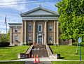
Steuben County Courthouse in Corning

See also
 In Spanish: Condado de Steuben (Nueva York) para niños
