
Stutsman County, North Dakota facts for kids
Quick facts for kids
Stutsman County
|
|
|---|---|

Historic Stutsman County Courthouse
|
|

Location within the U.S. state of North Dakota
|
|
 North Dakota's location within the U.S. |
|
| Country | |
| State | |
| Founded | January 4, 1873 (created) June 10, 1873 (organized) |
| Named for | Enos Stutsman |
| Seat | Jamestown |
| Largest city | Jamestown |
| Area | |
| • Total | 2,298 sq mi (5,950 km2) |
| • Land | 2,222 sq mi (5,750 km2) |
| • Water | 76 sq mi (200 km2) 3.3% |
| Population
(2020)
|
|
| • Total | 21,593 |
| • Estimate
(2021)
|
21,576 |
| • Density | 9.3964/sq mi (3.6280/km2) |
| Time zone | UTC−6 (Central) |
| • Summer (DST) | UTC−5 (CDT) |
| Congressional district | At-large |
Stutsman County is a county in the U.S. state of North Dakota. As of the 2020 census, the population was 21,593. Its county seat is Jamestown.
The Jamestown, North Dakota Micropolitan Statistical Area includes all of Stutsman County.
Contents
Geography
According to the U.S. Census Bureau, the county has a total area of 2,298 square miles (5,950 km2), of which 2,222 square miles (5,750 km2) is land and 76 square miles (200 km2) (3.3%) is water. It is the second-largest county in North Dakota by land area and third-largest by total area.
Major highways
 Interstate 94
 U.S. Highway 52
 U.S. Highway 281
 North Dakota Highway 9
 North Dakota Highway 20
 North Dakota Highway 30
 North Dakota Highway 36
 North Dakota Highway 46
Adjacent counties
- Foster County (north)
- Griggs County (northeast)
- Barnes County (east)
- LaMoure County (southeast)
- Logan County (southwest)
- Kidder County (west)
- Wells County (northwest)
National protected areas
- Arrowwood National Wildlife Refuge (part)
- Chase Lake National Wildlife Refuge
- Halfway Lake National Wildlife Refuge
Demographics
| Historical population | |||
|---|---|---|---|
| Census | Pop. | %± | |
| 1880 | 1,007 | — | |
| 1890 | 5,266 | 422.9% | |
| 1900 | 9,143 | 73.6% | |
| 1910 | 18,189 | 98.9% | |
| 1920 | 24,575 | 35.1% | |
| 1930 | 26,100 | 6.2% | |
| 1940 | 23,495 | −10.0% | |
| 1950 | 24,158 | 2.8% | |
| 1960 | 25,137 | 4.1% | |
| 1970 | 23,550 | −6.3% | |
| 1980 | 24,154 | 2.6% | |
| 1990 | 22,241 | −7.9% | |
| 2000 | 21,908 | −1.5% | |
| 2010 | 21,100 | −3.7% | |
| 2020 | 21,593 | 2.3% | |
| 2021 (est.) | 21,576 | 2.3% | |
| U.S. Decennial Census 1790-1960 1900-1990 1990-2000 2010-2020 |
|||
2010 census
As of the 2010 census, there were 21,100 people, 8,931 households, and 5,255 families in the county. The population density was 9.5 inhabitants per square mile (3.7/km2). There were 9,862 housing units at an average density of 4.4 per square mile (1.7/km2). The racial makeup of the county was 95.6% white, 1.4% American Indian, 0.7% black or African American, 0.5% Asian, 0.1% Pacific islander, 0.5% from other races, and 1.3% from two or more races. Those of Hispanic or Latino origin made up 1.7% of the population. In terms of ancestry, 56.5% were German, 27.6% were Norwegian, 7.2% were Irish, 6.0% were Russian, 5.2% were English, and 2.4% were American.
Of the 8,931 households, 25.6% had children under the age of 18 living with them, 47.3% were married couples living together, 7.5% had a female householder with no husband present, 41.2% were non-families, and 35.3% of all households were made up of individuals. The average household size was 2.17 and the average family size was 2.79. The median age was 42.0 years.
The median income for a household in the county was $44,620 and the median income for a family was $60,171. Males had a median income of $40,365 versus $27,549 for females. The per capita income for the county was $23,307. About 6.3% of families and 12.1% of the population were below the poverty line, including 14.5% of those under age 18 and 14.6% of those age 65 or over.
Communities
Cities
Townships
- Alexander
- Ashland
- Bloom
- Bloomenfield
- Buchanan
- Chicago
- Conklin
- Corinne
- Corwin
- Courtenay
- Cusator
- Deer Lake
- Durham
- Edmunds
- Eldridge
- Flint
- Fried
- Gerber
- Germania
- Glacier
- Gray
- Griffin
- Hidden
- Homer
- Iosco
- Jim River Valley
- Kensal
- Lenton
- Lippert
- Lowery
- Lyon
- Manns
- Marstonmoor
- Midway
- Montpelier
- Moon Lake
- Newbury
- Nogosek
- Paris
- Peterson
- Pingree
- Pipestem Valley
- Plainview
- Rose
- Round Top
- St. Paul
- Severn
- Sharlow
- Sinclair
- Spiritwood
- Stirton
- Streeter
- Strong
- Sydney
- Valley Spring
- Wadsworth
- Walters
- Weld
- Windsor
- Winfield
- Woodbury
- Ypsilanti
Census-designated places
Images for kids
-
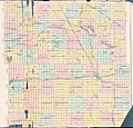
Outline map of Stutsman County, North Dakota, 1911

See also
 In Spanish: Condado de Stutsman para niños
