
Suhr, Aargau facts for kids
Quick facts for kids
Suhr
|
||
|---|---|---|
|
||
| Country | Switzerland | |
| Canton | Aargau | |
| District | Aarau | |
| Area | ||
| • Total | 10.62 km2 (4.10 sq mi) | |
| Elevation | 397 m (1,302 ft) | |
| Population
(Dec 2020 )
|
||
| • Total | 10,724 | |
| • Density | 1,009.8/km2 (2,615.4/sq mi) | |
| Postal code |
5034
|
|
| Surrounded by | Aarau, Buchs, Gränichen, Hunzenschwil, Oberentfelden, Rupperswil, Unterentfelden | |
| Twin towns | Castelnuovo Rangone (Italy) | |

Suhr is a municipality in the district of Aarau of the canton of Aargau in Switzerland.
Geography
Suhr has an area, as of 2006[update], of 10.6 km2 (4.1 sq mi). Of this area, 29.9% is used for agricultural purposes, while 44.4% is forested. Of the rest of the land, 25.2% is settled (buildings or roads) and the remainder (0.5%) is non-productive (rivers or lakes).
Images for kids
-
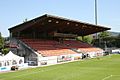
Stadion Brugglifeld
-
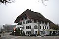
Hotel zum Kreuz at Suhr


See also
 In Spanish: Suhr para niños

All content from Kiddle encyclopedia articles (including the article images and facts) can be freely used under Attribution-ShareAlike license, unless stated otherwise. Cite this article:
Suhr, Aargau Facts for Kids. Kiddle Encyclopedia.