
Sunnyvale, California facts for kids
Quick facts for kids
Sunnyvale, California
|
||
|---|---|---|
| City of Sunnyvale | ||
.jpg)
Downtown Sunnyvale
|
||
|
||

Location in Santa Clara County and the State of California
|
||

Sunnyvale, California
Location in the United States
|
||
| Country | United States | |
| State | California | |
| County | Santa Clara | |
| Incorporated | December 24, 1912 | |
| Government | ||
| • Type | Council–manager | |
| Area | ||
| • Total | 22.78 sq mi (58.99 km2) | |
| • Land | 22.06 sq mi (57.14 km2) | |
| • Water | 0.72 sq mi (1.86 km2) 3.09% | |
| Elevation | 125 ft (38 m) | |
| Population
(2020)
|
||
| • Total | 155,805 | |
| • Rank | 2nd in Santa Clara County 36th in California |
|
| • Density | 6,839.6/sq mi (2,641.21/km2) | |
| Time zone | UTC−8 (PST) | |
| • Summer (DST) | UTC−7 (PDT) | |
| ZIP codes |
94085–94090
|
|
| Area codes | 408/669 and 650 | |
| FIPS code | 06-77000 | |
| GNIS feature IDs | 1656344, 2412009 | |
Sunnyvale is a city located in the Santa Clara Valley in northwest Santa Clara County, California.
Sunnyvale lies along the historic El Camino Real and Highway 101 and is bordered by portions of San Jose to the north, Moffett Federal Airfield and NASA Ames Research Center to the northwest, Mountain View to the northwest, Los Altos to the southwest, Cupertino to the south, and Santa Clara to the east.
As of the 2020 United States Census, Sunnyvale's population was 155,805, making it the county's second most populous city (after San Jose) and the seventh most populous city in the San Francisco Bay Area.
As one of the major cities comprising California's high-tech area known as Silicon Valley, Sunnyvale is the birthplace of the video game industry, former location of Atari headquarters, and the location of a fictional computer game company in the 1983 film WarGames. Many technology companies are headquartered in Sunnyvale and many more operate there, including several aerospace/defense companies.
Sunnyvale was also the home to Onizuka Air Force Station, often referred to as "the Blue Cube" due to the color and shape of its windowless main building. The facility, previously known as Sunnyvale Air Force Station, was named for the deceased Space Shuttle Challenger astronaut Ellison Onizuka. It served as an artificial satellite control facility of the U.S. military until August 2010 and has since been decommissioned and demolished.
Sunnyvale is one of the few U.S. cities to have a single unified Department of Public Safety, where all personnel are trained as firefighters, police officers, and EMTs, so that they can respond to an emergency in any of the three roles.
Library services for the city are provided by the Sunnyvale Public Library, located at the Sunnyvale Civic Center.
Contents
History

When the Spanish first arrived in the 1770s at the Santa Clara Valley, it was heavily populated by the Ohlone Native Americans. In 1777, Mission Santa Clara was built by Ohlone who converted to Christianity.
In 1842, Rancho Pastoria de las Borregas was granted to Francisco Estrada and his wife Inez Castro. Portions of the land given in this grant later developed into the cities of Mountain View and Sunnyvale. Two years later, in 1844, another land grant was provided to Lupe Yñigo, one of the few Native Americans to hold land grants. His land grant was first called Rancho Posolmi, named in honor of a village of the Ohlone that once stood in the area. Rancho Posolmi was later known as Rancho Ynigo.
Martin Murphy Jr. came to California with his father as part of the Stephens-Townsend-Murphy Party in 1844. In 1850, Martin Murphy Jr. bought a piece of Rancho Pastoria de las Borregas for $12,500. Murphy established a wheat farm and ranch named Bay View. Murphy had the first wood frame house in Santa Clara County; it was shipped from New England. The house was demolished in 1961 but was reconstructed in 2008 as the Sunnyvale Heritage Park Museum. When he died in 1884, his land was divided among his heirs.
In 1860, The San Francisco and San Jose Rail Road was allowed to lay tracks on Bay View and established Murphy Station. Lawrence Station was later established on the southern edge of Bay View.
In the 1870s, county property tax laws, imports and soil degradation caused wheat farming to become uneconomical in Santa Clara County. Small fruit orchards replaced the large wheat farms. In 1871, James and Eloise Dawson established the first fruit cannery in the county. Fruit agriculture for canning soon became a major industry in the county. The invention of the refrigerated rail car further increased the viability of an economy based upon fruit. The fruit orchards became so prevalent that in 1886, the San Jose Board of Trade called Santa Clara County the "Garden of the World".
In the 1880s, Chinese workers made up 48 percent of the farm labor in Santa Clara County. This percentage reduced over time after the Chinese Exclusion Act was passed. In the following decade, the 1890s, multitudes of immigrants from Italy, the Azores, Portugal, and Japan arrived to work in the orchards.
In 1897, Walter Everett Crossman bought 200 acres (809,000 m2) and began selling real estate. He advertised the area as "Beautiful Murphy" and later, in the 1900s, as "the City of Destiny". Also in 1897, Encina School opened as the first school in Murphy. Previously, children in the town had to travel to Mountain View for school.
In 1901, the residents of Murphy were informed they could not use the names Encinal or Murphy for their post office. They decided to adopt Sunnyvale as the name of their town.
Sunnyvale continued to grow and in 1904, dried fruit production began. Two years later, Libby, McNeill & Libby, a Chicago meat-packing company, decided to open its first fruit-packing factory in Sunnyvale. Today, a water tower painted to resemble the first Libby's fruit cocktail can label identifies the former site of the factory.
Also in 1906, the Joshua Hendy Iron Works relocated from San Francisco to Sunnyvale after the company's building was destroyed by fire after the 1906 earthquake. The ironworks was the first non-agricultural industry in the town. The company later switched from producing mining equipment to other products such as marine steam engines.
In 1912, the residents of Sunnyvale voted to incorporate, and Sunnyvale became an official city.
Fremont High School first opened in 1923. It served as a military base before the school opened and through World War II. Planes flying to and from Moffett Field, which opened in 1933, commonly stopped here for fuel top-offs. A 1948 yearbook shows a military aircraft parked at one of the buildings as students watch nearby. The school has old military buildings on its campus including a Quonset hut installed after WWII, now used as a wrestling team facility.
In 1930, Congress decided to place the West Coast dirigible base in Sunnyvale. This naval airfield was later renamed Moffett Naval Air Station and then Moffett Federal Airfield and is commonly called Moffett Field.
In 1939, the National Advisory Committee for Aeronautics (NACA, the forerunner of NASA) began research at Ames Laboratory.
During World War II, the war economy began a change from the fruit industry to the high-tech industry in Santa Clara County. The Joshua Hendy Iron Works built marine steam engines, naval guns and rocket launchers to aid in the war effort. As the defense industry grew, a shortage of workers in the farm industry was created. Immigrants from Mexico came to Sunnyvale to fill this void of workers.
Following the war, the fruit orchards and sweetcorn farms were cleared to build homes, factories and offices. In 1956, the aircraft manufacturer Lockheed moved its headquarters to Sunnyvale. Since then, numerous high-tech companies have established offices and headquarters in Sunnyvale, including Advanced Micro Devices and Yahoo. The first prototype of Pong, one of the first arcade videogames, was installed in Sunnyvale in August 1972, in a bar named Andy Capp's Tavern, now Rooster T. Feathers. In 1970, the Census Bureau reported Sunnyvale's population as 94.6% white and 3.7% Asian.
By 2002, the few remaining orchards had been replaced with homes and shops. However, there are still city-owned orchards, such as the Heritage Orchard next to the Sunnyvale Community Center.
In 1979, an indoor mall called Sunnyvale Town Center opened in what used to be a traditional downtown shopping district. After years of successful operation, the mall started to decline in the 1990s. After numerous changes in plans and ownership, the mall was demolished in 2007. Plans for a new downtown shopping district to be constructed in its place have been approved by the city and the redevelopment agency oversight board.
Sunnyvale celebrated its one-hundredth anniversary on August 25, 2012.
Geography
Sunnyvale is located at 37°22′7.56″N 122°2′13.4″W / 37.3687667°N 122.037056°W.
According to the United States Census Bureau, the city has a total area of 22.7 sq mi (58.8 km2), of which, 22.0 sq mi (56.9 km2) of it is land and 0.69 sq mi (1.8 km2) of it (3.09%) is water. The elevation is 130 feet above sea level.
Climate
Like most of the San Francisco Bay Area, Sunnyvale has a Mediterranean climate, with mild, moist winters and comfortably warm, very dry summers. Average daytime summer temperatures are in the high 70s, and during the winter, average daytime high temperatures rarely stay below 50 °F (10 °C). Snowfall is rare, but on January 21, 1962, and February 5, 1976, measurable snowfall occurred in Sunnyvale and most of the San Francisco Bay Area. Sunnyvale was briefly hit by tornados in 1998, but otherwise they are extremely rare.
| Climate data for Sunnyvale, California | |||||||||||||
|---|---|---|---|---|---|---|---|---|---|---|---|---|---|
| Month | Jan | Feb | Mar | Apr | May | Jun | Jul | Aug | Sep | Oct | Nov | Dec | Year |
| Record high °F (°C) | 75 (24) |
84 (29) |
85 (29) |
94 (34) |
100 (38) |
107 (42) |
105 (41) |
101 (38) |
105 (41) |
100 (38) |
89 (32) |
75 (24) |
107 (42) |
| Average high °F (°C) | 58 (14) |
62 (17) |
64 (18) |
69 (21) |
73 (23) |
77 (25) |
79 (26) |
79 (26) |
78 (26) |
73 (23) |
64 (18) |
58 (14) |
70 (21) |
| Average low °F (°C) | 40 (4) |
43 (6) |
46 (8) |
47 (8) |
51 (11) |
55 (13) |
57 (14) |
57 (14) |
55 (13) |
50 (10) |
44 (7) |
39 (4) |
49 (9) |
| Record low °F (°C) | 21 (−6) |
24 (−4) |
22 (−6) |
31 (−1) |
33 (1) |
40 (4) |
41 (5) |
44 (7) |
41 (5) |
34 (1) |
15 (−9) |
20 (−7) |
15 (−9) |
| Average precipitation inches (mm) | 3.24 (82) |
3.18 (81) |
2.65 (67) |
0.89 (23) |
0.35 (8.9) |
0.11 (2.8) |
0.03 (0.76) |
0.08 (2.0) |
0.19 (4.8) |
0.85 (22) |
1.83 (46) |
2.31 (59) |
15.71 (399.26) |
| Source: National Weather Service | |||||||||||||
Demographics
| Historical population | |||
|---|---|---|---|
| Census | Pop. | %± | |
| 1930 | 3,094 | — | |
| 1940 | 4,373 | 41.3% | |
| 1950 | 9,829 | 124.8% | |
| 1960 | 59,898 | 509.4% | |
| 1970 | 95,976 | 60.2% | |
| 1980 | 106,618 | 11.1% | |
| 1990 | 117,229 | 10.0% | |
| 2000 | 131,760 | 12.4% | |
| 2010 | 140,081 | 6.3% | |
| 2020 | 155,805 | 11.2% | |
| U.S. Decennial Census | |||

The 2010 United States Census reported that Sunnyvale had a population of 140,081. The population density was 6,173.9 people per square mile (2,383.8/km2). The racial makeup of Sunnyvale was 60,193 (43.0%) White, 2,735 (2.0%) African American, 662 (0.5%) Native American, 57,320 (40.9%) Asian, 638 (0.5%) Pacific Islander, 12,177 (8.7%) from other races, and 6,356 (4.5%) from two or more races. Hispanic or Latino of any race were 26,517 persons (18.9%). Non-Hispanic Whites were 34.5% of the population in 2010, compared to 74.7% in 1980.
The Census reported that 139,232 people (99.4% of the population) lived in households, 380 (0.3%) lived in non-institutionalized group quarters, and 469 (0.3%) were institutionalized.
There were 53,384 households, out of which 18,614 (34.9%) had children under the age of 18 living in them, 28,583 (53.5%) were opposite-sex married couples living together, 4,629 (8.7%) had a female householder with no husband present, 2,341 (4.4%) had a male householder with no wife present. There were 2,386 (4.5%) unmarried opposite-sex partnerships, and 357 (0.7%) same-sex married couples or partnerships. 13,457 households (25.2%) were made up of individuals, and 3,775 (7.1%) had someone living alone who was 65 years of age or older. The average household size was 2.61. There were 35,553 families (66.6% of all households); the average family size was 3.15.
The population was spread out, with 31,435 people (22.4%) under the age of 18, 9,350 people (6.7%) aged 18 to 24, 50,919 people (36.3%) aged 25 to 44, 32,721 people (23.4%) aged 45 to 64, and 15,656 people (11.2%) who were 65 years of age or older. The median age was 35.6 years. For every 100 females, there were 101.5 males. For every 100 females age 18 and over, there were 100.9 males.
There were 55,791 housing units at an average density of 2,458.9 per square mile (949.4/km2), of which 25,623 (48.0%) were owner-occupied, and 27,761 (52.0%) were occupied by renters. The homeowner vacancy rate was 1.1%; the rental vacancy rate was 4.4%. 68,895 people (49.2% of the population) lived in owner-occupied housing units and 70,337 people (50.2%) lived in rental housing units.
|
Neighborhoods
The City of Sunnyvale maintains a registry of 26 neighborhood associations.
The southern half of Sunnyvale is predominantly residential, while most of the portion of Sunnyvale north of Highway 237 is zoned for industrial use.
Within this southern half are several neighborhoods that account for a large number of Eichler homes throughout residential Sunnyvale. More specifically, there are 16 housing tracts containing over 1100 Eichler homes.
The far eastern section of El Camino Real in Sunnyvale has a significant concentration of businesses owned by Indian immigrants.
Parks
There are 476 acres of parks in the Sunnyvale Area. These include Las Palmas Park, Ortega Park, Seven Seas Park Washington Park near downtown, two public golf courses, and Baylands Park, site of the annual Linux Picnic.
Full Circle Farm, encompassing 11 acres, is the largest community-based urban farm in Silicon Valley, and is located in the Birdland neighborhood of Sunnyvale. Charles Street Gardens, Sunnyvale's oldest and largest community garden, is located adjacent to Sunnyvale's Public Library.
Downtown redevelopment
In November 2009, previously closed portions of the main streets in downtown Sunnyvale were reopened as part of the ongoing downtown redevelopment of the Sunnyvale Town Center mall, marking the first time in over three decades that those street blocks have been open to vehicle and pedestrian traffic. In December 2009, work was started to finish the exteriors of the residential buildings on McKinley Ave and Washington Ave, the two office towers on Mathilda and weatherize the remaining partially completed Redwood Square buildings until the project's resolution can be determined. The two office towers are now fully occupied by Apple and Nokia.
Mixed-use developments have been built at the former Town and Country location near the Plaza del Sol just north of Murphy Avenue. As of mid-2015 there are new mulitistory apartment complexes plus a number of ground-floor businesses.
Transportation

Several major roads and freeways go through Sunnyvale:
 Interstate 280 (Junipero Serra Freeway)
 U.S. Route 101
 State Route 82 (El Camino Real)
 State Route 85 (Stevens Creek Freeway)
 State Route 237 (Southbay Freeway)
Public transportation
Sunnyvale is served by Santa Clara Valley Transportation Authority (light rail and buses) and by Caltrain commuter rail. Two Caltrain stations are located in Sunnyvale: the Sunnyvale station in the Heritage District downtown, and the Lawrence station in eastern Sunnyvale, north of the Ponderosa neighborhood.
Bicycle
Sunnyvale has been listed by the League of American Bicyclists as a bronze-level Bicycle Friendly Community.
The Bicycle and Pedestrian Advisory Committee advises the city council on the continued development of the bicycle plan for the city.
Airports
For commercial passenger air travel, Sunnyvale is served by three nearby international airports:
- Norman Y. Mineta San Jose International Airport (SJC), 9.5 miles from downtown Sunnyvale by car. It is also accessible by Caltrain, VTA light rail, and VTA bus. Caltrain and light rail stations require a transfer to a free shuttle bus to get to the airport terminal.
- San Francisco International Airport (SFO), 27.7 miles by car. SFO is transit accessible from Sunnyvale via Caltrain and Bay Area Rapid Transit (BART).
- Metropolitan Oakland International Airport (OAK), 37.5 miles by car. Access to Oakland airport by public transit is possible via multiple transfers.
Folklore
A long-standing legend of Sunnyvale is of a ghost that haunts the town's Toys 'R' Us store. A purported psychic, Sylvia Browne, claimed to have made contact with the ghost on the 1978 TV show That's Incredible! and named him Johnny Johnson. This story was also explored in a 1991 episode of Haunted Lives: True Ghost Stories. Furthermore, she stated that he had been a farm hand who worked in the orchard where the toy store now stands and that he bled to death from an accidental, self-inflicted axe injury to his leg.
Twin towns – Sister cities
Until 1970, Sunnyvale had a Sister City relationship with Chillán, Chile. In 2013, the city entered into a three-year Friendly Exchange Relations Agreement with Iizuka, Japan; in July 2016 the city council voted to change this to a Sister City relationship.
Economy

Companies based in Sunnyvale include Infinera, Fortinet, Intuitive Surgical, Juniper Networks, LinkedIn, Proofpoint, Inc., and Trimble Inc..
Largest employers
According to the city's 2021 Comprehensive Annual Financial Report, the top employers in the city are:
| # | Employer | # of Employees |
|---|---|---|
| 1 | 14,713 | |
| 2 | Apple Inc. | 4,500 |
| 3 | Lockheed Martin Space | 3,855 |
| 4 | Amazon.com Services | 3,748 |
| 5 | 3,549 | |
| 6 | Juniper Networks Inc | 3,000 |
| 7 | Intuitive Surgical | 2,169 |
| 8 | Microsoft | 1,893 |
| 9 | Synopsys | 1,590 |
| 10 | Walmart | 1,586 |
Education
For elementary and middle schools, most of the city is in the Sunnyvale School District, while some parts are in the Cupertino Union School District, the Santa Clara Unified School District, and the Mountain View Whisman Elementary School District.
For high schools, most of the city is in the Fremont Union High School District (the parts that are part of the Sunnyvale School District or Cupertino Union School District for primary schools), and those areas of Sunnyvale are divided between Fremont High School and Homestead High School. Some parts of the city are in the Santa Clara Unified School District.
French American School of Silicon Valley (FASSV, French: École franco-américaine de la Silicon Valley) is a private elementary school in Sunnyvale, which opened in 1992. It is recognized as a French international school by the AEFE.
Notable people
- Tony Anselmo, animator and voice of Donald Duck
- Robert Hawkins, artist and painter
- Ashleigh Aston Moore, actress
- Teri Hatcher, actress
- Imran Khan, Bollywood actor
- Steve Jobs, co-founder of Apple Inc.
- Lee Pelekoudas, Seattle Mariners interim general manager, raised in Sunnyvale.
- Steve Wozniak, co-founder of Apple Inc.
- Arthur Davis, animator and director
- Timothy Linh Bui, filmmaker
- Tony Bui, film director
- Steve Kloves, American screenwriter, film director and producer
- Antwon, hip-hop artist
- Brian MacLeod, musician
- The Orange Peels, musical group
- Juju Chang, television personality
- Martin Ford, entrepreneur, author
- Jeff Goodell, writer
- Michael S. Malone, multiple talents
- Amy Tan, novelist
- Tully Banta-Cain professional football player
- Brian Boitano, figure skater
- Benny Brown, runner
- Sean Dawkins, NFL player, lived in Sunnyvale while attending Homestead High School in Cupertino.
- Penny Deen, swimmer and coach
- Francie Larrieu-Smith, track and field athlete
- Peter Ueberroth, Major League Baseball Commissioner 1984–89
- Bill Green, former United States and NCAA record holder in Track and Field, 5th in the hammer throw at the 1984 Summer Olympics
- Chris Pelekoudas, Major League Baseball umpire, lived and died in Sunnyvale.
- Troy Tulowitzki, Major League Baseball player, graduated from Fremont High School
- Andrew Fire, 2006 Nobel Laureate in medicine
- Landon Curt Noll, astronomer, cryptographer and mathematician
- Mark Rober, NASA JPL employee 2004–2011, current scientific YouTuber
Images for kids
-
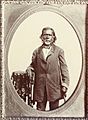
Lupe Yñigo was granted Rancho Posolmi in 1844, covering the northern part of Sunnyvale and Mountain View.
-
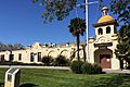
Joshua Hendy Iron Works Museum

.jpg)
See also
 In Spanish: Sunnyvale (California) para niños
