
Tamborine, Queensland facts for kids
Quick facts for kids TamborineQueensland |
|||||||||||||||
|---|---|---|---|---|---|---|---|---|---|---|---|---|---|---|---|

Greensward Road, 2014
|
|||||||||||||||

Tamborine
Location in Queensland
|
|||||||||||||||
| Population | 3,950 (2016 census locality) | ||||||||||||||
| • Density | 55.48/km2 (143.7/sq mi) | ||||||||||||||
| Postcode(s) | 4270 | ||||||||||||||
| Area | 71.2 km2 (27.5 sq mi) | ||||||||||||||
| Time zone | AEST (UTC+10:00) | ||||||||||||||
| LGA(s) |
|
||||||||||||||
| State electorate(s) |
|
||||||||||||||
| Federal Division(s) | Wright | ||||||||||||||
|
|||||||||||||||
Tamborine is a town in the Scenic Rim Region and a locality split between the Scenic Rim Region and the City of Logan in Queensland, Australia. In the 2016 census the locality of Tamborine had a population of 3,950 people.
History


Tamborine used to be spelled Tambourine. It was the administrative centre of the Shire of Tamborine (formerly the Shire of Tambourine).
Tambourine Provisional School opened on 24 August 1874, becoming Tambourine State School on 1 January 1909. The spelling was changed to Tamborine on 29 April 1926. Tamborine State School closed on 10 July 1970.
During World War II, the 32nd Infantry Division of the American Army established a camp initially called Camp Tamborine (but later called Camp Cable after deceased soldier Gerald O. Cable) at Tamborine in 1942.
Formerly in the Shire of Beaudesert, Tamborine was split between Logan City and Scenic Rim Region following the local government amalgamations in March 2008.
A station at Tamborine along the Canungra railway line operated from 1915 to 1955.
Heritage listings
Tamborine has the following heritage-listed sites:
- 869 Mundoolun Connection Road: Tamborine House
- — includes information on Tamborine State School
Road infrastructure
The Beaudesert–Beenleigh Road runs through from south-west to north-east. State Route 95, Waterford-Tamborine Road and Tamborine Mountain Road, runs through from north-west to south-east.
Images for kids
-
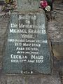
Headstone for Michael Yore, Tamborine Catholic Cemetery
-
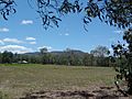
Tamborine Mountain as seen from Tamborine School Park

