
Tarbes facts for kids
Quick facts for kids
Tarbes
Tarba
|
||
|---|---|---|
|
Prefecture and commune
|
||

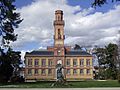
Tarbes, Musée des Beaux-Arts
|
||
|
||

Tarbes
Location in France

Tarbes
Location in Occitanie
|
||
| Country | France | |
| Region | Occitanie | |
| Department | Hautes-Pyrénées | |
| Arrondissement | Tarbes | |
| Canton | Chief town of 3 cantons | |
| Intercommunality | Le Grand Tarbes | |
| Area
1
|
15.33 km2 (5.92 sq mi) | |
| Population
(2014)
|
40,900 | |
| • Density | 2,668/km2 (6,910/sq mi) | |
| Demonym(s) | Tarbais(es) | |
| Time zone | UTC+01:00 (CET) | |
| • Summer (DST) | UTC+02:00 (CEST) | |
| INSEE/Postal code |
65440 /65000
|
|
| Elevation | 284–326 m (932–1,070 ft) (avg. 304 m or 997 ft) |
|
| Website | www.tarbes.fr | |
| 1 French Land Register data, which excludes lakes, ponds, glaciers > 1 km2 (0.386 sq mi or 247 acres) and river estuaries. | ||

Tarbes (Occitan: Tarba) is a commune in the Hautes-Pyrénées department in the Occitanie region in southwestern France. It is part of the historical region of Gascony and is the capital since 1790 of the Hautes-Pyrénées department.
It is the second largest metropolitan area of the old Midi-Pyrénées region, after Toulouse.
Contents
Name
The city is named for the first time during the 5th century like Civitas Turba ubi castrum Bigorra. It is also an important city of the Novempopulania. Gregory of Tours, in the 7th century, called the city as Talvam vicum.
During the Middle Ages, the city was named as Tarbe (1214), Tursa, Tarvia (1284) and also Tarbia.
History

A small town founded in the 3rd century B.C. became a Roman colony under the name of Tarba. It was destroyed by the Vikings in 840 and rebuilt by the Bishop of Bigorre or Tarbes.
From the twelfth century on, Tarbes became the capital of the County of Bigorre. During the religious wars, the cathedral was burnt in 1569 by Protestants but the bishop had it rebuilt in 1652.
In 1790, Tarbes became the capital of the new department of Hautes-Pyrénées.
Geography
Tarbes is located in the southwest of France, at the foot of the Pyrenees, in a fertile plain of the valley of the river Adour, at 20 km (12 mi) to the northeast of Lourdes, 70 km (43 mi) to the southeast of Auch, 144 km (89 mi) to the east of Bayonne and 155 km (96 mi) to the southwest of Toulouse.
It has an area of 15.33 km2 (6 sq mi) and its average altitude is 304 m (997 ft); at the city hall, the altitude is 311 m (1,020 ft).
Two rivers flow through the city: the Adour by the east and the Échez by the west.
Neighboring municipalities
 |
The following municipalities (communes) are around Tarbes:
- To the north: Andrest, Bazet (going to Bordeaux)
- To the northeast: Orleix, Aureilhan (going to Auch)
- To the east: Séméac (going to Saint-Gaudens, Toulouse)
- To the southeast: Soues, Barbazan-Debat
- To the south: Laloubère, Horgues (going to Bagnères-de-Bigorre)
- To the southwest: Juillan, Ossun, Hibarette, Odos (going to Lourdes, Argelès-Gazost)
- To the west: Ibos (going to Pau, Bayonne)
- To the northwest: Bordères-sur-l'Échez, Oursbelille
Climate
Tarbes has an oceanic climate with relatively hot summers, mild winters and abundant rainfall, Cfb in the Köppen climate classification.
| Climate data for Tarbes, France (altitude 360m, 1981–2010) (Source: Météo-France, Infoclimat.fr) | |||||||||||||
|---|---|---|---|---|---|---|---|---|---|---|---|---|---|
| Month | Jan | Feb | Mar | Apr | May | Jun | Jul | Aug | Sep | Oct | Nov | Dec | Year |
| Average high °C (°F) | 10.3 (50.5) |
11.3 (52.3) |
14.2 (57.6) |
15.8 (60.4) |
19.5 (67.1) |
22.8 (73.0) |
25.1 (77.2) |
25.2 (77.4) |
22.8 (73.0) |
19.0 (66.2) |
13.7 (56.7) |
11.0 (51.8) |
17.6 (63.6) |
| Average low °C (°F) | 1.0 (33.8) |
1.5 (34.7) |
3.7 (38.7) |
5.6 (42.1) |
9.5 (49.1) |
12.8 (55.0) |
14.9 (58.8) |
14.9 (58.8) |
11.9 (53.4) |
8.7 (47.7) |
4.3 (39.7) |
1.8 (35.2) |
7.6 (45.6) |
| Average precipitation mm (inches) | 95.0 (3.74) |
81.1 (3.19) |
87.0 (3.43) |
111.7 (4.40) |
111.6 (4.39) |
78.0 (3.07) |
56.0 (2.20) |
68.1 (2.68) |
71.6 (2.82) |
88.1 (3.47) |
102.5 (4.04) |
96.7 (3.81) |
1,047.4 (41.24) |
| Source 1: climat.meteofrance.com | |||||||||||||
| Source 2: infoclimat.fr | |||||||||||||
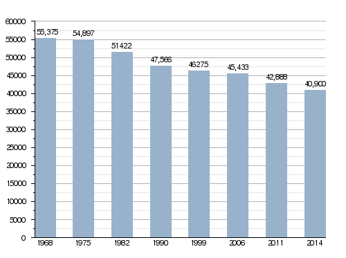
Population
The inhabitants of Tarbes are known, in French, as Tarbais (women: Tarbaises).
The city of Tarbes has a population, in 2014, of 40,900; its population density is of 2,668 inhabitants/km2.
Evolution of the population in Tarbes
Administration
Tarbes is the prefecture of the Hautes-Pyrénées department since 1790. It is also the capital of three Cantons:
- Tarbes-1, formed with a part of Tarbes (13,514 inhabitants) (2014)
- Tarbes-2, formed with a part of Tarbes (13,402 inhabitants) (2014)
- Tarbes-3, formed with a part of Tarbes (13,984 habitants) (2014)
It is part of the intercommunality Le Grand Tarbes (French: Communauté d'agglomération du Grand Tarbes).
Sister cities
Tarbes is twinned with:
 Huesca, Spain, since 7 May 1964
 Altenkirchen, Germany, since 24 June 1972
Transport
The Gare de Tarbes railway station offers direct connections with Paris, Bordeaux, Toulouse, Bayonne and other cities in the region. There is a motorway that connects Tarbes with Bayonne and Toulouse. Tarbes is also served by the small Tarbes-Lourdes-Pyrénées Airport situated 10 kilometers away of the city centre.
Education
Gallery
-
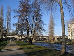
The Adour river through Tarbes
-
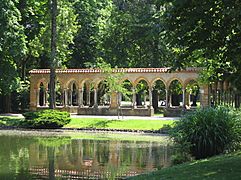
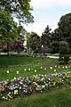
Massey garden
-
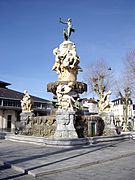
Fountain of the Quatre-Vallées
-
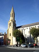
Sainte-Thérèse de Tarbes church
_quai_de_l%27Adour.jpg)


Related pages
Images for kids
-
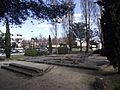
Foundations of an old villa in the Ormeau quarter
-
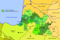
Map of the fiefs of Gascocony around 1150
-
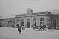
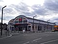
The Gare de Tarbes, around 1900
-
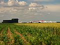
TARMAC and the fields around Ossun.
-
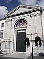
The Tribunal of Grand Instance (High Court) of Tarbes
-
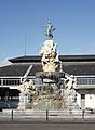
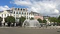
Fountain of the Quatre-Vallées
-
The Alhambra Fountain in Tarbes
-
The fountain in the Place de Verdun
-
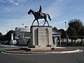
Equestrian statue of Ferdinand Foch
-
The Henri Duparc Conservatory
-
The Massey Garden
-
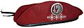
Red beret of the 1st Parachute Hussar Regiment
-
House of Martial Arts
-
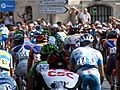
2006 Tour de France stage held in Tarbes with a large turn out
-
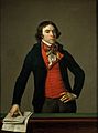
Bertrand Barère
-

Bernard Lapasset
-
Birthplace of Ferdinand Foch
-
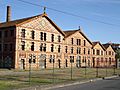
Building 119 became a cinema complex
-
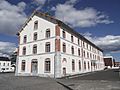
Building 103 became the municipal archives
-
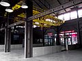
An overhead crane in building 117, which became a leisure complex
-
The Oustau ceramic factory in Aureilhan
-
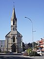
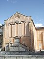
The Church of Saint-Anne
-
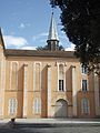
Carmel de Tarbes
-
Carmel de Tarbes
-
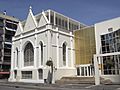
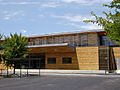
Massey Museum


.jpg)
.JPG)
.JPG)


.JPG)
.JPG)

.JPG)


.jpg)
.JPG)
.JPG)
.JPG)

.JPG)
.JPG)
.JPG)
See also
 In Spanish: Tarbes para niños
