
Temora, New South Wales facts for kids
Quick facts for kids TemoraNew South Wales |
|||||||||
|---|---|---|---|---|---|---|---|---|---|

Temora Court House, constructed in 1902
|
|||||||||

Temora
Location in New South Wales
|
|||||||||
| Population | 4,693 (2016 census) | ||||||||
| Postcode(s) | 2666 | ||||||||
| Elevation | 302 m (991 ft) | ||||||||
| Location |
|
||||||||
| LGA(s) | Temora Shire | ||||||||
| County | Bland | ||||||||
| Parish | Bundawarrah | ||||||||
| State electorate(s) | Cootamundra | ||||||||
| Federal Division(s) | Riverina | ||||||||
|
|||||||||
Temora is a town in the north-east of the Riverina area of New South Wales, 418 kilometres (260 mi) south-west of the state capital, Sydney. At the 2016 census the population of Temora was 4,693.
Temora has been reported as being the friendliest town in New South Wales, following a series of mentions in the Sydney Morning Herald's Column 8, which organised a bus trip to the town for Sydney readers in 2005.
Temora was named by John Donald McCansh. In September 1880 he told the Warwick Argus:
I took up the country for a sheep run in 1847, my sole companion being Valentine Lawler, who was then lessee of a station ('Nimbi') on Cunningham Creek. We could not ascertain the native name of the place as there were no blacks about, and rather than give it an English name, I called it 'Temora', the native name of a property near which I lived some years previously in another part of the Colony. I gave the station the name specially because it was aboriginal and I liked it. I did not know at that time, nor for years afterwards, that Temora was a name in Ossian’s poems.
Neither the Wiradjuri Dictionary (2010) nor the Macquarie Dictionary of Aboriginal Words (2006) lists "temora" or any words similar to it, but the Dharug language dictionary online defines "temora" as "a tree standing alone". Alternatively, in the Celtic language it is derived from a term which means "an eminence commanding a wide view."
Contents
Geography
Temora is located in North Eastern end of the Riverina region of NSW and is also part of the South West Slopes. Temora has an elevation of 302 metres (991 ft) above sea level. The countryside is flat to undulating. To the north of Temora lies the Narraburra Hills which incorporate the Boginderra Hills Nature Reserve.
Temora is located approximately 90 kilometres (56 mi) north of Wagga Wagga. It is situated on the Burley Griffin Way linking Canberra and Griffith and the Goldenfields Way which link Albury and Wagga Wagga to the Newell Highway.
Climate
Temora has a warm temperate climate, with cool to mild winters and warm to hot summers. Under the Köppen climate classification, Temora has a borderline humid subtropical (Cfa) and semi-arid climate (BSk).
Winters can be cool by Australian standards with the mean maximum temperature falling in July to 13.0 °C (55.4 °F) and a mean minimum of 2.1 °C (35.8 °F). The lowest temperature recorded at Temora was −6.4 °C (20.5 °F) on 12 July 1971.
By contrast, summers in Temora are warm to hot with a low Relative humidity. Mean maximum temperatures range between 29.6 and 31.5 °C (85.3 and 88.7 °F). The hottest temperature on record is 44.0 °C (111.2 °F) on 03 Jan 1990. Overnight minimums averaging between13.8 and 16.2 °C (56.8 and 61.2 °F).
| Climate data for Temora Research Station | |||||||||||||
|---|---|---|---|---|---|---|---|---|---|---|---|---|---|
| Month | Jan | Feb | Mar | Apr | May | Jun | Jul | Aug | Sep | Oct | Nov | Dec | Year |
| Record high °C (°F) | 44.0 (111.2) |
43.5 (110.3) |
40.1 (104.2) |
35.8 (96.4) |
27.6 (81.7) |
24.0 (75.2) |
23.9 (75.0) |
27.1 (80.8) |
33.9 (93.0) |
35.8 (96.4) |
42.0 (107.6) |
42.1 (107.8) |
44.0 (111.2) |
| Average high °C (°F) | 31.5 (88.7) |
30.8 (87.4) |
27.8 (82.0) |
22.5 (72.5) |
17.8 (64.0) |
13.9 (57.0) |
13.0 (55.4) |
14.8 (58.6) |
18.2 (64.8) |
22.0 (71.6) |
26.0 (78.8) |
29.7 (85.5) |
22.3 (72.1) |
| Average low °C (°F) | 16.0 (60.8) |
16.2 (61.2) |
13.3 (55.9) |
9.0 (48.2) |
5.6 (42.1) |
3.2 (37.8) |
2.1 (35.8) |
3.0 (37.4) |
4.7 (40.5) |
7.7 (45.9) |
10.6 (51.1) |
13.8 (56.8) |
8.8 (47.8) |
| Record low °C (°F) | 4.7 (40.5) |
4.9 (40.8) |
2.8 (37.0) |
−1.1 (30.0) |
−4.5 (23.9) |
−5.3 (22.5) |
−6.4 (20.5) |
−5.3 (22.5) |
−3.9 (25.0) |
−2.8 (27.0) |
−1.0 (30.2) |
3.4 (38.1) |
−6.4 (20.5) |
| Average precipitation mm (inches) | 46.0 (1.81) |
40.2 (1.58) |
40.4 (1.59) |
41.1 (1.62) |
41.8 (1.65) |
43.1 (1.70) |
46.3 (1.82) |
45.0 (1.77) |
42.1 (1.66) |
52.2 (2.06) |
46.2 (1.82) |
41.3 (1.63) |
525.8 (20.70) |
| Average precipitation days | 5.6 | 5.0 | 5.1 | 6.0 | 8.6 | 10.6 | 12.7 | 11.6 | 9.3 | 8.9 | 6.9 | 6.0 | 96.3 |
History

Temora started as a pastoral station in 1847. Gold was discovered later in the area, and a small village established. Temora Post Office opened on 1 February 1874 and was renamed West Temora in 1880 on the same day an existing East Temora office was renamed Temora.
Gold was first found in the area in 1869 but the main rush commenced in 1879, with over 20,000 people thronging to the gold diggings at Temora the district was proclaimed a gold field on June 4, 1880. Despite drought conditions, it is said that, by 1881, the Temora field was producing half the state's gold. In 1881 the highest yield from the Temora field was attained - an Impressive 35,228oz.
Some large discoveries were made, including the famous Mother Shipton nugget, which weighed in at 308.35 ounces, a facsimile of which appears in the Rock and Mineral Museum section of Temora Rural Museum.
With the collapse of the gold field Temora witnessed a rapid drop in population. By the time of the first Australian Census in 1911 the population was 2,784.
The Temora railway station opened in 1893.
In the early twentieth century, Temora was among a number of places in New South Wales settled by people of German origin. Temora and surrounding districts such a Trungley have many Germanic road names.
In more recent times, gold mining occurred at the Paragon Gold Mine at Gidginbung, 12 km north of the town, from 1986 to 1996.
Transport
Road
Temora is on the crossroads of the Goldfields Way [B85] and Burley Griffin Way [B94]. Goldfields Way runs North-South from Wagga Wagga to West Wyalong and is the main route between Albury and Brisbane. Burley Griffin Way links Griffith to the Hume Highway north west of Yass.
Rail
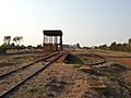
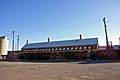
Temora railway station is on the Lake Cargelligo railway line. It opened in 1893. The station had a traditional role as a transfer point for passenger services to Hillston, Lake Cargelligo, Rankin Springs, Burcher and Naradhan, most of which were withdrawn in the late 1970s. The station is not presently served by passenger services however remains an important signalling facility, is used as a stop by the Lachlan Valley Railway and is currently being restored by Temora Shire Council for use a tourist and youth facility.
The Lake Cargelligo railway line branches from the Main South line at Cootamundra and travels in a north-westerly direction to the small town of Lake Cargelligo. The line is used primarily for grain haulage, although passenger service was provided until 1983.
The Temora–Roto railway line is a partly closed railway line which branches from the Lake Cargelligo line at the town of Temora and travels west through the northern part of the Riverina to the towns of Griffith and Hillston. A connection to the Broken Hill line created a cross-country route, although this was never utilised to its full potential, and the line beyond Hillston was built to low grade 'pioneer' standards.
Air
Temora Airport can handle aircraft from light single-engine planes to narrow-body airliners such as the Boeing 737. Currently no regularly scheduled passenger flights serve the airport. As well as the aviation museum the airport also includes a housing estate where people have built houses with an aircraft hangar in their back yard.
Public transport and cycling
NSW TrainLink trains operate from Sydney and Melbourne to Cootamundra train station where they are met by a connecting bus service to transport passengers to Temora. The train to Melbourne includes a stop at Wagga which provides further links to Adelaide.
Temora has an off road bicycle track from the township to Lake Centenary. Temora also has a modest number of on-road bicycle tracks.
Sport
Sport has long been a significant part of life in Temora as can seen by the success Temora has had in various sporting arenas.
Sporting clubs include:
- Temora Basketball Association
- Temora Bowling and Recreation Club
- Temora District Cricket Association
- Temora Dragons Rugby League Club
- Temora Golf Club
- Temora Greyhound Racing Club
- Temora Harness Racing Club
- Temora Little Athletics
- Temora Kangaroos - AFL & Netball
- Temora Rugby Union Club Inc
- Temora Running and Multipsorts Club (RAMS)
- Temora Swimming Club
- Temora Town Tennis Courts
- Temora United Soccer Club
- Temora V8 Jetboats
- The Bonecuds aka Tha Bonecuds, a basketball dynasty with local hip hop group of the same name.
-
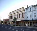
A sample of the architecture in Temora
-
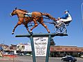
Paleface Adios Memorial
-
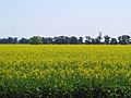
Canola field near Temora
-
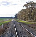
Railway line near Temora
-
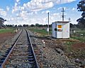
Railway line near Temora
-
Lake Cargelligo Water Tower & Turntable
-
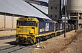
Temora Sub Terminal
-
-
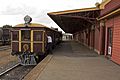
Temora Railway Station


.jpg)


_at_the_Temora_Sub_Terminal.jpg)


Notable people
- Trent Barrett, Former National Rugby League footballer
- Luke Breust, Australian Football League footballer
- Angus Crichton, Rugby League footballer
- Archer Denness, an Australian Army officer who won the Military Cross at the Battle of Yongju in 1950, during the Korean War
- Brett Firman, Rugby League footballer
- Ryan Hinchcliffe, Rugby League footballer
- Raymond Hogan, cricketer who played first-class cricket in England for Northamptonshire
- Kate Jennings, poet, essayist, memoirist, and novelist
- Brad Kahlefeldt World champion triathlete
- Mark Kerry, Olympic gold medal swimmer, member of the "Quietly Confident Quartet"
- Zac Lomax, Rugby League footballer
- Liam Martin, Rugby League footballer
- Josh McCrone, Rugby League footballer
- Don McAlpine, cinema photographer
- Todd Payten, Rugby League footballer
- Scott Reardon, World Champion Water-Skier and Australian Paralympian
- Steve Reardon, Former Rugby League footballer
- Cate Shortland writer and director of film and television
