
Thun facts for kids
Quick facts for kids
Thun
|
||
|---|---|---|

Thun in 2012
|
||
|
||

Thun
Location in Switzerland

Thun
Location in Canton of Bern
|
||
| Country | Switzerland | |
| Canton | Bern | |
| District | Thun | |
| Area | ||
| • Total | 21.57 km2 (8.33 sq mi) | |
| Elevation
(Railway station)
|
560 m (1,840 ft) | |
| Highest elevation
(Dürrenbergwald)
|
1,172 m (3,845 ft) | |
| Lowest elevation
(Aare at Lerchenfeld)
|
552 m (1,811 ft) | |
| Population
(Dec 2020 )
|
||
| • Total | 43,476 | |
| • Density | 2,015.6/km2 (5,220.3/sq mi) | |
| Demonym(s) | German: Thuner(in) | |
| Postal code |
3600-3645
|
|
| Surrounded by | Amsoldingen, Heiligenschwendi, Heimberg, Hilterfingen, Homberg, Schwendibach, Spiez, Steffisburg, Thierachern, Uetendorf, Zwieselberg | |

Thun (French: Thoune) is a city of the administrative district of Thun in the canton of Berne in Switzerland. The city has about 43,783 inhabitants (around 90,000 in the agglomeration), as of 31 December 2013.
It is located where the Aare flows out of Lake Thun (Thunersee), 30 km (19 mi) south of Berne.
Gallery
-
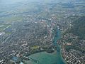
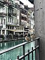
Thun
-
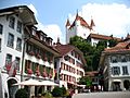
Castle Thun over City Hall Square
-
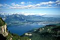
Lake Thun


Images for kids
-
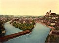
Photochrome of the Aare and Thun Castle from 1900
-
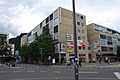
Low rise apartments in Thun
-
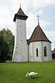
The historic Scherzligen Church in Thun
-

Thun railway station
-

The Hotelfachschule (Hotel management school) in Thun
-
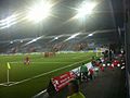
The Thun Arena at night
-
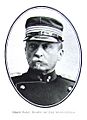
Kolonel Eduard Alexander Rubin, 1920
-

Simona de Silvestro, 2010
-
Thun with birds
-
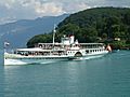
Steamship Blüemlisalp
-
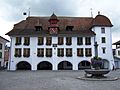
Town council house
-
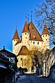
Thun Castle
-
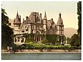
The Castle of Schadau in an early 20th-century image
-
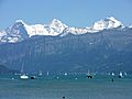
Eiger, Mönch and Jungfrau
-
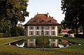
Landsitz Bellerive

_456.JPG)

_457.JPG)


See also
 In Spanish: Thun para niños
