
Transportation in Dallas facts for kids
This article is about transportation systems in and around Dallas, Texas (USA).
Walking and bicycling

Dallas is the 30th most walkable large city in the US, with a Walk Score® of 47. Most of the pedestrian-friendly areas in the city are near downtown and Uptown. The majority of Dallas, whether or not it was developed with the pedestrian in mind, was completely rebuilt or reworked to accommodate the vehicle in the mid-20th century. In the late 1990s and early 2000s (decade), the importance of the pedestrian, bicyclist, and those who use mass transportation began to be realized and most new developments cater to all forms of transportation.
Walking trails, though once nonexistent, are also starting to be built and improved by the city. Perhaps the flagship is the Katy Trail, built over the old Katy Railway, which goes from the Victory Park neighborhood through Uptown and Oak Lawn up to Knox Park. Other trails include the levee-top trails along the Trinity River and the Texas Buckeye Trail in the Great Trinity Forest of south Dallas. The city also maintains walking trails at area parks including parks around White Rock Lake and Bachman Lake.
The city maintains 800 lane miles of cyclist-selected bike routes along low-volume roadways throughout the city that parallel major thoroughfares. The City does not employ bicycle control devices like bike lanes, as the necessary pre-conditions do not exist. The city has also installed a series of Pedestrian Tunnels in Downtown Dallas, although these have been under much criticism regarding their ability to "suck the life off of" the aboveground streets.
Streets


Dallas is devoid of any major street grid as a whole, though a number of major attempts intersect at awkward angles and in confusing interchanges around the city. The main street grid in the center city runs 45° to the typical N/S/E/W grid, creating confusion for many out-of-town visitors. This street grid prevails primarily in east Dallas, though it also permeates Oak Lawn, portions of downtown, and the Cedars. Another much smaller street grid lies downtown between Pacific and Young streets — it is about 15° off the typical N/S/E/W grid, and is on average 5-8 streets across N/S and about 3 miles (5 km) wide E/W. There is also a fairly extensive N/S/E/W grid around the original city of Oak Cliff. The rest of Dallas, developed from the middle of the 20th century on, is typically on a N/S/E/W grid, especially with major thoroughfares. In trying to make the city traversable, city planners have over time created wide boulevards that jump between the rights-of-way of multiple minor streets, trying to force a wide road wherever they can discover space for it. This forces the destruction of the minor streets' original paths, a name-change for the boulevard or minor streets, and roads (e.g. Cole 1, 2, 3) that exist in two or more places. Major thoroughfares in Oak Cliff typically do not cross the Trinity River, and when they do, they frequently do not continue with the same name on the north or eastern sides, which creates a degree of confusion. Also, many times a street will change names each time it crosses a municipal border. Conversely, many streets keep their names through sharp turns across the city.
Highways

The city of Dallas is at the confluence of a large number of major interstate highways—Interstates 20, 30, 35E, and 45 all run through the city. The city's freeway system, as it has no major geographical inhibitors surrounding it, is set up in the popular hub-and-spoke system, much like a wagon wheel. The center of the system is the downtown freeway loop, made up of Interstate 30 on the south, Interstate 35E on the west, Spur 366 on the north, and Interstate 345 on the east. (Interstate 345 is a short spur of Interstate 45 that connects Interstate 45 with US 75.) The next major freeway loop is the Interstate 635/20 Lyndon B. Johnson loop, and the outermost is the tolled President George Bush Turnpike. Inside these freeway loops are other partially limited-access and parkway-style loops including Loop 12 and Belt Line Road. Another beltway around the city is planned upwards of 45 miles (72 km) from downtown in Collin County. Radiating out of downtown as the spokes of the system are Interstates 30, 35E, and 45, US 75, US 175, Spur 366, the tolled Dallas North Tollway, and further out SH 114, US 80 and US 67. Other major highways within the city that do not serve primarily as spokes include SH 183 and Spur 408.
Portions of Interstates 30, 35E, and 635, and US 75 also have either bidirectional or reversible HOV lanes. Future highway plans typically integrate usage of both HOV and/or HOT (tolled) lanes, e.g. the expansion of Interstate 635. Plans for the road include HOV lanes and massive HOT tunnels in the heavily congested segment of the highway between, generally, Interstate 35E and US 75. This portion of the highway travels through one of the densest regions of north Dallas, which, coupled with its primary role as a circulator for commuters, makes the freeway constantly congested at all hours of the day and night.
The city of Dallas's freeways, much like the city, are generally relatively new and in good condition. TxDOT is famous for its highway system in the state and many of what could be considered "flagship freeways" lie within the city. One example is North Central Expressway or US 75, which was trenched, immaculately landscaped and heavily ornamented between downtown and Loop 12 in the 1990s. Interstate 30 west of downtown Dallas was recently brought to a level near North Central Expressway and Interstate 635, Interstate 30 east of downtown, and Interstate 35E all share similar futures. Construction, like many cities, is a constant burden for the city's heavily automobile-centered culture.
Mass transportation


Dallas Area Rapid Transit (DART) is the Dallas area public transportation authority, providing bus and rail service.
DART began operating the first light rail system in the Southwest United States in 1996 and continues to expand its coverage. Currently, four light rail lines are in service. The Red Line goes through Oak Cliff, downtown, Uptown, North Dallas, Richardson and Plano. The Blue Line goes through South Dallas, downtown, Uptown, North Dallas, Garland, and Rowlett. The Green Line goes through south east Dallas, Fair Park, Baylor University Medical Center, downtown, Victory, west of Dallas Love Field, Farmers Branch, then ends in Carrollton. The Orange Line follows the Dart Red Line from North Plano through downtown, then follows the Green Line up through Victory, to Bachman Station, then goes west to Las Colinas before terminating at DFW Airport. All current rail lines are connected downtown by four rail stations. Red, Orange and Blue Lines connect to Cityplace/Uptown Station, currently the only subway station in the Southwest.
DART completed expansions to the Orange line in 2014, bringing the length of the light rail system to around 93 miles (150 km). Further ambitions include expanding the commuter rail network in the region to over 93 miles (150 km); expanding the DART light rail network to over 150 miles (240 km) with a second route through downtown included; expanding the Dallas Streetcar to the Bishop Arts District and Convention Center Hotel; and expanding the elevated Las Colinas Area Personal Transit system to serve new entertainment venues in the area.
The DART light rail system remained the only light rail system in Texas until Houston opened METRORail, its starter light rail system (one line running less than 10 miles), in 2004. Fort Worth's smaller public transit system connects with Dallas's via a commuter rail line, the Trinity Railway Express, connecting downtown Dallas's Union Station with downtown Fort Worth's T&P Station and several points in between. The light rail system has caused a dramatic increase in land values in downtown Dallas and has sparked a residential population boom in the area. Although the system is increasingly popular, large parts of the Metroplex remain outside the current service area of the system and remain dependent on the automobile.
DART now uses Google Maps as its main provider of transit information. An independent company, Dadnab, offers a service that enables riders to retrieve similar information using text messaging from their mobile phones. DART provides transit route and schedule information to Google and this has spawned a new generation of trip planners such as TransitTrips.
RideSearch.com is based out of Carrollton, Texas and serves the Dallas/Fort Worth area. They are similar to DART in that they are a rideshare program that helps match people up who are looking for a ride. Established on January 1, 2008, RideSearch.com has been successful in finding a carpool for many people in the metroplex.
Images for kids
-
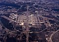
Dallas/Fort Worth International Airport serves most passengers flying in and out of the metroplex

