
Trempealeau County, Wisconsin facts for kids
Quick facts for kids
Trempealeau County
|
|
|---|---|

Carnegie library in Arcadia, Wisconsin.
|
|

Location within the U.S. state of Wisconsin
|
|
 Wisconsin's location within the U.S. |
|
| Country | |
| State | |
| Founded | 1855 |
| Named for | Trempealeau River |
| Seat | Whitehall |
| Largest city | Arcadia |
| Area | |
| • Total | 742 sq mi (1,920 km2) |
| • Land | 733 sq mi (1,900 km2) |
| • Water | 9.0 sq mi (23 km2) 1.2%% |
| Population
(2020)
|
|
| • Total | 30,760 |
| • Density | 41.46/sq mi (16.006/km2) |
| Time zone | UTC−6 (Central) |
| • Summer (DST) | UTC−5 (CDT) |
| Congressional district | 3rd |
Trempealeau County ( trem-PƏ-loh) is a county in the U.S. state of Wisconsin. As of the 2020 census, the population was 30,760. Its county seat is Whitehall. Many people of Polish, Norwegian and German descent live in this area.
Contents
History
Patches of woodland are all that remain of the brush and light forest that once covered the county. In ancient times, the woodlands contained a great deal of timber, but Native Americans burned them periodically to encourage the growth of berries. They did little cultivation and had been almost completely removed from the area by 1837.
French fur traders were the first Europeans to enter this land, traveling by river across the county. At the mouth of the Trempealeau River at its confluence with the Mississippi River, they found a bluff surrounded by water and called it La Montagne qui trempe à l’eau, which means 'mountain steeped in water' (now known as Trempealeau Mountain. The name was later shortened to Trempealeau. Created in 1854 and organized in 1855, the county is named after the river.
Geography
According to the U.S. Census Bureau, the county has a total area of 742 square miles (1,920 km2), of which 733 square miles (1,900 km2) is land and 9.0 square miles (23 km2) (1.2%) is water. It is part of the Driftless Zone.
Adjacent counties
- Buffalo County - west
- Eau Claire County - north
- Jackson County - east
- La Crosse County - southeast
- Winona County, Minnesota - southwest
Major highways
|
|
National protected areas
- Trempealeau National Wildlife Refuge (part)
- Upper Mississippi River National Wildlife and Fish Refuge (part)
Demographics
| Historical population | |||
|---|---|---|---|
| Census | Pop. | %± | |
| 1860 | 2,560 | — | |
| 1870 | 10,732 | 319.2% | |
| 1880 | 17,189 | 60.2% | |
| 1890 | 18,920 | 10.1% | |
| 1900 | 23,114 | 22.2% | |
| 1910 | 22,928 | −0.8% | |
| 1920 | 24,506 | 6.9% | |
| 1930 | 23,910 | −2.4% | |
| 1940 | 24,381 | 2.0% | |
| 1950 | 23,730 | −2.7% | |
| 1960 | 23,377 | −1.5% | |
| 1970 | 23,344 | −0.1% | |
| 1980 | 26,158 | 12.1% | |
| 1990 | 25,263 | −3.4% | |
| 2000 | 27,010 | 6.9% | |
| 2010 | 28,816 | 6.7% | |
| 2020 | 30,760 | 6.7% | |
| U.S. Decennial Census 1790–1960 1900–1990 1990–2000 2010–2020 2020 census |
|||

As of the census of 2000, there were 27,010 people, 10,747 households, and 7,243 families residing in the county. The population density was 37 inhabitants per square mile (14/km2). There were 11,482 housing units at an average density of 16 per square mile (6/km2). The racial makeup of the county was 98.81% White, 0.13% Black or African American, 0.17% Native American, 0.13% Asian, 0.01% Pacific Islander, 0.29% from other races, and 0.47% from two or more races. 0.89% of the population were Hispanic or Latino of any race. 43.5% were of Norwegian, 24.6% German and 17.0% Polish ancestry. 94.9% spoke English, 1.6% Norwegian and 1.6% Spanish as their first language.
There were 10,747 households, out of which 31.80% had children under the age of 18 living with them, 55.20% were married couples living together, 7.40% had a female householder with no husband present, and 32.60% were non-families. 27.60% of all households were made up of individuals, and 13.50% had someone living alone who was 65 years of age or older. The average household size was 2.45 and the average family size was 3.00.
In the county, the population was spread out, with 25.30% under the age of 18, 6.90% from 18 to 24, 28.20% from 25 to 44, 23.10% from 45 to 64, and 16.40% who were 65 years of age or older. The median age was 38 years. For every 100 females there were 100.30 males. For every 100 females age 18 and over, there were 98.80 males.
In 2017, there were 450 births, giving a general fertility rate of 93.1 births per 1000 women aged 15–44, the third highest rate out of all 72 Wisconsin counties.
Communities
Cities
- Arcadia
- Blair
- Galesville
- Independence
- Osseo
- Whitehall (county seat)
Villages
Towns
Census-designated place
Unincorporated communities
Ghost towns
Images for kids
-
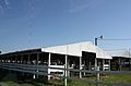
Fairgrounds in Galesville
-
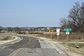
Entrance sign to Trempealeau County in the Town of Ettrick
-
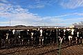
The Cow Farm, Trempealeau County


See also
 In Spanish: Condado de Trempealeau para niños
