
Twin Bridges, Montana facts for kids
Quick facts for kids
Twin Bridges, Montana
|
|
|---|---|

Welcoming water tower from a ranch road
|
|

Location of Twin Bridges, Montana
|
|
| Country | United States |
| State | Montana |
| County | Madison |
| Government | |
| • Type | Council-Mayor |
| Area | |
| • Total | 1.01 sq mi (2.63 km2) |
| • Land | 1.01 sq mi (2.63 km2) |
| • Water | 0.00 sq mi (0.00 km2) |
| Elevation | 4,626 ft (1,410 m) |
| Population
(2020)
|
|
| • Total | 330 |
| • Density | 326.73/sq mi (125.48/km2) |
| Time zone | UTC-7 (Mountain Time Zone) |
| • Summer (DST) | UTC-6 (Mountain Daylight Time) |
| ZIP code |
59754
|
| Area code(s) | 406 |
| FIPS code | 30-75475 |
| GNIS feature ID | 0792499 |
Twin Bridges is a town in Madison County, Montana, United States. It lies at the confluence of the Ruby, Beaverhead and Big Hole Rivers which form the Jefferson River. Twin Bridges is a well-known fly fishing mecca for trout anglers. The population was 330 at the 2020 census.
Contents
Geography
According to the United States Census Bureau, the town has a total area of 0.96 square miles (2.49 km2), all of it land.
Climate
According to the Köppen Climate Classification system, Twin Bridges has a semi-arid climate, abbreviated "BSk" on climate maps.
History

Four Indian trails came together at a bend of the Beaverhead River north of the present school building in Twin Bridges. These trails were used by early settlers and freight companies, and helped to establish where the community of Twin Bridges would develop. Judge M.H. Lott came to Montana in 1862, and with his brother John T. Lott, settled in the Ruby Valley in 1864. In 1865 they built a bridge across the Beaverhead River, and later built another bridge across the Beaverhead at the Point of Rocks. The Lott brothers continued development of roads and promoted settlement of the town, which was incorporated in 1902, with M.H. Lott as the first mayor.
Demographics
| Historical population | |||
|---|---|---|---|
| Census | Pop. | %± | |
| 1910 | 491 | — | |
| 1920 | 755 | 53.8% | |
| 1930 | 671 | −11.1% | |
| 1940 | 534 | −20.4% | |
| 1950 | 497 | −6.9% | |
| 1960 | 509 | 2.4% | |
| 1970 | 613 | 20.4% | |
| 1980 | 437 | −28.7% | |
| 1990 | 374 | −14.4% | |
| 2000 | 400 | 7.0% | |
| 2010 | 375 | −6.2% | |
| 2020 | 330 | −12.0% | |
| U.S. Decennial Census | |||
2010 census
As of the census of 2010, there were 375 people, 172 households, and 94 families living in the town. The population density was 390.6 inhabitants per square mile (150.8/km2). There were 206 housing units at an average density of 214.6 per square mile (82.9/km2). The racial makeup of the town was 96.0% White, 0.5% African American, 0.5% Native American, 0.8% from other races, and 2.1% from two or more races. Hispanic or Latino of any race were 2.9% of the population.
There were 172 households, of which 25.0% had children under the age of 18 living with them, 42.4% were married couples living together, 7.0% had a female householder with no husband present, 5.2% had a male householder with no wife present, and 45.3% were non-families. 37.2% of all households were made up of individuals, and 18% had someone living alone who was 65 years of age or older. The average household size was 2.18 and the average family size was 2.91.
The median age in the town was 44.6 years. 22.7% of residents were under the age of 18; 5.1% were between the ages of 18 and 24; 22.6% were from 25 to 44; 30.7% were from 45 to 64; and 18.9% were 65 years of age or older. The gender makeup of the town was 54.7% male and 45.3% female.
Economy
Twin Bridges serves as a tourist destination for both fly fishers and cyclists. The town sits on two long-distance cycling trails - the TransAmerica Trail, and the Lewis & Clark Bicycle Trail. In 2009, a "bike camp" was built in the town, and local stores started stocking basic cycling supplies.
Education
Twin Bridges Public Schools educate students from kindergarten through 12th grade. The Twin Bridges Public Library serves the area.
Infrastructure
Twin Bridges Airport is a public use airport located two miles (4 km) southeast of town.
Montana Highway 287 and Montana Highway 41 intersect in town.
Notable people
- Angela McLean, lieutenant governor of Montana
- Benny Reynolds, rodeo champion
- Donald Rumsfeld, American political figure and businessman
- Spokane, winner of the 1889 Kentucky Derby
- Kenneth Walsh, member of the Montana House of Representatives
Images for kids
-
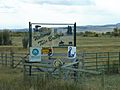
Northern Entrance To Twin Bridges, MT
-
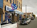
Blue Anchor Cafe, Main Street, Twin Bridges, MT


See also
 In Spanish: Twin Bridges (Montana) para niños
