
U.S. Route 250 facts for kids
Quick facts for kids
|
|
|---|---|
| Lua error in Module:Infobox_road/map at line 15: attempt to index field 'wikibase' (a nil value). | |
| Route information | |
| Auxiliary route of US 50 | |
| Length | 514 mi (827 km) |
| Existed | 1928–present |
| Major junctions | |
| West end | |
|
|
| East end | |
| Highway system | |
| United States Numbered Highways List • Bannered • Divided • Replaced |
|

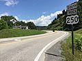
U.S. Route 250 (US 250) is a route of the United States Numbered Highway System. It is a spur of U.S. Route 50. It runs for 514 miles (827 km) from Sandusky, Ohio to Richmond, Virginia. It passes through the states of Virginia, West Virginia, and Ohio. The road goes through the cities of Richmond, Virginia, Charlottesville, Virginia, Staunton, Virginia, and Wheeling, West Virginia. US 250 intersects and forms a short overlap with its parent US 50 west of Pruntytown, West Virginia. In West Virginia, the route is signed north–south. In Ohio and Virginia, the route is signed east–west.
Images for kids
-
View south along US 250 Truck in Philippi
_at_U.S._Route_119_(Mansfield_Drive)_in_Philippi,_Barbour_County,_West_Virginia.jpg)
See also
 In Spanish: U.S. Route 250 para niños
