
Ucayali Region facts for kids
Quick facts for kids
Ucayali Region
|
|||
|---|---|---|---|
|
|||
.svg)
Location of the Ucayali department in Peru
|
|||
| Country | Peru | ||
| Subdivisions | 4 provinces and 14 districts | ||
| Largest city | Pucallpa | ||
| Capital | Pucallpa | ||
| Area | |||
| • Total | 101,830.64 km2 (39,317.03 sq mi) | ||
| Elevation
(Capital)
|
120 m (390 ft) | ||
| Highest elevation | 350 m (1,150 ft) | ||
| Lowest elevation | 135 m (443 ft) | ||
| Population
(2017)
|
|||
| • Total | 496,459 | ||
| • Density | 4.875340/km2 (12.627073/sq mi) | ||
| UBIGEO |
25
|
||
| Dialing code | 061 | ||
| ISO 3166 code | PE-UCA | ||
| Principal resources | Wood, fruit. | ||
| Poverty rate | 70.5% | ||
| Percentage of Peru's GDP | 0.85% | ||
| Website | www.regionucayali.gob.pe | ||


Ucayali is a region in Peru. The capital is the city of Pucallpa. It is in the Amazon rainforest and is bordered by the Brazilian state of Acre on the east; the department of Madre de Dios on the southeast; Cusco on the south; Junín, Pasco and Huánuco on the west; and Loreto on the north.
The name Ucayali comes from the Ucayali River.
Images for kids
-
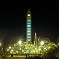
Fountain in the city of Pucallpa.

See also
 In Spanish: Departamento de Ucayali para niños

All content from Kiddle encyclopedia articles (including the article images and facts) can be freely used under Attribution-ShareAlike license, unless stated otherwise. Cite this article:
Ucayali Region Facts for Kids. Kiddle Encyclopedia.