
Upper Arlington, Ohio facts for kids
Quick facts for kids
Upper Arlington, Ohio
|
|
|---|---|

The Upper Arlington Municipal Services Center functions as the seat of city government as well as police headquarters.
|
|
| Motto(s):
"Contendite Ductum" "Strive for Leadership"
|
|
| Country | United States |
| State | Ohio |
| County | Franklin |
| Area | |
| • Total | 9.82 sq mi (25.44 km2) |
| • Land | 9.79 sq mi (25.36 km2) |
| • Water | 0.03 sq mi (0.08 km2) |
| Elevation | 814 ft (248 m) |
| Population | |
| • Total | 36,800 |
| • Density | 3,611.72/sq mi (1,394.51/km2) |
| Time zone | UTC-5 (Eastern (EST)) |
| • Summer (DST) | UTC-4 (EDT) |
| Area code(s) | 614 and 380 |
| FIPS code | 39-79002 |
| GNIS feature ID | 1075125 |
| Website | https://upperarlingtonoh.gov/ |
Upper Arlington, often known by its initials U.A., is a city in Franklin County, Ohio, United States, on the northwest side of the Columbus metropolitan area. The Old Arlington neighborhood is listed on the National Register of Historic Places. As of 2020, the population was 36,800.
Contents
Geography
Upper Arlington is located at 40°1′14″N 83°3′59″W / 40.02056°N 83.06639°W (40.020613, -83.066520). It is bordered on the west by the Scioto River, on the north and east by Columbus, and on the south by Marble Cliff and Grandview Heights. The Olentangy River and the main campus of the Ohio State University are a short distance to the east of Upper Arlington. Downtown Columbus lies to the southeast, its skyline visible across the OSU farmland research facilities extending along Upper Arlington's eastern border.
The city is around 800 ft elevation located between the Olentangy and Scioto rivers. Two ravines cut through the city. The Slate Run in the northwest corner flows into the Scioto River. However, the Turkey Run is longer. It originates in the north then runs southwards until it makes an eastward bend around Reed Rd. Then, it flows eastwards through the OSU Golf Course. The run is used as a storm drain at points, has been dammed in the Ohio State course and runs through concrete pipes at two points. The soil is glacial till and is suitable for agriculture, supporting a research farm operated by The Ohio State University.
According to the United States Census Bureau, the city has a total area of 9.87 square miles (25.56 km2), of which 9.84 square miles (25.49 km2) is land and 0.03 square miles (0.08 km2) is water.
History
Upper Arlington was founded by the real estate developers Ben and King Thompson, who purchased most of the farmland that was to become Upper Arlington in 1913. This land was directly adjacent to the Marble Cliff Quarry Co. They originally wanted to call it the "Country Club District" after the Country Club development in Kansas City, but by 1917, the community became known as "Upper Arlington", in reference to its southern neighbor of Arlington (now known as Marble Cliff). The Upper Arlington Company was incorporated that year and operated out of a field office built on the former Miller farm; that building is presently the Miller Park branch of the Upper Arlington Library (see no. 4 on the map).
The development proceeded according to the Garden City–inspired plan by landscape architect William Pitkin, Jr., which called for following the contours of the land to form curving streets, copiously lined with trees, rather than a gridded street layout. This development style gave the oldest district in Upper Arlington (at its southernmost end) its distinctively pleasant, park-like feel, though the lack of roadway predictability can lead to some frustrating driving experiences even for those familiar with the neighborhood. The area features numerous small green spaces.

In 1916, the development was interrupted (and largely unfinished) when the National Guard used the area as a temporary training camp called Camp Willis, after Ohio's governor at the time, Frank B. Willis. Most annexation occurred in the late 1940s through 1960. The two largest annexations occurred in 1954 and 1955, by which the city more than doubled its surface area.
As was typical in many developing northern communities of the time, the Thompsons included restrictive covenants in their housing deeds that prevented African-Americans from purchasing homes in Upper Arlington (though the deeds did allow "colored servants" to be domiciled within owners' homes). The covenants also prevented Jewish people from purchasing homes. Today’s population remains predominantly white.
The post–World War II housing boom led to the development of many new housing tracts north of Lane Avenue. The newer developments took on a much different character from the older core of the city, being mostly organized along normal street grids, and with the usually ranch-style houses, this area is called River Ridge. By the 1960s, as the city grew north, the houses were larger and the neighborhoods more consistent with the intent, if not style, of the original section south of Lane Avenue. The southern half of the city, designated as the "Upper Arlington Historic District" (though simply referred to as "Old Arlington"), was listed on the National Register of Historic Places in 1985. The city is sister cities with St. Andrews, Scotland.
Materials related to Upper Arlington's history and culture can be viewed online at the UA Archives local history website. The site is part of the UA Archives program, the Upper Arlington Public Library's digital library initiative, which works with the Upper Arlington Historical Society, City of Upper Arlington, Upper Arlington School District, and other community groups to digitize, preserve, and provide free online access to historically and culturally significant materials related to Upper Arlington, to preserve Upper Arlington's history as well as the Upper Arlington Historic District's listing on the National Register of Historic Places.
Demographics
| Historical population | |||
|---|---|---|---|
| Census | Pop. | %± | |
| 1920 | 620 | — | |
| 1930 | 3,059 | 393.4% | |
| 1940 | 5,370 | 75.5% | |
| 1950 | 9,024 | 68.0% | |
| 1960 | 28,486 | 215.7% | |
| 1970 | 38,727 | 36.0% | |
| 1980 | 35,648 | −8.0% | |
| 1990 | 34,128 | −4.3% | |
| 2000 | 33,686 | −1.3% | |
| 2010 | 33,771 | 0.3% | |
| 2015 (est.) | 34,907 | 3.4% | |
| Sources: | |||
2010 census
As of the 2010 census, the population was 33,771 persons, 16,157 male (47.84%) and 17,614 female (52.16%). The following table summarizes census findings for age with the media being 42.8.
| Age group | Number of persons | Percentage |
|---|---|---|
| 0-18 | 8467 | 25.07% |
| 18+ | 25304 | 74.93% |
| 20-24 | 1100 | 3.26% |
| 25-34 | 3177 | 9.41% |
| 35-49 | 7199 | 21.32% |
| 50-64 | 7574 | 22.43% |
| 65+ | 5636 | 16.69% |
| Race | Number of persons | Percentage |
|---|---|---|
| White | 31118 | 92.14% |
| Asian | 1665 | 4.93% |
| Two or More Races | 546 | 1.62 |
| African American | 269 | .80% |
| Other Race | 130 | .38% |
| Native American or Alaskan Native | 36 | .11% |
| Native Hawaiian or Pacific Islander | 7 | - |
| Non-Hispanic (all races) | 33224 | 98.38% |
| Hispanic or Latino (all races) | 547 | 1.62% |
| Housing category | Number of homes | Misc |
|---|---|---|
| Total Homes | 14544 | - |
| Occupied Homes | 13754 | 2.46 residents per occupied home |
| Owner Occupied Homes | 11117 | 80.83% of homes (83.27% of residents) are owner occupied |
| Rented Homes | 2637 | 19.17% of homes (16.73% or residents) are rented |
| Homes with Minors | 4486 | 32.62% of homes had minors, at 1.89 minors/home |
| Vacant Homes | 790 | 5.43% of homes were vacant, including 260 for sale, 201 for rent, and 44 occasional use |
2000 Census
As of the census of 2000, there were 33,686 people, 13,985 households, and 9,509 families residing in the city. The population density was 3,450.2 people per square mile (1,332.6/km²). There were 14,432 housing units at an average density of 1,478.2 per square mile (570.9/km²). The racial makeup of the city was 93.74% White, 3.52% Asian, 0.98% Hispanic or Latino, 0.52% African American, 0.10% Native American, 0.01% Pacific Islander, 0.27% from other races, and 0.79% from two or more races.
There were 13,985 households out of which 31.9% had children under the age of 18 living with them, 59.1% were married couples living together, 6.9% had a female householder with no husband present, and 32.0% were non-families. 28.2% of all households were made up of individuals and 12.9% had someone living alone who was 65 years of age or older. The average household size was 2.39 and the average family size was 2.95.
In the city the population was spread out with 24.9% under the age of 18, 4.4% from 18 to 24, 25.1% from 25 to 44, 27.1% from 45 to 64, and 18.6% who were 65 years of age or older. The median age was 43 years. For every 100 females there were 89.2 males. For every 100 females age 18 and over, there were 85.0 males.
The median income for a household in the city was $72,116, and the median income for a family was $110,208 (According to a 2007 estimate, these values were $88,365 and $112,575 respectively). Males had a median income of $66,846 versus $41,581 for females. The per capita income for the city was $42,025. About 1.7% of families and 2.4% of the population were below the poverty line, including 1.9% of those under age 18 and 2.0% of those age 65 or over.
Family data
- 99.2% (33,517) live in households
- 40.7% (13754) are householders
- 24.1% (8124) were spouses of householders
- 30.0% (10,123) were children
- 24.5% were the householder's child under 18 years
- 68.9% of households were families, 32.6% were households with children
- 59.1% were married couples
- 26.9% were householders living alone
- 4.3% were single mothers
- 1.3% were single fathers
One notable feature of the Upper Arlington demographic is a "bottleneck" population pyramid, with large numbers of children (under 18), few young adults, and more older adults. The most prevalent population group is 50-64, higher than the national average. This population bottleneck can be explained by young residents moving outside the city upon adulthood and families with children moving to the city at a relatively late age. Such an explanation would also reflect the relatively high price of homes in the city (compared to neighboring areas), which are not affordable for younger adults. Another feature of the Upper Arlington demographic is the overwhelming white majority and the relative lack of other groups except Asians, whose population proportion is similar to the national average and above the Ohio average. In general, Upper Arlington has above average rates of home ownership and relatively few unoccupied homes.
Community Events

Key to map: 1. Upper Arlington Municipal Services Center; 2. UA High School; 3. Northam Park and main UA Public Library; 4. Miller Park and library branch; 5. Lane Road Park and library branch; 6. Fancyburg Park; 7. Lane Avenue Shopping Center; 8. Kingsdale Shopping Center; 9. Ohio State University Golf Course; 10. Scioto Country Club; 11. Griggs Reservoir; 12. AOL office (former Compuserve corporate headquarters); 13. Quarries.
Upper Arlington annually hosts a Fourth of July parade and fireworks display, thanks to the efforts of members of the Upper Arlington Civic Association. The fireworks display is the second largest in the state by volume. The Upper Arlington Labor Day Arts Festival at Northam Park (see no. 3 on the map) and the annual Halloween festival at Tremont Elementary School, where visitors can buy crafts, treats, pumpkins and other items are other notable community events. The City's Parks & Recreation Department hosts numerous events including the Winter Festival and Tree Lighting, Spring Fling, Summer Celebration and Fall Fest. Other events include the Chamber's Taste of UA festival, and during the summer months Upper Arlington also hosts a program called "Movie in the Park" where movies are typically shown free of charge in Upper Arlington's various parks. A farmer's market is held every Wednesday afternoon in the parking lot of the Senior Center in Northam Park from May into October. The City’s Cultural Arts Division hosts a summer Music in the Park series and showcases juried exhibitions featuring two- and three-dimensional art in the Concourse Gallery at the Municipal Services Center, 3600 Tremont Road.
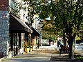
Gallery
-
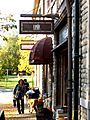
Downtown
-


Education

The Upper Arlington City School District serves the entire municipality. As of 2000, the Upper Arlington Board of Education was the city's largest employer. The district provides an early education school, five elementary schools, two middle schools, and a high school. Burbank Early Education School serves students before the elementary level and was created during a period when the population demanded fewer elementary buildings. The district offers an optional informal/progressive style of education through Wickliffe Progressive Elementary and Barrington Elementary, the latter of which also provides a contemporary program [1]. Other elementary schools include Greensview, Tremont and Windermere.
Hastings Middle School was built in the 1960s and serves the northern area of the district. Jones Middle School is located in the former high school building that was also the site of the Willis National Guard Camp and serves the southern portion. Upper Arlington High School serves students from the entire district and boasts membership in the International Baccalaureate program. The Upper Arlington High School mascot is the Golden Bear, which became the nickname of professional golfer Jack Nicklaus, an alumnus of the school.
Also in the city are a private K-12 school, The Wellington School and two Catholic grade schools—St. Agatha and St. Andrew. Both St. Agatha and St. Andrew offer K-8 programs and preschool childcare centers.
Notable people
- John W. Bricker, U.S. Senator and the 54th Governor of Ohio
- Jake Borelli, actor
- Cordelia E Cook, first woman to receive both the Bronze Star Medal and the Purple Heart
- John Cooper, football player and coach for The Ohio State University from 1988 to 2000
- Beverly D'Angelo, actress and singer
- Nick Foligno, ice hockey player, team captain for the Columbus Blue Jackets
- Simon Fraser, college and professional football player
- Woody Hayes, head football coach of The Ohio State Buckeyes
- Arthur G. James, surgeon who specialized in treating cancer patients, namesake of the Arthur G. James Cancer Hospital
- Abigail Johnston, USA Olympic silver-medalist synchronized diver
- Jack Nicklaus, professional golfer
- William O’Neill, 59th Governor of Ohio
- James A. Rhodes, U.S. state governor, served four, four-year terms in office
- Randy Skinner, Broadway Director and Choreographer
- George Smoot, Nobel Prize winning astrophysicist, cosmologist
- Chris Spielman, professional football player, television sports commentator for ESPN and ABC Sports
- Steve Stivers, U.S. House Representative for Ohio's 15th congressional district
- Melinda Lou "Wendy" Thomas, businesswoman and namesake for Wendy's
- Rex Dave Thomas, businessman and founder of Wendy's
- Jim Tressel, head football coach of The Ohio State Buckeyes, President of Youngstown State University
Images for kids
-
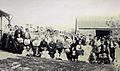
Richards & McCoy reunion
-
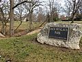
Jack Nicklaus Park, named for Upper Arlington resident Jack Nicklaus

_(31709609883).jpg)
See also
 In Spanish: Upper Arlington (Ohio) para niños
