
Urana County facts for kids
Quick facts for kids UranaNew South Wales |
|||||||||||||||
|---|---|---|---|---|---|---|---|---|---|---|---|---|---|---|---|

Location in New South Wales
|
|||||||||||||||
|
|||||||||||||||
Urana County is one of the 141 Cadastral divisions of New South Wales. It contains the towns of Urana and Bidgeemia.
The name Urana is believed to be derived from a local Aboriginal word, and is referenced in relation to the town of Urana, New South Wales as coming from the Aboriginal word 'airana', meaning a temporary shelter (usually consisting of a simple frame of branches covered with bark, leaves, or grass).
Parishes within this county
A full list of parishes found within this county; their current LGA and mapping coordinates to the approximate centre of each location is as follows:
| Parish | LGA | Coordinates |
|---|---|---|
| Betts | Federation Council | 35°04′54″S 146°13′04″E / 35.08167°S 146.21778°E |
| Bingagong | Federation Council | 34°58′54″S 146°17′04″E / 34.98167°S 146.28444°E |
| Bolton | Murrumbidgee Council | 35°12′54″S 145°49′04″E / 35.21500°S 145.81778°E |
| Booroobanilly | Murrumbidgee Council | 35°28′54″S 145°34′04″E / 35.48167°S 145.56778°E |
| Boree Creek | Federation Council | 35°04′54″S 146°39′04″E / 35.08167°S 146.65111°E |
| Boreegerry | Federation Council | 35°32′54″S 146°05′04″E / 35.54833°S 146.08444°E |
| Brookong North | Lockhart Shire | 35°10′54″S 146°00′04″E / 35.18167°S 146.00111°E |
| Brookong | Lockhart Shire | 35°17′54″S 146°35′04″E / 35.29833°S 146.58444°E |
| Broome | Murrumbidgee Council | 35°05′54″S 145°49′04″E / 35.09833°S 145.81778°E |
| Bundure North | Murrumbidgee Council | 35°02′54″S 145°59′04″E / 35.04833°S 145.98444°E |
| Bundure | Murrumbidgee Council | 35°05′54″S 145°59′04″E / 35.09833°S 145.98444°E |
| Butherwa | Federation Council | 35°15′54″S 146°21′04″E / 35.26500°S 146.35111°E |
| Cadell | Murrumbidgee Council | 35°01′54″S 145°52′04″E / 35.03167°S 145.86778°E |
| Carnerney | Murrumbidgee Council | 35°16′15″S 145°50′08″E / 35.27083°S 145.83556°E |
| Clear Hill | Federation Council | 35°28′54″S 146°11′04″E / 35.48167°S 146.18444°E |
| Clear Hill | Federation Council | 35°30′54″S 146°10′04″E / 35.51500°S 146.16778°E |
| Clive | Lockhart Shire | 35°23′54″S 146°45′04″E / 35.39833°S 146.75111°E |
| Clyde | Narrandera Shire | 35°01′54″S 146°27′04″E / 35.03167°S 146.45111°E |
| Cocketgedong | Federation Council | 35°14′54″S 145°59′04″E / 35.24833°S 145.98444°E |
| Colkmannan | Federation Council | 34°57′54″S 146°08′04″E / 34.96500°S 146.13444°E |
| Colombo | Federation Council | 35°07′54″S 146°06′04″E / 35.13167°S 146.10111°E |
| Combermere | Federation Council | 35°23′54″S 146°05′04″E / 35.39833°S 146.08444°E |
| Coonong | Federation Council | 35°11′54″S 146°10′04″E / 35.19833°S 146.16778°E |
| Coree North | Murrumbidgee Council | 35°17′54″S 145°35′04″E / 35.29833°S 145.58444°E |
| Coree South | Murrumbidgee Council | 35°23′54″S 145°34′04″E / 35.39833°S 145.56778°E |
| Crommelin | Federation Council | 35°00′54″S 146°07′04″E / 35.01500°S 146.11778°E |
| Cullivel | Lockhart Shire | 35°16′54″S 146°30′04″E / 35.28167°S 146.50111°E |
| Douglas | Federation Council | 35°04′54″S 146°04′04″E / 35.08167°S 146.06778°E |
| Faed | Federation Council | 35°22′54″S 146°22′04″E / 35.38167°S 146.36778°E |
| Finlay | Lockhart Shire | 35°25′54″S 146°35′04″E / 35.43167°S 146.58444°E |
| Galore | Lockhart Shire | 35°10′54″S 146°45′04″E / 35.18167°S 146.75111°E |
| Goolgumbla | Murrumbidgee Council | 35°03′54″S 145°37′04″E / 35.06500°S 145.61778°E |
| Gunambill | Federation Council | 35°15′54″S 146°15′04″E / 35.26500°S 146.25111°E |
| Gunambill | Federation Council | 35°33′54″S 146°15′04″E / 35.56500°S 146.25111°E |
| Hardie | Murrumbidgee Council | 35°28′54″S 145°54′04″E / 35.48167°S 145.90111°E |
| Hastings | Federation Council | 35°23′54″S 146°10′04″E / 35.39833°S 146.16778°E |
| Hebden | Lockhart Shire | 35°17′54″S 146°40′04″E / 35.29833°S 146.66778°E |
| Henty | Federation Council | 35°28′54″S 146°05′04″E / 35.48167°S 146.08444°E |
| Howell | Federation Council | 34°55′54″S 146°14′04″E / 34.93167°S 146.23444°E |
| Jerilderie North | Murrumbidgee Council | 35°17′54″S 145°44′04″E / 35.29833°S 145.73444°E |
| Jerilderie South | Murrumbidgee Council | 35°22′54″S 145°44′04″E / 35.38167°S 145.73444°E |
| Kendall | Federation Council | 35°13′54″S 146°04′04″E / 35.23167°S 146.06778°E |
| Lake | Federation Council | 35°06′54″S 146°31′04″E / 35.11500°S 146.51778°E |
| Lockhart | Lockhart Shire | 35°12′54″S 146°46′04″E / 35.21500°S 146.76778°E |
| Mairjimmy | Murrumbidgee Council | 35°30′54″S 145°46′04″E / 35.51500°S 145.76778°E |
| Morundah South | Federation Council | 35°06′54″S 146°21′04″E / 35.11500°S 146.35111°E |
| Morundah | Federation Council | 35°01′18″S 146°22′31″E / 35.02167°S 146.37528°E |
| Mucra | Lockhart Shire | 35°11′54″S 146°30′04″E / 35.19833°S 146.50111°E |
| Munyabla | Lockhart Shire | 35°27′54″S 146°48′04″E / 35.46500°S 146.80111°E |
| Napier | Lockhart Shire | 35°17′54″S 146°46′04″E / 35.29833°S 146.76778°E |
| North Gunambill | Federation Council | 35°25′54″S 146°16′04″E / 35.43167°S 146.26778°E |
| Nowranie | Murrumbidgee Council | 35°21′54″S 146°01′04″E / 35.36500°S 146.01778°E |
| Osborne | Lockhart Shire | 35°11′54″S 146°41′04″E / 35.19833°S 146.68444°E |
| Palmer | Murrumbidgee Council | 35°26′54″S 146°01′04″E / 35.44833°S 146.01778°E |
| Palmer | Federation Council | 35°30′54″S 146°01′04″E / 35.51500°S 146.01778°E |
| Piney Ridge | Federation Council | 35°10′54″S 146°22′04″E / 35.18167°S 146.36778°E |
| Pullega | Murrumbidgee Council | 34°55′54″S 145°53′04″E / 34.93167°S 145.88444°E |
| Ross | Lockhart Shire | 35°27′54″S 146°40′04″E / 35.46500°S 146.66778°E |
| Stanley | Murrumbidgee Council | 35°05′54″S 145°42′04″E / 35.09833°S 145.70111°E |
| Sumner | Lockhart Shire | 35°25′54″S 146°31′04″E / 35.43167°S 146.51778°E |
| Thurrowa | Jerilderie | 35°09′54″S 145°58′04″E / 35.16500°S 145.96778°E |
| Urana | Federation Council | 35°19′54″S 146°16′04″E / 35.33167°S 146.26778°E |
| Urangeline | Lockhart Shire | 35°21′54″S 146°31′04″E / 35.36500°S 146.51778°E |
| Wallandoon | Lockhart Shire | 35°27′54″S 146°44′04″E / 35.46500°S 146.73444°E |
| Waloona | Murrumbidgee Council | 34°54′54″S 145°40′04″E / 34.91500°S 145.66778°E |
| Watt | Federation Council | 35°15′54″S 146°09′04″E / 35.26500°S 146.15111°E |
| Waugh | Federation Council | 34°58′54″S 146°23′04″E / 34.98167°S 146.38444°E |
| Widgiewa | Federation Council | 35°11′54″S 146°16′04″E / 35.19833°S 146.26778°E |
| Wilson | Federation Council | 35°29′54″S 146°17′04″E / 35.49833°S 146.28444°E |
| Wood | Murrumbidgee Council | 35°09′54″S 145°35′04″E / 35.16500°S 145.58444°E |
| Wunnamurra | Murrumbidgee Council | 35°26′54″S 145°43′04″E / 35.44833°S 145.71778°E |
| Yamma | Murrumbidgee Council | 34°56′54″S 146°00′04″E / 34.94833°S 146.00111°E |
| Yanko South | Murrumbidgee Council | 34°59′54″S 145°48′04″E / 34.99833°S 145.80111°E |
| Yanko | Murrumbidgee Council | 34°54′54″S 145°47′04″E / 34.91500°S 145.78444°E |
| Yathong South | Murrumbidgee Council | 35°22′54″S 145°54′04″E / 35.38167°S 145.90111°E |
| Yathong | Murrumbidgee Council | 35°17′17″S 145°55′06″E / 35.28806°S 145.91833°E |
Images for kids
-
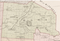
Urana County NSW as shown on John Sands 1886 map)
.png)

All content from Kiddle encyclopedia articles (including the article images and facts) can be freely used under Attribution-ShareAlike license, unless stated otherwise. Cite this article:
Urana County Facts for Kids. Kiddle Encyclopedia.