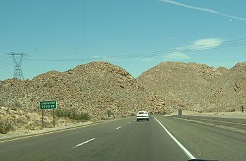
Vallecito Mountains facts for kids
Quick facts for kids Vallecito Mountains |
|
|---|---|

Vallecito Mountains
|
|
| Highest point | |
| Peak | Whale Peak |
| Elevation | 1,630 m (5,350 ft) |
| Geography | |
| Country | United States |
| State | California |
| Region | Colorado Desert |
| District | Anza-Borrego Desert State Park, San Diego County |
| Range coordinates | 33°1′45.170″N 116°18′58.044″W / 33.02921389°N 116.31612333°W |
| Topo map | USGS Whale Peak |
The Vallecito Mountains are located in the Colorado Desert, in eastern San Diego County, Southern California. They are about 28 miles (45 km) north of the U.S. border with Mexico.
Geography
The mountains lie in Anza-Borrego Desert State Park, in an east–west direction, southwest of the community of Ocotillo Wells, and south of Highway 78. The range is approximately 15 miles (24 km) long, and reaches an elevation of 5,349 feet (1,630 m) above sea level at Whale Peak.
The Laguna Mountains are to the southwest and Volcan Mountains to the northwest, and the Pinyon Mountains and Borrego Valley are on the north side. The Sawtooth Mountains, Tierra Blanca Mountains and Jacumba Mountains ranges lie to the south and southeast.

All content from Kiddle encyclopedia articles (including the article images and facts) can be freely used under Attribution-ShareAlike license, unless stated otherwise. Cite this article:
Vallecito Mountains Facts for Kids. Kiddle Encyclopedia.

