
Washington, Missouri facts for kids
Quick facts for kids
Washington, Missouri
|
|
|---|---|

Downtown Washington at dusk, as seen from its Missouri River dock and park
|
|
| Nickname(s):
Pipe City
|
|

Location of Washington, Missouri
|
|
| Country | United States |
| State | Missouri |
| County | Franklin |
| Named for | George Washington |
| Area | |
| • Total | 9.95 sq mi (25.76 km2) |
| • Land | 9.45 sq mi (24.47 km2) |
| • Water | 0.50 sq mi (1.30 km2) |
| Elevation | 551 ft (168 m) |
| Population
(2010)
|
|
| • Total | 13,982 |
| • Estimate
(2019)
|
14,081 |
| • Density | 1,490.53/sq mi (575.50/km2) |
| Time zone | UTC-6 (Central (CST)) |
| • Summer (DST) | UTC-5 (CDT) |
| ZIP code |
63090
|
| Area code(s) | 636 |
| FIPS code | 29-77416 |
| GNIS feature ID | 0731664 |
Washington is a city on the Missouri River in Franklin County, Missouri, United States. The population was 13,892 from the 2010 census. It is the corncob pipe capital of the world, with Missouri Meerschaum located on the riverfront.
Contents
Geography
Washington is located at 38°33′7″N 91°0′48″W / 38.55194°N 91.01333°W (38.551879, -91.013313). According to the United States Census Bureau, the city has a total area of 9.87 square miles (25.56 km2), of which, 9.34 square miles (24.19 km2) is land and 0.53 square miles (1.37 km2) is water. The city has an extreme continental climate. The majority of annual precipitation falls during the humid springs and summers. Typically, falls and winters are relatively dry. While snow is not rare, it is not as frequent as in the upper Midwest. An average of 19 inches falls annually.
History
Named after George Washington after it came under American control, the town was first settled during the rule of the Spanish Empire. It was originally called St. John Meyer's Settlement and was the site of the Spanish log fort, San Juan del Misuri (1796–1803).
Family and followers of Daniel Boone settled the area starting in 1799. In 1814 a ferry boat was licensed for crossing the Missouri River to the north and the settlement became known as Washington Landing. In 1827 a town was laid out, with sale of lots starting in 1829. The cost of land was waived if the buyer could build a substantial house within two years. This encouraged many new settlers.
Substantial numbers of anti-slavery German families started moving to the town in 1833, and they soon overwhelmed the existing population of slaveowners. Washington became a strong supporter of the Union during the American Civil War. The town was ransacked by Confederate General Sterling Price's soldiers, but they were unable to keep control of the area.
After the war, Washington became a railroad and steamboat transportation center. Its manufacturing industry while strong, is not as vibrant as it was decades ago. The town of Washington has 445 buildings on the National Register of Historic Places, a state record. Due to its historic charm, Washington has a growing heritage tourism industry, with visitors also attracted to the nearby Missouri Rhineland.
Washington was the site for the third season of the television series Town Haul.
Demographics
| Historical population | |||
|---|---|---|---|
| Census | Pop. | %± | |
| 1880 | 2,421 | — | |
| 1890 | 2,725 | 12.6% | |
| 1900 | 3,015 | 10.6% | |
| 1910 | 3,670 | 21.7% | |
| 1920 | 3,132 | −14.7% | |
| 1930 | 5,918 | 89.0% | |
| 1940 | 6,756 | 14.2% | |
| 1950 | 6,850 | 1.4% | |
| 1960 | 7,961 | 16.2% | |
| 1970 | 8,499 | 6.8% | |
| 1980 | 9,251 | 8.8% | |
| 1990 | 10,704 | 15.7% | |
| 2000 | 13,243 | 23.7% | |
| 2010 | 13,982 | 5.6% | |
| 2019 (est.) | 14,081 | 0.7% | |
| U.S. Decennial Census | |||
2010 census
As of the census of 2010, there were 13,982 people, 5,863 households, and 3,665 families living in the city. The population density was 1,497.0 inhabitants per square mile (578.0/km2). There were 6,319 housing units at an average density of 676.6 per square mile (261.2/km2). The racial makeup of the city was 96.7% White, 0.7% African American, 0.1% Native American, 0.5% Asian, 0.1% Pacific Islander, 0.7% from other races, and 1.2% from two or more races. Hispanic or Latino of any race were 2.1% of the population.
There were 5,863 households, of which 31.3% had children under the age of 18 living with them, 48.3% were married couples living together, 10.1% had a female householder with no husband present, 4.0% had a male householder with no wife present, and 37.5% were non-families. 31.9% of all households were made up of individuals, and 14% had someone living alone who was 65 years of age or older. The average household size was 2.35 and the average family size was 2.97.
The median age in the city was 39.4 years. 24.1% of residents were under the age of 18; 8.1% were between the ages of 18 and 24; 24.8% were from 25 to 44; 26.1% were from 45 to 64; and 17% were 65 years of age or older. The gender makeup of the city was 47.8% male and 52.2% female.
Sister city
In 1990 Marbach am Neckar (Germany) became the sister city of Washington. Student exchanges and visitations between the two cities occur occasionally.
Education

School District of Washington operates public schools. Washington High School is the local high school.
Private schools:
- St. Francis Borgia Regional High School
- St. Francis Borgia Grade School (PK-8)
- Our Lady of Lourdes Grade School (PK-8)
- Immanuel Lutheran School (PK-8)
Washington has a public library, a branch of the Scenic Regional Library system.
Notable people
- Jack Wagner - (born October 3, 1959 in Washington) is an Emmy Award-nominated American actor. Roles on General Hospital and The Bold and the Beautiful. He also played a swinging doctor on Melrose Place.
- Matt Pickens is a professional soccer player currently playing for the Tampa Bay Rowdies. Pickens played in the Major League Soccer (MLS) with the Chicago Fire and the Colorado Rapids. While captain of the Rapids, Pickens led his team to Colorado's first MLS championship. Pickens was signed by the English football club Queens Park Rangers, only to be plagued by injuries and unstable front office management.
Images for kids
-
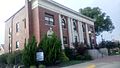
City hall

See also
 In Spanish: Washington (Misuri) para niños
