
Watertown, South Dakota facts for kids
Quick facts for kids
Watertown, South Dakota
|
|
|---|---|

Intersection of Interstate 29 and Highway 212: The Redlin Art Center
|
|
| Nickname(s):
South Dakota's Rising Star
|
|

Location in Codington County and the state of South Dakota
|
|
| Country | United States |
| State | South Dakota |
| County | Codington |
| Founded | 1879 |
| Incorporated | 1885 |
| Government | |
| • Type | Mayor–council |
| • Body | Watertown City Council |
| Area | |
| • City | 26.09 sq mi (67.59 km2) |
| • Land | 18.12 sq mi (46.93 km2) |
| • Water | 7.98 sq mi (20.66 km2) |
| Elevation | 1,732 ft (528 m) |
| Population
(2020)
|
|
| • City | 22,655 |
| • Estimate
(2020)
|
22,655 |
| • Density | 1,231.3/sq mi (475.3/km2) |
| • Metro | 28,099 (US: 443th) |
| Time zone | UTC−6 (CST) |
| • Summer (DST) | UTC−5 (CDT) |
| ZIP code |
57201
|
| Area code(s) | 605 |
| FIPS code | 46-69300 |
| GNIS feature ID | 1258841 |
| Website | Watertown |
Watertown is a city in and the county seat of Codington County, South Dakota, United States. Watertown is home to the Redlin Art Center which houses many of the original art works produced by Terry Redlin, one of America's most popular wildlife artists. Watertown is located between Pelican Lake and Lake Kampeska, from which Redlin derived inspiration for his artwork.
The population was 22,655 at the 2020 census, making Watertown the fifth largest city in South Dakota. It is also the principal city of the Watertown Micropolitan Statistical Area, which includes all of Codington and Hamlin counties. Watertown also is home to the Bramble Park Zoo. Watertown's residential real estate is considered the most expensive in South Dakota for cities of its size; the median price for a home in Watertown is approximately $200,000.
Contents
Geography
Watertown is located at 44°54′12″N 97°7′14″W / 44.90333°N 97.12056°W (44.903433, -97.120437), along the Big Sioux River.
According to the United States Census Bureau, the city has a total area of 25.04 square miles (64.85 km2), of which, 17.45 square miles (45.20 km2) is land and 7.59 square miles (19.66 km2) is water. Watertown sits on the Big Sioux River and two major lakes, Lake Pelican and Lake Kampeska. Most of Watertown also sits upon a short plateau. Elevation at Watertown Regional Airport is 1,745 feet.
Watertown has been assigned the ZIP code 57201 and the FIPS place code 69300.
History

Watertown was founded in 1879 as a rail terminus when the Chicago & Northwestern Railroad reactivated part of a line it had constructed to Lake Kampeska. Despite the prominence of rivers and lakes in the area, the city was named after Watertown, New York, the hometown of brothers John E. Kemp and Oscar P. Kemp, two of the city's founders. The town's name was originally planned to be named Kampeska.
During the 1880s, Watertown prospered as a transportation hub after the railroads had been extended further west. Along with several other cities, Watertown had been a candidate as capital of the new state of South Dakota, although it lost out to the more centrally located Pierre. The city's current newspaper, the Watertown Public Opinion, began publishing in 1887.
In the mid-20th century, Interstate 29 was constructed through eastern South Dakota. The route included a slight bend to bring the interstate closer to Watertown. The interstate's construction has been a major economic benefit to the larger communities along its route, including Watertown.
Climate
| Climate data for Watertown, SD | |||||||||||||
|---|---|---|---|---|---|---|---|---|---|---|---|---|---|
| Month | Jan | Feb | Mar | Apr | May | Jun | Jul | Aug | Sep | Oct | Nov | Dec | Year |
| Record high °F (°C) | 65 (18) |
66 (19) |
82 (28) |
95 (35) |
106 (41) |
107 (42) |
110 (43) |
105 (41) |
104 (40) |
91 (33) |
77 (25) |
69 (21) |
110 (43) |
| Average high °F (°C) | 21.0 (−6.1) |
25.5 (−3.6) |
38.3 (3.5) |
55.3 (12.9) |
67.8 (19.9) |
77.1 (25.1) |
83.4 (28.6) |
81.6 (27.6) |
71.7 (22.1) |
58.6 (14.8) |
40.2 (4.6) |
26.1 (−3.3) |
53.9 (12.2) |
| Average low °F (°C) | 0.6 (−17.4) |
4.8 (−15.1) |
18.2 (−7.7) |
31.8 (−0.1) |
43.4 (6.3) |
53.7 (12.1) |
58.6 (14.8) |
56.3 (13.5) |
46.6 (8.1) |
34.8 (1.6) |
20.4 (−6.4) |
7.3 (−13.7) |
31.4 (−0.3) |
| Record low °F (°C) | −40 (−40) |
−38 (−39) |
−27 (−33) |
−10 (−23) |
16 (−9) |
25 (−4) |
35 (2) |
32 (0) |
9 (−13) |
−2 (−19) |
−20 (−29) |
−37 (−38) |
−40 (−40) |
| Average precipitation inches (mm) | 0.55 (14) |
0.59 (15) |
1.05 (27) |
2.09 (53) |
2.86 (73) |
3.69 (94) |
2.88 (73) |
2.28 (58) |
2.05 (52) |
1.54 (39) |
0.78 (20) |
0.51 (13) |
20.87 (531) |
| Average snowfall inches (cm) | 6.0 (15) |
6.2 (16) |
6.1 (15) |
2.5 (6.4) |
0.2 (0.51) |
0 (0) |
0 (0) |
0 (0) |
0 (0) |
1.2 (3.0) |
4.0 (10) |
5.1 (13) |
31.3 (78.91) |
| Source: http://www.wrcc.dri.edu/cgi-bin/cliMAIN.pl?sd8932 | |||||||||||||
Demographics
| Historical population | |||
|---|---|---|---|
| Census | Pop. | %± | |
| 1880 | 746 | — | |
| 1890 | 2,672 | 258.2% | |
| 1900 | 3,352 | 25.4% | |
| 1910 | 7,010 | 109.1% | |
| 1920 | 9,400 | 34.1% | |
| 1930 | 10,214 | 8.7% | |
| 1940 | 10,617 | 3.9% | |
| 1950 | 12,699 | 19.6% | |
| 1960 | 14,077 | 10.9% | |
| 1970 | 13,388 | −4.9% | |
| 1980 | 15,649 | 16.9% | |
| 1990 | 17,592 | 12.4% | |
| 2000 | 20,237 | 15.0% | |
| 2010 | 21,482 | 6.2% | |
| 2019 (est.) | 22,174 | 3.2% | |
| U.S. Decennial Census | |||
The per capita income for the city was $18,994. About 5.7% of families and 9.3% of the population were below the poverty line, including 8.5% of those under age 18 and 11.0% of those age 65 or over.
2010 census
As of the census of 2010, there were 21,482 people, 9,278 households, and 5,563 families residing in the city. The population density was 1,231.3 inhabitants per square mile (475.4/km2). There were 10,050 housing units at an average density of 575.9 per square mile (222.4/km2). The racial makeup of the city was 94.8% White, 0.4% African American, 2.4% Native American, 0.5% Asian, 0.5% from other races, and 1.4% from two or more races. Hispanic or Latino of any race were 1.6% of the population.
There were 9,278 households, of which 29.6% had children under the age of 18 living with them, 45.7% were married couples living together, 10.0% had a female householder with no husband present, 4.3% had a male householder with no wife present, and 40.0% were non-families. 33.0% of all households were made up of individuals, and 12.4% had someone living alone who was 65 years of age or older. The average household size was 2.28 and the average family size was 2.90.
The median age in the city was 36.6 years. 24.2% of residents were under the age of 18; 10.3% were between the ages of 18 and 24; 24.9% were from 25 to 44; 25.2% were from 45 to 64; and 15.4% were 65 years of age or older. The gender makeup of the city was 49.2% male and 50.8% female.
Points of interest

- Redlin Art Center
- Bramble Park Zoo
- Codington County Heritage Museum
- Mellette House
- Watertown Stadium
- Lake Kampeska
- Lake Pelican
Transportation
 Interstate 29-serves Watertown at Exits 177 and 180
 U.S. Highway 81
 U.S. Highway 212
 South Dakota Highway 20
- 20th Avenue South, 20th Avenue Southeast, and 29th Street Southeast-Alternate City Truck Route around the south side of Watertown.
- 448th Avenue and North Lake Drive-Former South Dakota Highway 139; runs along the west side of Lake Kampeska.
Watertown also has one airport, Watertown Regional Airport, served by two commercial airlines, and local bus service provided by the Watertown Area Transit Corporation.
Notable people
- Notable Watertown people include:
-
John Hamre,
born 1950,
U.S. Deputy Secretary of Defense, 1997–2000. -
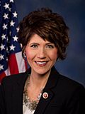
Kristi Noem,
born 1971,
current Governor of South Dakota. -
Lee Raymond,
born 1938,
CEO and President, ExxonMobil.


.jpg)
[Tuskegee Institute]] Multiple hall of fame coach and educator
- Sylvia Bacon (born 1931), D.C. Superior judge
- Nancy Turbak Berry, trial attorney and South Dakota state senator
- Stephen Foster Briggs (1885-1976), founder Briggs & Stratton Corporation
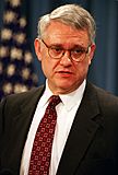
- John Hamre (born 1950), Deputy Secretary of Defense and international studies specialist
- Fred H. Hildebrandt, U.S. Representative from South Dakota
- Wendell Hurlbut (1918-2011), amusement park designer
- J. A. Jance (born 1944), writer
- Charles B. Kornmann (born 1937), federal judge on United States District Court for the District of South Dakota
- Jake Krull (1938-2016), U.S. General and South Dakota state senator
- George R. Mather, General in the U.S. Army, Commander in Chief, United States Southern Command (USCINCSO) from 1969 to 1971
- Arthur C. Mellette, (1842-1896), last Dakota Territorial Governor and first Governor of the State of South Dakota.
- Kristi Noem, (born 1971), current Governor of the State of South Dakota.
- Hope A. Olson, author and professor in the field of information studies
- Henry Roberts Pease (1837-1907) Civil War veteran and United States Senator from Mississippi
- Lee Raymond, (born 1938), chemical engineer and long-time Chairman and CEO, Exxon Corporation and ExxonMobil, born and attended primary and secondary school in Watertown
- Terry Redlin (1937-2016), wildlife artist and Redlin Art Center
- Bob Scholtz (born 1937), American football player
- Joseph Schull (6 February 1906 – 19 May 1980), Canadian playwright and historian
- Ramona Solberg (1921-2005), jeweler
- Lee Schoenbeck (born 1958), lawyer and current President Pro Tempore of the State Senate
- Neal Tapio (born 1970), businessman and former Trump presidential campaign director for South Dakota
- Timmy Williams (born 1981), American comedian of The Whitest Kids U' Know
- Roger Zwieg (1942-2015), NASA test pilot and flight instructor
Education
Watertown has two institutions providing post-secondary education. Lake Area Technical Institute is a public technical school classified as a community college, offering degrees in areas such as Agriculture, Nursing, and Welding. There is also a satellite campus of Mount Marty College, a private Catholic school based in Yankton, South Dakota.
Lake Area Technical Institute received the 2017 Aspen Prize for Community College Excellence, following three previous Finalist-With-Distinction honors in 2011, 2013, and 2015 (bi-annual competition/selection process). The Prize was awarded by the Aspen Institute in March 2017 in Washington, D.C. following an intense data collection process by Aspen officials that included a rigorous review of critical elements of student success including learning, completion, and employment after college.
Watertown has one public high school, Watertown High School, and one private boarding school, Great Plains Lutheran High School, of the Wisconsin Evangelical Lutheran Synod.
Watertown Middle School (7th and 8th grades) is the only public middle school in Watertown. Construction of the Middle School was completed in August 2015. The community's “Prairie Lakes Wellness Center”, opened in 2017, is adjacent to the Middle School. When the Middle School opened in 2015, the prior middle school was completely renovated and became the Intermediate School (5th and 6th grades).
There are multiple elementary schools in Watertown. The five public elementary schools include: Lincoln Elementary, Jefferson Elementary, Roosevelt Elementary, McKinnely Elementary, and Mellette Elementary. Immaculate Conception School is a private Catholic elementary school. St. Martin's Lutheran School is a private Lutheran elementary school of the WELS. Watertown Christian School is a private non-denominational Christian elementary school.
The Watertown Regional Library is the town's main library, located on 6th St. NE, and open every day of the week.
Harmony Hill High School was a Catholic girls boarding school in Watertown from 1967 to 1974.
See also
 In Spanish: Watertown (Dakota del Sur) para niños
