
Webster, Texas facts for kids
Quick facts for kids
Webster, Texas
|
|
|---|---|

Webster City Hall and Police Department
|
|

Location in Harris County and the state of Texas
|
|
| Country | |
| State | |
| County | Harris |
| Area | |
| • Total | 6.62 sq mi (17.15 km2) |
| • Land | 6.39 sq mi (16.56 km2) |
| • Water | 0.23 sq mi (0.59 km2) |
| Elevation | 26 ft (8 m) |
| Population
(2010)
|
|
| • Total | 10,684 |
| • Estimate
(2019)
|
11,451 |
| • Density | 1,791.46/sq mi (691.64/km2) |
| Time zone | UTC-6 (Central (CST)) |
| • Summer (DST) | UTC-5 (CDT) |
| ZIP code |
77598
|
| Area code(s) | 281 |
| FIPS code | 48-76948 |
| GNIS feature ID | 1349594 |
Webster is a city in the U.S. state of Texas located in Harris County, within the Houston–The Woodlands-Sugar Land metropolitan area. The population was 10,400 at the 2010 U.S. census and 11,451 in 2019.
Contents
History

The community was founded in 1879 by James W. Webster under the name Gardentown. It was established initially as a colony for settlers from England. It began as a stopover for travelers between Houston/Harrisburg, Galveston, Kemah, and Seabrook. Eventually railroads, such as the Missouri, Kansas and Texas Railway, were built through the area. Farmers in the area raised pears and other produce.
In 1903, the Houston Chamber of Commerce invited Seito Saibara, a former Japanese member of parliament and a Christian theologian, to come to Texas to teach rice farming. Rice at that time was emerging as an important cash crop. Saibara settled in Webster and established a small farming community of Japanese Christians. Saibara and his son Kiyoaki established the foundations of what became the rice industry of the U.S. Gulf Coast.
Dairies and livestock ranches developed in the town as well in the early 1900s. Petroleum was discovered at the Webster-Friendswood Oilfield in the 1930s, but the population remained small. The community was incorporated in 1958.
In 1961 the National Aeronautics and Space Administration announced that it was building the Manned Spacecraft Center (now known as the Johnson Space Center) nearby along the shores of Clear Lake. Growth and development quickly swept over the Clear Lake Area, and Webster's population blossomed. Webster today has become a thriving bedroom community closely tied to the Clear Lake Area and its high-tech industry.
Geography

Webster is located at 29°32′19″N 95°07′10″W / 29.538581°N 95.119354°W (29.538581, -95.119354).
According to the United States Census Bureau, the city has a total area of 6.6 square miles (17.0 km2), of which 6.3 square miles (16.4 km2) is land and 0.23 square miles (0.6 km2), or 3.24%, is water.
Climate
The climate in this area is characterized by hot, humid summers and generally mild to cool winters. According to the Köppen Climate Classification system, Webster has a humid subtropical climate, abbreviated "Cfa" on climate maps.
Demographics
| Historical population | |||
|---|---|---|---|
| Census | Pop. | %± | |
| 1960 | 329 | — | |
| 1970 | 2,231 | 578.1% | |
| 1980 | 2,405 | 7.8% | |
| 1990 | 4,678 | 94.5% | |
| 2000 | 9,083 | 94.2% | |
| 2010 | 10,684 | 17.6% | |
| 2019 (est.) | 11,451 | 7.2% | |
| U.S. Decennial Census | |||
The 2019 American Community Survey determined there were 11,451 people in the city limits. The racial and ethnic makeup of the city was 70.6% non-Hispanic white, 19.4% Black or African American, 0.1% American Indian or Alaska Native, 4.2% Asian, 3.7% multiracial, and 33.1% Hispanic or Latin American of any race.
There was 4,994 households in 2019 and an owner-occupied housing rate of 13.1% in 2019 and the median value of an owner-occupied housing unit was $186,400. Webster had a median gross rent of $1,131 from 2015–2019. The city of Webster had a median household income of $55,497 and per capita income of $29,242. Roughly 18.7% of persons lived at or below the poverty line according to the 2019 survey.
At the census of 2000, there were 9,083 people, 4,114 households, and 1,970 families residing in the city. The population density was 1,372.9 people per square mile (529.8/km2). There were 4,733 housing units at an average density of 715.4 per square mile (276.0/km2). The racial makeup of the city was 64.85% White, 9.03% African American, 0.55% Native American, 5.72% Asian, 0.15% Pacific Islander, 15.78% from other races, and 3.92% from two or more races. Hispanic or Latino of any race were 27.24% of the population.
There were 4,114 households, out of which 24.6% had children under the age of 18 living with them, 32.7% were married couples living together, 10.1% had a female householder with no husband present, and 52.1% were non-families. 40.6% of all households were made up of individuals, and 2.1% had someone living alone who was 65 years of age or older. The average household size was 2.14 and the average family size was 2.97.
In the city, the population was spread out, with 20.9% under the age of 18, 15.0% from 18 to 24, 43.5% from 25 to 44, 15.4% from 45 to 64, and 5.1% who were 65 years of age or older. The median age was 29 years. For every 100 females, there were 109.3 males. For every 100 females age 18 and over, there were 107.3 males.
The median income for a household in the city was $42,385, and the median income for a family was $43,495. Males had a median income of $35,346 versus $29,808 for females. The per capita income for the city was $21,964. About 12.5% of families and 13.2% of the population were below the poverty line, including 19.2% of those under age 18 and 5.6% of those age 65 or over.
Parks and recreation
The Edgar A. Smith Family YMCA is located in Houston; it has a Webster mailing address.
Economy

The Baybrook Mall is located in the City of Houston. The mall is in proximity to Webster.
Education
Primary and secondary schools
Public schools
Pupils in Webster attend schools in Clear Creek Independent School District. The community is divided between the Board of Trustees District 2 and the Board of Trustees District 4. They are represented by Win Weber and Stuart J. Stromeyer, respectively, as of 2008.
Most residents within the city limits are zoned to Margaret S. McWhirter Elementary School in Webster. The school occupies a 125,000-square-foot (11,600 m2) building that is one story tall. The current McWhirter campus held its groundbreaking in 2014, and opened in 2016. The re-dedication was held in March of that year. That year the Texas Education Agency (TEA) gave the school a grant allowing it to re-establish a full day PreKindergarten program.
Some residential sections of the city are served by Armand Bayou (Houston), Falcon Pass (Houston), League City (League City), and Whitcomb (Houston) elementary schools. Most residents are zoned to Clear Creek Intermediate School (League City). Some residents are zoned to Clear Lake, and Space Center intermediate schools, both in Clear Lake City and in Houston. Most residents are zoned to Clear Creek High School in League City, while Clear Lake High School in Clear Lake City, Houston, serves a small section.
P.H. Greene Elementary School, in an unincorporated area, serves areas outside of the city with Webster addresses.
History of schools
Webster Intermediate School formerly served the city but moved to an unincorporated area near Friendswood and was renamed Westbrook Intermediate School in spring 2005; As of 2016[update] Westbrook does not serve Webster.
Private schools
Iman Academy Southeast Secondary School is in southeast Houston, northeast of Webster, off of Highway 3.
Colleges and universities
The portion of Clear Creek ISD in Harris County (and therefore Webster) is assigned to San Jacinto College.
Notable people
- Stephanie Beatriz, actress
- Josh Huestis, basketball player for the Oklahoma City Thunder
- Dennis Paul, Republican member of the Texas House of Representatives from District 129, formerly resided in Webster
- Steve Stockman, Republican former member of the United States House of Representatives from Texas's 36th congressional district
- Ryan Trecartin, multimedia artist
Images for kids
-
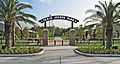
A popular park in Webster

See also
 In Spanish: Webster (Texas) para niños
