
Wellington facts for kids
Quick facts for kids
Wellington
Te Whanganui-a-Tara (Māori)
|
|||
|---|---|---|---|
|
Capital city
|
|||
|
Clockwise from top: Waterfront and Te Aro along Wellington Harbour, The Beehive, Oriental Bay at sunset, Cuba Street and its Bucket Fountain, Wellington Cable Car
|
|||
|
|||
| Nickname(s):
Windy Wellington, Wellywood
|
|||
| Motto(s):
Suprema a Situ
English: Supreme by position |
|||

Wellington
Location in New Zealand

Wellington
Location in Oceania

Wellington
Location in Pacific Ocean
|
|||
| Country | New Zealand | ||
| Region | Wellington | ||
| Wards |
|
||
| Community boards |
|
||
| Settled by Europeans | 1839 | ||
| Named for | A. Wellesley, 1st Duke of Wellington | ||
| Electorates | Mana Ōhāriu Rongotai Te Tai Hauāuru (Māori) Te Tai Tonga (Māori) Wellington Central |
||
| Area | |||
| • Territorial | 289.91 km2 (111.93 sq mi) | ||
| • Urban | 112.36 km2 (43.38 sq mi) | ||
| • Rural | 177.55 km2 (68.55 sq mi) | ||
| • Metro | 303.00 km2 (116.99 sq mi) | ||
| Highest elevation | 495 m (1,624 ft) | ||
| Lowest elevation | 0 m (0 ft) | ||
| Population
(June 2023)
|
|||
| • Urban | 215,200 | ||
| • Urban density | 1,915.3/km2 (4,960.5/sq mi) | ||
| • Metro | 440,900 | ||
| • Metro density | 1,455.12/km2 (3,768.7/sq mi) | ||
| • Demonym | Wellingtonian | ||
| Time zone | UTC+12 (NZST) | ||
| • Summer (DST) | UTC+13 (NZDT) | ||
| Postcode(s) |
5016, 5028, 6011, 6012, 6021, 6022, 6023, 6035, 6037, 6972
|
||
| Area code(s) | 04 | ||
| Local iwi | Ngāti Toa Rangatira, Ngāti Raukawa, Te Āti Awa | ||
| Website | wellington.govt.nz www.wellingtonnz.com |
||
.jpg)
.JPG)
.jpg)


Wellington (Māori: Te Whanganui-a-Tara or Māori: Pōneke) is the capital city of New Zealand. It is located at the south-western tip of the North Island, between Cook Strait and the Remutaka Range. Wellington is the second-largest city in New Zealand by metro area, and is the administrative centre of the Wellington Region. It is the world's southernmost capital of a sovereign state. Wellington features a temperate maritime climate, and is the world's windiest city by average wind speed.
Wellington was originally designed by Captain William Mein Smith, the first Surveyor General for Edward Wakefield's New Zealand Company, in 1840. The New Zealand Government and Parliament, the Supreme Court and most of the public service are based in the city. As of June 2023, the Wellington urban area (which only includes urbanised areas within Wellington City) has a resident population of 215,200. Its metro area, which includes the cities of Porirua, Upper Hutt and Lower Hutt, has a resident population of 434500. The city has served as New Zealand's capital since 1865, a status that is not defined in legislation, but established by convention.
In addition to governmental institutions, Wellington accommodates several of the nation's largest and oldest cultural institutions, such as the National Archives, the National Library, New Zealand's national museum, Te Papa and numerous theatres. It plays host to many artistic and cultural organisations, including the New Zealand Symphony Orchestra and Royal New Zealand Ballet. Its architectural attractions include the Old Government Buildings – one of the largest wooden buildings in the world – as well as the iconic Beehive, the executive wing of Parliament Buildings as well as internationally renowned Futuna Chapel. The city has a strong art scene, with hundreds of art galleries. Most of these are small and independent, but the major ones are Te Papa and the City Gallery. Wellington also leads in large summer festivals, such as CubaDupa and the Newtown Festival. Wellington's economy is primarily service-based, with an emphasis on finance, business services, government, and the film industry. It is the centre of New Zealand's film and special effects industries, and increasingly a hub for information technology and innovation, with two public research universities. Wellington is one of New Zealand's chief seaports and serves both domestic and international shipping. The city is served by Wellington International Airport in Rongotai, the third busiest airport in the country. Wellington's transport network includes train and bus lines which reach as far as the Kapiti Coast and the Wairarapa, and ferries connect the city to the South Island.
Often referred to as New Zealand's cultural capital, the culture of Wellington is a diverse and often youth-driven one which has yielded influence across Oceania. One of the world's most liveable cities, the 2016 Mercer Quality of Living Survey ranked Wellington 12th in the world, and was first in the world for both liveability and non-pollution by Deutsche Bank, from 2017 to 2018. Cultural precincts such as Cuba Street and Newtown are renowned for creative innovation, "op shops", historic character, and food. The city is known for its coffee scene, with now-globally common foods and drinks such as the flat white perfected here. Wellington has a strong coffee culture – the city has more cafés per capita than New York City in the United States – and was pioneered by Italian and Greek immigrants to areas such as Mount Victoria, Island Bay and Miramar. Nascent influence is derived from Ethiopian migrants. Wellington's cultural vibrance and diversity is well-known across the world. It is New Zealand's second most ethnically diverse city, bested only by Auckland, and boasts a "melting pot" culture of significant minorities such as Malaysian, Italian, Dutch, Korean, Chinese, Greek, Indian, Samoan and indigenous Taranaki Whānui communities as a result. Described by Lonely Planet in 2013 as "the coolest little capital in the world", the global city has grown from a bustling Māori settlement, to a remote colonial outpost, and from there to an Australasian capital that has experienced a "remarkable creative resurgence".
Contents
Toponymy
Wellington takes its name from Arthur Wellesley, the first Duke of Wellington and victor of the Battle of Waterloo (1815): his title comes from the town of Wellington in the English county of Somerset. It was named in November 1840 by the original settlers of the New Zealand Company on the suggestion of the directors of the same, in recognition of the Duke's strong support for the company's principles of colonisation and his "strenuous and successful defence against its enemies of the measure for colonising South Australia". One of the founders of the settlement, Edward Jerningham Wakefield, reported that the settlers "took up the views of the directors with great cordiality and the new name was at once adopted".
In the Māori language, Wellington has three names. Te Whanganui-a-Tara refers to Wellington Harbour and means "the great harbour of Tara"; Pōneke is a transliteration of Port Nick, short for Port Nicholson (the city's central marae, the community supporting it and its kapa haka have the pseudo-tribal name of Ngāti Pōneke); Te Upoko-o-te-Ika-a-Māui, meaning 'The Head of the Fish of Māui' (often shortened to Te Upoko-o-te-Ika), a traditional name for the southernmost part of the North Island, deriving from the legend of the fishing up of the island by the demi-god Māui. The legendary Maori explorer Kupe, a chief from Hawaiki (the homeland of Polynesian explorers, of unconfirmed geographical location, not to be confused with Hawaii), was said to have stayed in the harbour prior to 1000 CE. Here, it is said he had a notable impact on the area, with local mythology stating he named the two islands in the harbour after his daughters, Matiu (Somes Island), and Mākaro (Ward Island). However, the primary settlement of Wellington is said to have been executed by Tara, the son of Whatonga, a chief from the Mahia Peninsula, who told his son to travel south, to find more fertile lands to settle.
In New Zealand Sign Language, the name is signed by raising the index, middle and ring fingers of one hand, palm forward, to form a "W", and shaking it slightly from side to side twice.
The city's location close to the mouth of the narrow Cook Strait leaves it vulnerable to strong gales, leading to the nickname of "Windy Wellington".
History


Māori settlement
Legends recount that Kupe discovered and explored the region in about the 10th century. Before European colonisation, the area in which the city of Wellington would eventually be founded was seasonally inhabited by indigenous Māori. The earliest date with hard evidence for human activity in New Zealand is about 1280.
Wellington and its environs have been occupied by various Māori groups from the 12th century. The legendary Polynesian explorer Kupe, a chief from Hawaiki (the homeland of Polynesian explorers, of unconfirmed geographical location, not to be confused with Hawaii), was said to have stayed in the harbour from c. 925. A later Māori explorer, Whatonga, named the harbour Te Whanganui-a-Tara after his son Tara. Before the 1820s, most of the inhabitants of the Wellington region were Whatonga's descendants.
At about 1820, the people living there were Ngāti Ira and other groups who traced their descent from the explorer Whātonga, including Rangitāne and Muaūpoko. However, these groups were eventually forced out of Te Whanganui-a-Tara by a series of migrations other iwi (Māori tribes) from the north. The migrating groups were Ngāti Toa, which came from Kāwhia, Ngāti Rangatahi, from near Taumarunui, and Te Atiawa, Ngāti Tama, Ngāti Mutunga, Taranaki and Ngāti Ruanui from Taranaki. Ngāti Mutunga later moved on to the Chatham Islands. The Waitangi Tribunal has found that at the time of the signing of the Treaty of Waitangi in 1840, Te Atiawa, Taranaki, Ngati Ruanui, Ngati Tama, and Ngati Toa held mana whenua interests in the area, through conquest and occupation.
Early European settlement
Steps towards Pākehā (European) settlement in the area began in 1839, when Colonel William Wakefield arrived to purchase land for the New Zealand Company to sell to prospective British settlers. Prior to this time, the Māori inhabitants had had contact with Pākehā whalers and traders.
.jpg)
European settlement began with the arrival of an advance party of the New Zealand Company on the ship Tory on 20 September 1839, followed by 150 settlers on the Aurora on 22 January 1840. Thus the Wellington settlement preceded the signing of the Treaty of Waitangi (on 6 February 1840). The 1840 settlers constructed their first homes at Petone (which they called Britannia for a time) on the flat area at the mouth of the Hutt River. Within months that area proved swampy and flood-prone, and most of the newcomers transplanted their settlement across Wellington Harbour to Thorndon in the present-day site of Wellington city.
National capital

Wellington was declared a city in 1840, and was chosen to be the capital city of New Zealand in 1865.
Wellington became the capital city in place of Auckland, which William Hobson had made the capital in 1841. The New Zealand Parliament had first met in Wellington on 7 July 1862, on a temporary basis; in November 1863, the Prime Minister of New Zealand, Alfred Domett, placed a resolution before Parliament in Auckland that "... it has become necessary that the seat of government ... should be transferred to some suitable locality in Cook Strait [region]." There had been some concerns that the more populous South Island (where the goldfields were located) would choose to form a separate colony in the British Empire. Several commissioners (delegates) invited from Australia, chosen for their neutral status, declared that the city was a suitable location because of its central location in New Zealand and its good harbour; it was believed that the whole Royal Navy fleet could fit into the harbour. Wellington's status as capital is a result of constitutional convention rather than statute.

Wellington is New Zealand's political centre, housing the nation's major government institutions. The New Zealand Parliament relocated to the new capital city, having spent the first ten years of its existence in Auckland. A session of parliament officially met in the capital for the first time on 26 July 1865. At that time, the population of Wellington was just 4,900.
The Government Buildings were constructed at Lambton Quay in 1876. The site housed the original government departments in New Zealand. The public service rapidly expanded beyond the capacity of the building, with the first department leaving shortly after it was opened; by 1975 only the Education Department remained, and by 1990 the building was empty. The capital city is also the location of the highest court, the Supreme Court of New Zealand, and the historic former High Court building (opened 1881) has been enlarged and restored for its use. The Governor-General's residence, Government House (the current building completed in 1910) is situated in Newtown, opposite the Basin Reserve. Premier House (built in 1843 for Wellington's first mayor, George Hunter), the official residence of the prime minister, is in Thorndon on Tinakori Road.
Over six months in 1939 and 1940 Wellington hosted the New Zealand Centennial Exhibition, celebrating a century since the signing of the Treaty of Waitangi. Held on 55 acres of land at Rongotai it featured three exhibition courts, grand Art Deco-style edifices and a hugely popular three-acre amusement park. Wellington attracted more than 2.5 million visitors at a time when New Zealand's population was 1.6 million.
Geography

Wellington is at the south-western tip of the North Island on Cook Strait, separating the North and South Islands. On a clear day the snowcapped Kaikoura Ranges are visible to the south across the strait. To the north stretch the golden beaches of the Kapiti Coast. On the east the Remutaka Range divides Wellington from the broad plains of the Wairarapa, a wine region of national notability.
With a latitude of 41° 17' South, Wellington is the southernmost capital city in the world. It is also the most remote capital city, the farthest away from any other capital.
Wellington is more densely populated than most other cities in New Zealand due to the restricted amount of land that is available between its harbour and the surrounding hills. It has very few open areas in which to expand, and this has brought about the development of the suburban towns. Because of its location in the Roaring Forties and its exposure to the winds blowing through Cook Strait, Wellington is the world's windiest city, with an average wind speed of 27 km/h (17 mph).

The urban area stretches across the areas administered by the city councils of Wellington, Lower Hutt, Upper Hutt and Porirua. The suburb of Porirua lies on Porirua Harbour to the north. Lower Hutt and Upper Hutt, collectively referred to as the Hutt Valley, are suburban areas to the northeast of Wellington City.
.jpg)
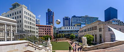
Wellington's scenic natural harbour and green hillsides adorned with tiered suburbs of colonial villas are popular with tourists. The central business district (CBD) is close to Lambton Harbour, an arm of Wellington Harbour, which lies along an active geological fault, clearly evident on its straight western shore. The land to the west of this rises abruptly, meaning that many suburbs sit high above the centre of the city. There is a network of bush walks and reserves maintained by the Wellington City Council and local volunteers. These include Otari-Wilton's Bush, dedicated to the protection and propagation of native plants. The Wellington region has 500 square kilometres (190 sq mi) of regional parks and forests. In the east is the Miramar Peninsula, connected to the rest of the city by a low-lying isthmus at Rongotai, the site of Wellington International Airport. Industry has developed mainly in the Hutt Valley, where there are food-processing plants, engineering industries, vehicle assembly and oil refineries.
The narrow entrance to the harbour is to the east of the Miramar Peninsula, and contains the dangerous shallows of Barrett Reef, where many ships have been wrecked (notably the inter-island ferry TEV Wahine in 1968). The harbour has three islands: Matiu/Somes Island, Makaro/Ward Island and Mokopuna Island. Only Matiu/Somes Island is large enough for habitation. It has been used as a quarantine station for people and animals, and was an internment camp during World War I and World War II. It is a conservation island, providing refuge for endangered species, much like Kapiti Island farther up the coast. There is access during daylight hours by the Dominion Post Ferry.
Wellington is primarily surrounded by water, but some of the nearby locations are listed below.
 |
Kapiti, Tararua Forest Park and Masterton | |
||
| Rimutaka Forest Park | ||||
Relief
Steep landforms shape and constrain much of Wellington city. Notable hills in and around Wellington include:
- Mount Victoria – 196 m. Mt Vic is a popular walk for tourists and Wellingtonians alike, as from the summit one can see most of Wellington. There are numerous mountain bike and walking tracks on the hill.
- Mount Albert – 178 m
- Mount Cook
- Mount Alfred (west of Evans Bay) – 122 m
- Mount Kaukau – 445 m
- Mount Crawford
- Brooklyn Hill – 299 m
- Wrights Hill
- Mākara Hill
- Te Ahumairangi (Tinakori) Hill
Climate
Averaging 2,055 hours of sunshine per year, the climate of Wellington is temperate marine, (Köppen: Cfb), generally moderate all year round with warm summers and mild winters, and rarely sees temperatures above 25 °C (77 °F) or below 4 °C (39 °F). The hottest recorded temperature in the city is 31.1 °C (88 °F), while −1.9 °C (29 °F) is the coldest. The city is notorious for its southerly blasts in winter, which may make the temperature feel much colder. It is generally very windy all year round with high rainfall; average annual rainfall is 1,250 mm (49 in), June and July being the wettest months. Frosts are quite common in the hill suburbs and the Hutt Valley between May and September. Snow is very rare at low altitudes, although snow fell on the city and many other parts of the Wellington region during separate events on 25 July 2011 and 15 August 2011.
On 29 January 2019, the suburb of Kelburn reached 30.3 °C (87 °F), the highest temperature since records began in 1927.
| Climate data for Kelburn (1928–2020, Humidity 1962–2020) | |||||||||||||
|---|---|---|---|---|---|---|---|---|---|---|---|---|---|
| Month | Jan | Feb | Mar | Apr | May | Jun | Jul | Aug | Sep | Oct | Nov | Dec | Year |
| Record high °C (°F) | 30.3 (86.5) |
30.1 (86.2) |
28.3 (82.9) |
27.3 (81.1) |
22.0 (71.6) |
18.3 (64.9) |
17.6 (63.7) |
19.3 (66.7) |
21.9 (71.4) |
25.1 (77.2) |
26.9 (80.4) |
29.1 (84.4) |
30.3 (86.5) |
| Average high °C (°F) | 20.2 (68.4) |
20.4 (68.7) |
19.0 (66.2) |
16.6 (61.9) |
14.0 (57.2) |
11.9 (53.4) |
11.2 (52.2) |
11.9 (53.4) |
13.4 (56.1) |
15.0 (59.0) |
16.7 (62.1) |
18.7 (65.7) |
15.8 (60.4) |
| Daily mean °C (°F) | 16.7 (62.1) |
16.9 (62.4) |
15.7 (60.3) |
13.7 (56.7) |
11.4 (52.5) |
9.3 (48.7) |
8.6 (47.5) |
9.2 (48.6) |
10.5 (50.9) |
11.9 (53.4) |
13.4 (56.1) |
15.3 (59.5) |
12.7 (54.9) |
| Average low °C (°F) | 13.2 (55.8) |
13.4 (56.1) |
12.4 (54.3) |
10.7 (51.3) |
8.6 (47.5) |
6.7 (44.1) |
5.9 (42.6) |
6.4 (43.5) |
7.5 (45.5) |
8.8 (47.8) |
10.2 (50.4) |
12.0 (53.6) |
9.7 (49.5) |
| Record low °C (°F) | 4.1 (39.4) |
5.2 (41.4) |
4.6 (40.3) |
2.6 (36.7) |
1.0 (33.8) |
−0.1 (31.8) |
0.0 (32.0) |
−0.1 (31.8) |
0.2 (32.4) |
1.2 (34.2) |
1.7 (35.1) |
3.4 (38.1) |
−0.1 (31.8) |
| Average rainfall mm (inches) | 77.5 (3.05) |
77.0 (3.03) |
85.8 (3.38) |
100.9 (3.97) |
120.7 (4.75) |
132.4 (5.21) |
136.0 (5.35) |
125.5 (4.94) |
100.8 (3.97) |
110.3 (4.34) |
91.5 (3.60) |
92.0 (3.62) |
1,250.4 (49.23) |
| Average rainy days (≥ 1.0 mm) | 7.2 | 6.9 | 8.2 | 9.4 | 11.6 | 13.3 | 13.4 | 13.1 | 11.1 | 11.4 | 9.6 | 9.1 | 124.3 |
| Average relative humidity (%) | 79.4 | 81.5 | 82.1 | 82.7 | 84.3 | 86.0 | 85.8 | 84.3 | 80.6 | 80.3 | 79.0 | 79.7 | 82.2 |
| Mean monthly sunshine hours | 238.6 | 205.7 | 194.0 | 154.4 | 126.6 | 102.4 | 112.5 | 137.3 | 162.6 | 191.4 | 209.6 | 222.9 | 2,058.1 |
| Source: CliFlo | |||||||||||||
| Climate data for Paraparaumu (2000–2020) | |||||||||||||
|---|---|---|---|---|---|---|---|---|---|---|---|---|---|
| Month | Jan | Feb | Mar | Apr | May | Jun | Jul | Aug | Sep | Oct | Nov | Dec | Year |
| Average ultraviolet index | 11 | 9 | 5 | 4 | 2 | 1 | 1 | 2 | 3 | 6 | 8 | 10 | 5 |
| Source: CliFlo | |||||||||||||
| Climate data for Wellington International Airport (1960–2018, Temperature 1962–2018) | |||||||||||||
|---|---|---|---|---|---|---|---|---|---|---|---|---|---|
| Month | Jan | Feb | Mar | Apr | May | Jun | Jul | Aug | Sep | Oct | Nov | Dec | Year |
| Record high °C (°F) | 29.4 (84.9) |
30.6 (87.1) |
28.3 (82.9) |
25.2 (77.4) |
22.0 (71.6) |
19.2 (66.6) |
18.8 (65.8) |
18.3 (64.9) |
22.6 (72.7) |
23.9 (75.0) |
26.8 (80.2) |
29.6 (85.3) |
30.6 (87.1) |
| Average high °C (°F) | 21.1 (70.0) |
21.1 (70.0) |
19.8 (67.6) |
17.3 (63.1) |
15.0 (59.0) |
13.0 (55.4) |
12.2 (54.0) |
12.8 (55.0) |
14.3 (57.7) |
15.8 (60.4) |
17.6 (63.7) |
19.6 (67.3) |
16.7 (62.1) |
| Daily mean °C (°F) | 17.8 (64.0) |
17.8 (64.0) |
16.6 (61.9) |
14.4 (57.9) |
12.3 (54.1) |
10.3 (50.5) |
9.5 (49.1) |
10.1 (50.2) |
11.4 (52.5) |
12.9 (55.2) |
14.5 (58.1) |
16.5 (61.7) |
13.7 (56.7) |
| Average low °C (°F) | 14.5 (58.1) |
14.5 (58.1) |
13.5 (56.3) |
11.5 (52.7) |
9.6 (49.3) |
7.6 (45.7) |
6.7 (44.1) |
7.3 (45.1) |
8.6 (47.5) |
9.9 (49.8) |
11.3 (52.3) |
13.3 (55.9) |
10.7 (51.3) |
| Record low °C (°F) | 4.3 (39.7) |
4.5 (40.1) |
4.3 (39.7) |
2.3 (36.1) |
0.6 (33.1) |
−0.6 (30.9) |
−1.1 (30.0) |
−0.2 (31.6) |
−1.0 (30.2) |
1.2 (34.2) |
2.1 (35.8) |
3.8 (38.8) |
−1.1 (30.0) |
| Average rainfall mm (inches) | 64.2 (2.53) |
56.1 (2.21) |
71.1 (2.80) |
80.5 (3.17) |
94.1 (3.70) |
107.8 (4.24) |
111.7 (4.40) |
102.2 (4.02) |
80.6 (3.17) |
85.1 (3.35) |
69.7 (2.74) |
70.0 (2.76) |
993.0 (39.09) |
| Average rainy days (≥ 1.0 mm) | 6.6 | 6.3 | 7.7 | 8.2 | 10.2 | 12.3 | 12.0 | 12.4 | 10.6 | 10.3 | 8.4 | 8.1 | 113.0 |
| Average relative humidity (%) | 75.1 | 76.8 | 77.6 | 78.0 | 80.0 | 81.5 | 81.0 | 80.0 | 76.5 | 75.4 | 73.6 | 74.9 | 77.5 |
| Source: CliFlo | |||||||||||||
Earthquakes

Wellington suffered serious damage in a series of earthquakes in 1848 and from another earthquake in 1855. The 1855 Wairarapa earthquake occurred on the Wairarapa Fault to the north and east of Wellington. It was probably the most powerful earthquake in recorded New Zealand history, with an estimated magnitude of at least 8.2 on the Moment magnitude scale. It caused vertical movements of two to three metres over a large area, including raising land out of the harbour and turning it into a tidal swamp. Much of this land was subsequently reclaimed and is now part of the central business district. For this reason, the street named Lambton Quay is 100 to 200 metres (325 to 650 ft) from the harbour – plaques set into the footpath mark the shoreline in 1840, indicating the extent of reclamation. The 1942 Wairarapa earthquakes caused considerable damage in Wellington.
The area has high seismic activity even by New Zealand standards, with a major fault, the Wellington Fault, running through the centre of the city and several others nearby. Several hundred minor faults lines have been identified within the urban area. Inhabitants, particularly in high-rise buildings, typically notice several earthquakes every year. For many years after the 1855 earthquake, the majority of buildings were made entirely from wood. The 1996-restored Government Buildings near Parliament is the largest wooden building in the Southern Hemisphere. While masonry and structural steel have subsequently been used in building construction, especially for office buildings, timber framing remains the primary structural component of almost all residential construction. Residents place their confidence in good building regulations, which became more stringent in the 20th century. Since the Canterbury earthquakes of 2010 and 2011, earthquake readiness has become even more of an issue, with buildings declared by Wellington City Council to be earthquake-prone, and the costs of meeting new standards.
Every five years a year-long slow quake occurs beneath Wellington, stretching from Kapiti to the Marlborough Sounds. It was first measured in 2003, and reappeared in 2008 and 2013. It releases as much energy as a magnitude 7 quake, but as it happens slowly there is no damage.
During July and August 2013 there were many earthquakes, mostly in Cook Strait near Seddon. The sequence started at 5:09 pm on Sunday 21 July 2013 when the magnitude 6.5 Seddon earthquake hit the city, but no tsunami report was confirmed nor any major damage. At 2:31 pm on Friday 16 August 2013 the Lake Grassmere earthquake struck, this time magnitude 6.6, but again no major damage occurred, though many buildings were evacuated. On Monday 20 January 2014 at 3:52 pm a rolling 6.2 magnitude earthquake struck the lower North Island 15 km east of Eketahuna and was felt in Wellington, but little damage was reported initially, except at Wellington Airport where one of the two giant eagle sculptures commemorating The Hobbit became detached from the ceiling.
At two minutes after midnight on Monday 14 November 2016, the 7.8 magnitude Kaikoura earthquake, which was centred between Culverden and Kaikoura in the South Island, caused the Wellington CBD, Victoria University of Wellington, and the Wellington suburban rail network to be largely closed for the day to allow inspections. The earthquake damaged a considerable number of buildings, with 65% of the damage being in Wellington. Subsequently, a number of recent buildings were demolished rather than being rebuilt, often a decision made by the insurer. Two of the buildings demolished were about eleven years old – the seven-storey NZDF headquarters and Statistics House at Centreport on the waterfront. The docks were closed for several weeks after the earthquake.
Demographics
.jpg)
Wellington City covers 289.91 km2 (111.93 sq mi) and had an estimated population of 216,200 as of June 2023, with a population density of 746 people per km2. This comprises 215,200 people in the Wellington urban area and 1000 people in the surrounding rural areas.
| Historical population | ||
|---|---|---|
| Year | Pop. | ±% p.a. |
| 2006 | 179,466 | — |
| 2013 | 190,956 | +0.89% |
| 2018 | 202,737 | +1.20% |
Wellington City had a population of 202,737 at the 2018 New Zealand census, an increase of 11,781 people (6.2%) since the 2013 census, and an increase of 23,271 people (13.0%) since the 2006 census. There were 74,841 households. There were 98,823 males and 103,911 females, giving a sex ratio of 0.95 males per female. The median age was 34.1 years (compared with 37.4 years nationally), with 32,856 people (16.2%) aged under 15 years, 54,999 (27.1%) aged 15 to 29, 93,669 (46.2%) aged 30 to 64, and 21,213 (10.5%) aged 65 or older.
Of those at least 15 years old, 74,922 (44.1%) people had a bachelor or higher degree, and 12,690 (7.5%) people had no formal qualifications. The median income was $41,800, compared with $31,800 nationally. 48,633 people (28.6%) earned over $70,000 compared to 17.2% nationally. The employment status of those at least 15 was that 96,453 (56.8%) people were employed full-time, 24,738 (14.6%) were part-time, and 7,719 (4.5%) were unemployed.
| Name | Area (km2) | Population | Density (per km2) | Households | Median age | Median income |
|---|---|---|---|---|---|---|
| Northern Ward | 102.22 | 47,796 | 468 | 16,467 | 35.9 years | $41,500 |
| Onslow-Western Ward | 136.22 | 43,176 | 317 | 15,750 | 38.6 years | $51,800 |
| Lambton Ward | 12.91 | 46,140 | 3,574 | 18,204 | 28.4 years | $37,500 |
| Eastern Ward | 16.20 | 37,965 | 2,344 | 14,199 | 37.0 years | $41,100 |
| Southern Ward | 22.22 | 27,654 | 1,245 | 10,221 | 34.0 years | $38,700 |
| New Zealand | 37.4 years | $31,800 |
Quality of living
Wellington ranks 12th in the world for quality of living, according to a 2014 study by consulting company Mercer; of cities in the Asia–Pacific region, Wellington ranked third behind Auckland and Sydney (as of 2014[update]).
In 2009, Wellington was ranked as a highly affordable city in terms of cost of living, coming in at 139th most expensive city out of 143 cities in the Mercer worldwide Cost of Living Survey. Between 2009 and 2020 the cost of living in Wellington increased, and it is now ranked 123rd most expensive city out of a total of 209 cities.
Culture and identity
At the 2018 census, ethnicities were 74.1% European/Pākehā, 8.6% Māori, 5.1% Pacific peoples, 18.3% Asian, and 4.5% other ethnicities. People may identify with more than one ethnicity.
| Largest groups of overseas-born residents | |
|---|---|
| Nationality | Population (2018) |
| England | 12,534 |
| India | 6,234 |
| China | 5,157 |
| Australia | 3,975 |
| Philippines | 3,408 |
| United States | 3,045 |
| South Africa | 2,376 |
| Samoa | 1,785 |
| Fiji | 1,719 |
| Scotland | 1,611 |
English is the most spoken language (96.0%) followed by French (3.2%), Te Reo Maori (2.2%), Mandarin (2.0%) and German (2.0%). Percentages add up to more than 100% as people may select more than one language.
Although some people objected to giving their religion, 53.2% had no religion, 31.4% were Christian, 3.7% were Hindu, 1.6% were Muslim, 1.7% were Buddhist and 3.3% had other religions.

At the 2018 Census, 33.4% of Wellington's population was born overseas, compared with 27.1% nationally. The most common overseas birthplace is England, place of origin of 6.2% of the urban area's population. The next most-common countries of origin were India (3.1%), mainland China (2.6%), Australia (2.0%), the Philippines (1.7%), the United States (1.5%) South Africa (1.2%).
| Ethnicity | 2006 census | 2013 census | 2018 census | |||
|---|---|---|---|---|---|---|
| Number | % | Number | % | Number | % | |
| European | 121,296 | 70.1 | 139,107 | 76.4 | 150,198 | 74.1 |
| Māori | 13,335 | 7.7 | 14,433 | 7.9 | 17,409 | 8.6 |
| Pacific peoples | 8,931 | 5.2 | 8,928 | 4.9 | 10,392 | 5.1 |
| Asian | 22,851 | 13.2 | 28,542 | 15.7 | 37,158 | 18.3 |
| Middle Eastern/Latin American/African | 3,615 | 2.1 | 4,494 | 2.5 | 6,135 | 3.0 |
| Other | 18,384 | 10.6 | 3,351 | 1.8 | 2,892 | 1.4 |
| Total people stated | 172,971 | 182,121 | 202,737 | |||
| Not elsewhere included | 6,492 | 3.8 | 8,835 | 4.9 | 0 | 0.0 |
Architecture

Wellington showcases a variety of architectural styles from the past 150 years – 19th-century wooden cottages (Painted Ladies), such as the Italianate Katherine Mansfield Birthplace in Thorndon; streamlined Art Deco structures such as the old Wellington Free Ambulance headquarters, the Central Fire Station, Fountain Court Apartments, the City Gallery, and the former Post and Telegraph Building; and the curves and vibrant colours of post-modern architecture in the CBD.
The oldest building is the 1858 Colonial Cottage in Mount Cook. The tallest building is the Majestic Centre on Willis Street at 116 metres high, the second tallest being the structural expressionist Aon Centre (Wellington) at 103 metres. Futuna Chapel in Karori is an iconic building designed by Māori architect John Scott and is architecturally considered one of the most significant New Zealand buildings of the 20th century.
.jpg)
Old St Paul's is an example of 19th-century Gothic Revival architecture adapted to colonial conditions and materials, as is St Mary of the Angels. Sacred Heart Cathedral is a Palladian Revival Basilica with the Portico of a Roman or Greek temple. The Museum of Wellington City & Sea in the Bond Store is in the Second French Empire style, and the Wellington Harbour Board Wharf Office Building is in a late English Classical style. There are several restored theatre buildings: the St James Theatre, the Opera House and the Embassy Theatre.
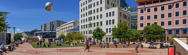
Te Ngākau Civic Square is surrounded by the Town Hall and council offices, the Michael Fowler Centre, the Wellington Central Library, Capital E (home of the National Theatre for Children), the City-to-Sea Bridge, and the City Gallery.
As it is the capital city, there are many notable government buildings. The Executive Wing of New Zealand Parliament Buildings, on the corner of Lambton Quay and Molesworth Street, was constructed between 1969 and 1981 and is commonly referred to as the Beehive. Across the road is the largest wooden building in the Southern Hemisphere, part of the old Government Buildings which now houses part of Victoria University of Wellington's Law Faculty.
A modernist building housing the Museum of New Zealand Te Papa Tongarewa lies on the waterfront, on Cable Street. It is strengthened using base isolation – essentially seating the entire building on supports made from lead, steel and rubber that slow down the effect of an earthquake.
Other notable buildings include Wellington Town Hall, Wellington railway station, Dominion Museum (now Massey University), Aon Centre (Wellington), Wellington Regional Stadium, and Wellington Airport at Rongotai. Leading architects include Frederick Thatcher, Frederick de Jersey Clere, W. Gray Young, Bill Alington, Ian Athfield, Roger Walker and Pynenburg and Collins.

Wellington contains many iconic sculptures and structures, such as the Bucket Fountain in Cuba Street and Invisible City by Anton Parsons on Lambton Quay. Kinetic sculptures have been commissioned, such as the Zephyrometer. This 26-metre orange spike built for movement by artist Phil Price has been described as "tall, soaring and elegantly simple", which "reflects the swaying of the yacht masts in the Evans Bay Marina behind it" and "moves like the needle on the dial of a nautical instrument, measuring the speed of the sea or wind or vessel."
Wellington has many different architectural styles, such as classic Painted Ladies in Mount Victoria (more basic versions pictured above), Newtown and Oriental Bay, Wooden Art Deco houses spread throughout (especially further north in the Hutt Valley), the classic masonry buildings in Cuba Street, state houses particularly in the Hutt and Wellington's southern suburbs, railway houses in Ngaio and other railway-side suburbs, large modern buildings in the city centre (such as the distinctive skyscraper called the Majestic Centre) and grand Victorian buildings common in the inner city as well.
Housing and real estate

Wellington experienced a real estate boom in the early 2000s and the effects of the international property bust at the start of 2007. In 2005, the market was described as "robust". By 2008, property values had declined by about 9.3% over a 12-month period, according to one estimate. More expensive properties declined more steeply, sometimes by as much as 20%. "From 2004 to early 2007, rental yields were eroded and positive cash flow property investments disappeared as house values climbed faster than rents. Then that trend reversed and yields slowly began improving," according to two The New Zealand Herald reporters writing in May 2009. In the middle of 2009 house prices had dropped, interest rates were low, and buy-to-let property investment was again looking attractive, particularly in the Lambton precinct, according to these two reporters.

A Wellington City Council survey conducted in March 2009 found the typical central city apartment dweller was a New Zealand native aged 24 to 35 with a professional job in the downtown area, with household income higher than surrounding areas. Three-quarters (73%) walked to work or university, 13% travelled by car, 6% by bus, 2% bicycled (although 31% own bicycles), and did not travel very far since 73% worked or studied in the central city. The large majority (88%) did not have children in their apartments; 39% were couples without children; 32% were single-person households; 15% were groups of people flatting together. Most (56%) owned their apartment; 42% rented (of renters, 16% paid NZ$351 to NZ$450 per week, 13% paid less and 15% paid more – only 3% paid more than NZ$651 per week). The report continued: "The four most important reasons for living in an apartment were given as lifestyle and city living (23%), close to work (20%), close to shops and cafes (11%) and low maintenance (11%) ... City noise and noise from neighbours were the main turnoffs for apartment dwellers (27%), followed by a lack of outdoor space (17%), living close to neighbours (9%) and apartment size and a lack of storage space (8%)."
Households are primarily one-family, making up 66.9% of households, followed by single-person households (24.7%); there were fewer multiperson households and even fewer households containing two or more families. These counts are from the 2013 census for the Wellington region (which includes the surrounding area in addition to the four cities).
In December 2019, Quotable Value reported the average house price for Wellington metro was $747,000, ranging from $603,000 in Upper Hutt to $978,000 in the western suburbs of Wellington City.
Economy

Wellington Harbour ranks as one of New Zealand's chief seaports and serves both domestic and international shipping. The port handles approximately 10.5 million tonnes of cargo on an annual basis, importing petroleum products, motor vehicles, minerals and exporting meats, wood products, dairy products, wool, and fruit. Many cruise ships also use the port.
The Government sector has long been a mainstay of the economy, which has typically risen and fallen with it. Traditionally, its central location meant it was the location of many head offices of various sectors – particularly finance, technology and heavy industry – many of which have since relocated to Auckland following economic deregulation and privatisation.
In recent years, tourism, arts and culture, film, and ICT have played a bigger role in the economy. Wellington's median income is well above the average in New Zealand, and the highest of all New Zealand cities. It has a much higher proportion of people with tertiary qualifications than the national average. Major companies with their headquarters in Wellington include:
- Centreport
- Chorus Networks
- Contact Energy
- The Cooperative Bank
- Datacom Group
- Infratil
- Kiwibank
- Meridian Energy
- NZ Post
- NZX
- Todd Corporation
- Trade Me
- Weta Digital
- Wellington International Airport
- Xero
- Z Energy
At the 2013 census, the largest employment industries for Wellington residents were professional, scientific and technical services (25,836 people), public administration and safety (24,336 people), health care and social assistance (17,446 people), education and training (16,550 people) and retail trade (16,203 people). In addition, Wellington is an important centre of the New Zealand film and theatre industry, and second to Auckland in terms of numbers of screen industry businesses.
Tourism

Tourism is a major contributor to the city's economy, injecting approximately NZ$1.3 billion into the region annually and accounting for 9% of total FTE employment. The city is consistently named as New Zealanders' favourite destination in the quarterly FlyBuys Colmar Brunton Mood of the Traveller survey and it was ranked fourth in Lonely Planet Best in Travel 2011's Top 10 Cities to Visit in 2011. New Zealanders make up the largest visitor market, with 3.6 million visits each year; New Zealand visitors spend on average NZ$2.4 million a day. There are approximately 540,000 international visitors each year, who spend 3.7 million nights and NZ$436 million. The largest international visitor market is Australia, with over 210,000 visitors spending approximately NZ$334 million annually.

It has been argued that the construction of the Te Papa museum helped transform Wellington into a tourist destination. Wellington is marketed as the 'coolest little capital in the world' by Positively Wellington Tourism, an award-winning regional tourism organisation set up as a council controlled organisation by Wellington City Council in 1997. The organisation's council funding comes through the Downtown Levy commercial rate. In the decade to 2010, the city saw growth of over 60% in commercial guest nights. It has been promoted through a variety of campaigns and taglines, starting with the iconic Absolutely Positively Wellington advertisements. The long-term domestic marketing strategy was a finalist in the 2011 CAANZ Media Awards.

Popular tourist attractions include Wellington Museum, Wellington Zoo, Zealandia and Wellington Cable Car. Cruise tourism is experiencing a major boom in line with nationwide development. The 2010/11 season saw 125,000 passengers and crew visit on 60 liners. There were 80 vessels booked for visits in the 2011/12 season – estimated to inject more than NZ$31 million into the economy and representing a 74% increase in the space of two years.
Wellington is a popular conference tourism destination due to its compact nature, cultural attractions, award-winning restaurants and access to government agencies. In the year ending March 2011, there were 6495 conference events involving nearly 800,000 delegate days; this injected approximately NZ$100 million into the economy.
Arts and culture
Culture

Wellington's culture has been befamed across the world since the 1990s for being notably "cool", incongruous and influential given the city's relatively small size (near half a million). It has been traditionally acclaimed as New Zealand's "cultural and creative capital". In particular, Wellington is noted for is contributions to art, cuisine (particularly coffee; Wellington has more cafés per head than New York City, and is likely the birthplace of the Flat White), and international filmmaking (with Avatar and The Lord of the Rings, the second-highest grossing film of all time and one of the most successful film series of all time respectively, being largely produced in the city), among many other fators listed below.
Museums and cultural institutions

Wellington is home to many cultural institutions, including Te Papa (the Museum of New Zealand), the National Library of New Zealand, Archives New Zealand, Wellington Museum (formerly the Wellington Museum of City and Sea), the Katherine Mansfield House and Garden (formerly Katherine Mansfield Birthplace), Colonial Cottage, the Wellington Cable Car Museum, the Reserve Bank Museum, Old St Paul's, the National War Memorial and the Wellington City Gallery.
Festivals
Wellington is home to many high-profile events and cultural celebrations, including the biennial New Zealand Festival of the Arts, biennial Wellington Jazz Festival, biennial Capital E National Arts Festival for Children and major events such as Brancott Estate World of Wearable Art, TEDxWellington, Cuba Street Carnival, Visa Wellington on a Plate, New Zealand Fringe Festival, New Zealand International Comedy Festival (also hosted in Auckland), Summer City, The Wellington Folk Festival (in Wainuiomata), New Zealand Affordable Art Show, the New Zealand Sevens Weekend and Parade, Out In The Square, Vodafone Homegrown, the Couch Soup theatre festival, Camp A Low Hum and numerous film festivals.
The annual children's Artsplash Festival brings together hundreds of students from across the region. The week-long festival includes music and dance performances and the presentation of visual arts.
Film

Filmmakers Sir Peter Jackson, Sir Richard Taylor and a growing team of creative professionals have turned the eastern suburb of Miramar into a film-making, post-production and special effects infrastructure centre, giving rise to the moniker 'Wellywood'. Jackson's companies include Weta Workshop, Weta Digital, Camperdown Studios, post-production house Park Road Post, and Stone Street Studios near Wellington Airport. Recent films shot partly or wholly in Wellington include the Lord of The Rings trilogy, King Kong and Avatar. Jackson described Wellington: "Well, it's windy. But it's actually a lovely place, where you're pretty much surrounded by water and the bay. The city itself is quite small, but the surrounding areas are very reminiscent of the hills up in northern California, like Marin County near San Francisco and the Bay Area climate and some of the architecture. Kind of a cross between that and Hawaii."
Sometime Wellington directors Jane Campion and Geoff Murphy have reached the world's screens with their independent spirit. Emerging Kiwi filmmakers, like Robert Sarkies, Taika Waititi, Costa Botes and Jennifer Bush-Daumec, are extending the Wellington-based lineage and cinematic scope. There are agencies to assist film-makers with tasks such as securing permits and scouting locations.
Wellington has a large number of independent cinemas, including the Embassy Theatre, Penthouse, the Roxy and Light House, which participate in film festivals throughout the year. Wellington has one of the country's highest turn-outs for the annual New Zealand International Film Festival.
Music
The music scene has produced bands such as The Warratahs, The Mockers, The Phoenix Foundation, Shihad, Beastwars, Fly My Pretties, Rhian Sheehan, Birchville Cat Motel, Black Boned Angel, Fat Freddy's Drop, The Black Seeds, Fur Patrol, Flight of the Conchords, Connan Mockasin, Rhombus and Module, Weta, Demoniac. The New Zealand School of Music was established in 2005 through a merger of the conservatory and theory programmes at Massey University and Victoria University of Wellington. New Zealand Symphony Orchestra, Nevine String Quartet and Chamber music New Zealand are based in Wellington. The city is also home to the Rodger Fox Big Band and the Internationally renowned men's A Cappella chorus Vocal FX.
Theatre and the dramatic arts

Wellington is home to BATS Theatre, Circa Theatre, the National Maori Theatre company Taki Rua, Whitireia Performance Centre, National Dance & Drama School Toi Whakaari and the National Theatre for Children at Capital E in Civic Square. St James' Theatre on Courtenay Place is a popular venue for artistic performances.
Wellington is home to groups that perform Improvised Theatre and Improvisational comedy, including Wellington Improvisation Troupe (WIT) an Improvisors and youth group, Joe Improv. Te Whaea National Dance & Drama Centre, houses New Zealand's University-level school of Dance and Drama, Toi Whakaari: NZ Drama School & New Zealand School of Dance, and Whitireia Performing Arts Centre. These are separate entities that share the building's facilities.
Dance
Wellington is the home for the Royal New Zealand Ballet, the New Zealand School of Dance and contemporary dance company Footnote.
Comedy
Many of New Zealand's prominent comedians have either come from Wellington or got their start there, such as Ginette McDonald ("Lyn of Tawa"), Raybon Kan, Dai Henwood, Ben Hurley, Steve Wrigley, Guy Williams, the Flight of the Conchords and the satirist John Clarke ("Fred Dagg").
The comedy group Breaking the 5th Wall operated out of Wellington and regularly did shows around the city, performing a mix of sketch comedy and semi-improvised theatre. In 2012 the group disbanded when some of its members moved to Australia.
Wellington is home to groups that perform improvised theatre and improvisational comedy, including Wellington Improvisation Troupe (WIT), The Improvisors and youth group Joe Improv.
Wellington hosts shows in the annual New Zealand International Comedy Festival.
Visual arts
From 1936 to 1992 Wellington was home to the National Art Gallery of New Zealand, when it was amalgamated into Museum of New Zealand Te Papa Tongarewa. Wellington is home to the New Zealand Academy of Fine Arts and the Arts Foundation of New Zealand. The city's arts centre, Toi Pōneke, is a nexus of creative projects, collaborations, and multi-disciplinary production. Arts Programmes and Services Manager Eric Vaughn Holowacz and a small team based in the Abel Smith Street facility have produced ambitious initiatives such as Opening Notes, Drive by Art, and public art projects. The city is home to experimental arts publication White Fungus. The Learning Connexion provides art classes. Other visual art galleries include the City Gallery.
- Te Ngākau Civic Square with the ''Ferns'' artwork suspended above
-
-


Cuisine
.JPG)
Wellington is characterised by small dining establishments, and its café culture is internationally recognised, being known for its large number of coffeehouses. There are a few iconic cafes that started the obsession with coffee that Wellington has. One of these is the Deluxe Expresso Bar that opened in 1988. Wellington Restaurants offer cuisines including from Europe, Asia and Polynesia; for dishes that have a distinctly New Zealand style, there are lamb, pork and cervena (venison), salmon, crayfish (lobster), Bluff oysters, pāua (abalone), mussels, scallops, pipis and tuatua (both New Zealand shellfish); kumara (sweet potato); kiwifruit and tamarillo; and pavlova, the national dessert.
Sport

Wellington is the home to:
- Hurricanes – Super Rugby team based in Wellington
- Wellington Lions – ITM Cup rugby team
- Wellington Phoenix FC – football (soccer) club playing in the Australasian A-League, the only fully professional football club in New Zealand
- Team Wellington – in the semi-professional New Zealand Football Championship
- Central Pulse – netball team representing the Lower North Island in the ANZ Championship, primarily based in Wellington
- Wellington Firebirds and Wellington Blaze – men's and women's cricket teams
- Wellington Saints – basketball team in the National Basketball League
Sporting events include:
- six pool games and two quarter-final games at the 2011 Rugby World Cup
- the Wellington Sevens – a round of the IRB Sevens World Series held at the Wellington Regional Stadium over several days every February.
- the 2011 Tae Kwon Do World Champs
- The 2014 World Field Target Championships
- the World Mountain Running Championships in 2005
- the Wellington 500 street race for touring cars, between 1985 and 1996
Government
Local
.JPG)
The Wellington urban area lies within four territorial authorities: Wellington City, Porirua, Lower Hutt and Upper Hutt. Wellington is also part of the wider Wellington Region, administered by the Greater Wellington Region Council. The local authorities are responsible for a wide variety of public services, which include management and maintenance of local roads, and land-use planning.
National
Wellington is covered by six general electorates: Hutt South, Mana, Ōhāriu, Remutaka, Rongotai, and Wellington Central. It is also covered by three Māori electorates: Ikaroa-Rāwhiti, Te Tai Hauāuru, and Te Tai Tonga. Each electorate returns one member to the New Zealand House of Representatives. All electorates are held by the governing Labour Party.
In addition, there are a number of Wellington-based list MPs, who are elected via party lists. The Speaker of the House, Trevor Mallard, is also a Wellington-based list MP having previously held Hutt South.
Due to Wellington being the capital city of New Zealand, its residents are more likely to participate in politics compared to other cities in New Zealand.
Education
Wellington offers a variety of college and university programs for tertiary students:

Victoria University of Wellington has four campuses and works with a three-trimester system (beginning March, July, and November). It enrolled 21,380 students in 2008; of these, 16,609 were full-time students. Of all students, 56% were female and 44% male. While the student body was primarily New Zealanders of European descent, 1,713 were Maori, 1,024 were Pacific students, 2,765 were international students. 5,751 degrees, diplomas and certificates were awarded. The university has 1,930 full-time employees.
Massey University has a Wellington campus known as the "creative campus" and offers courses in communication and business, engineering and technology, health and well-being, and creative arts. Its school of design was established in 1886 and has research centres for studying public health, sleep, Maori health, small & medium enterprises, disasters, and tertiary teaching excellence. It combined with Victoria University to create the New Zealand School of Music.
The University of Otago has a Wellington branch with its Wellington School of Medicine and Health.
Whitireia New Zealand has large campuses in Porirua, Wellington and Kapiti; the Wellington Institute of Technology and New Zealand's National Drama school, Toi Whakaari. The Wellington area has numerous primary and secondary schools.
Transport

Wellington is served by State Highway 1 in the west and State Highway 2 in the east, meeting at the Ngauranga Interchange north of the city centre, where SH 1 runs through the city to the airport. Road access into the capital is constrained by the mountainous terrain – between Wellington and the Kapiti Coast, SH 1 travels along the Centennial Highway, a narrow section of road, and between Wellington and Wairarapa SH 2 transverses the Rimutaka Ranges on a similar narrow winding road. Wellington has two motorways, both part of SH 1: the Johnsonville–Porirua Motorway and the Wellington Urban Motorway, which in combination with a small non-motorway section in the Ngauranga Gorge connect Porirua with Wellington city.
Bus transport in Wellington is supplied by several different operators under the banner of Metlink. Buses serve almost every part of Wellington city, with most of them running along the "Golden Mile" from Wellington railway station to Courtenay Place. Until October 2017 there were nine trolleybus routes, all other buses running on diesel. The trolleybus network was the last public system of its kind in the southern hemisphere.
Wellington lies at the southern end of the North Island Main Trunk railway (NIMT) and the Wairarapa Line, converging on Wellington railway station at the northern end of central Wellington. Two long-distance services leave from Wellington: the Capital Connection, for commuters from Palmerston North, and the Northern Explorer to Auckland.
Four electrified suburban lines radiate from Wellington railway station to the outer suburbs to the north of Wellington – the Johnsonville Line through the hillside suburbs north of central Wellington; the Kapiti Line along the NIMT to Waikanae on the Kapiti Coast via Porirua and Paraparaumu; the Melling Line to Lower Hutt via Petone; and the Hutt Valley Line along the Wairarapa Line via Waterloo and Taitā to Upper Hutt. A diesel-hauled carriage service, the Wairarapa Connection, connects several times daily to Masterton in the Wairarapa via the 8.8-kilometre-long (5.5 mi) Rimutaka Tunnel. Combined, these five services carry 11.64 million passengers per year.

Wellington is the North Island port for Cook Strait ferries to Picton in the South Island, provided by state-owned Interislander and private Bluebridge. Local ferries connect Wellington city centre with Eastbourne and Seatoun.
Wellington International Airport is 6 kilometres (3.7 mi) south-east of the city centre. It is serviced by flights from across New Zealand, Australia, Singapore and Fiji. Flights to other international destinations require a transfer at another airport, as larger aircraft cannot use Wellington's short (2,081-metre or 6,827-foot) runway, which has become an issue in recent years in regards to the Wellington region's economic performance.
Transport
Wellington is served by State Highway 1 in the west and State Highway 2 in the east, meeting at the Ngauranga Interchange north of the city centre, where SH 1 runs through the city to the airport. There are two other state highways in the wider region: State Highway 58 which provides a direct connection between the Hutt Valley and Porirua, and State Highway 59 which follows a coastal route between Linden and Mackays Crossing and was previously part of SH 1. Road access into the capital is constrained by the mountainous terrain – between Wellington and the Kapiti Coast, SH 1 passes through the steep and narrow Wainui Saddle, nearby SH 59 travels along the Centennial Highway, a narrow section of road between the Paekākāriki Escarpment and the Tasman Sea, and between Wellington and Wairarapa SH 2 transverses the Rimutaka Ranges on a similar narrow winding road. Wellington has two motorways: the Johnsonville–Porirua Motorway (largely part of SH 1, with the northernmost section part of SH 59) and the Wellington Urban Motorway (entirely part of SH 1), which in combination with a small non-motorway section in the Ngauranga Gorge connect Porirua with Wellington city. A third motorway in the wider region, the Transmission Gully Motorway forming part of the SH 1 route and officially opened on 30 March 2022, leaves the Johnsonville-Porirua Motorway at the boundary between Wellington and Porirua and provides the main route between Wellington and the wider North Island.
Bus transport in Wellington is supplied by several different operators under the banner of Metlink. Buses serve almost every part of Wellington city, with most of them running along the "Golden Mile" from Wellington railway station to Courtenay Place. Until October 2017 there were nine trolleybus routes, all other buses running on diesel. The trolleybus network was the last public system of its kind in the southern hemisphere.
Wellington lies at the southern end of the North Island Main Trunk railway (NIMT) and the Wairarapa Line, converging on Wellington railway station at the northern end of central Wellington. One long-distance service leaves from Wellington: the Capital Connection, for commuters from Palmerston North. The Northern Explorer to Auckland was discontinued in December 2021.
Four electrified suburban lines radiate from Wellington railway station to the outer suburbs to the north of Wellington – the Johnsonville Line through the hillside suburbs north of central Wellington; the Kapiti Line along the NIMT to Waikanae on the Kapiti Coast via Porirua and Paraparaumu; the Melling Line to Lower Hutt via Petone; and the Hutt Valley Line along the Wairarapa Line via Waterloo and Taitā to Upper Hutt. A diesel-hauled carriage service, the Wairarapa Connection, connects several times daily to Masterton in the Wairarapa via the 8.8-kilometre-long (5.5 mi) Rimutaka Tunnel. Combined, these five services carry 11.64 million passengers per year.
Wellington is the North Island port for Cook Strait ferries to Picton in the South Island, provided by state-owned Interislander and private Bluebridge. Local ferries connect Wellington city centre with Eastbourne and Seatoun.
Wellington International Airport is 6 kilometres (3.7 mi) south-east of the city centre. It is serviced by flights from across New Zealand, Australia, Singapore and Fiji. Flights to other international destinations require a transfer at another airport, as larger aircraft cannot use Wellington's short (2,081-metre or 6,827-foot) runway, which has become an issue in recent years in regards to the Wellington region's economic performance.
Media
Television
Television broadcasts began in Wellington on 1 July 1961 with the launch of channel WNTV1, becoming the third New Zealand city (after Auckland and Christchurch) to receive regular television broadcasts. WNTV1's main studios were in Waring Taylor Street in central Wellington and broadcast from a transmitter atop Mount Victoria. In 1967, the Mount Victoria transmitter was replaced with a more powerful transmitter at Mount Kaukau. In November 1969, WNTV1 was networked with its counterpart stations in Auckland, Christchurch and Dunedin to form NZBC TV.
In 1975, the NZBC was broken up with Wellington and Dunedin studios taking over NZBC TV as Television One while Auckland and Christchurch studios launched Television Two. At the same time, the Wellington studios moved to the new purpose-built Avalon Television Centre in Lower Hutt. In 1980, Televisions One and Two merged under a single company, Television New Zealand (TVNZ). The majority of television production moved to Auckland over the 1980s, culminating in the opening of TVNZ's new Auckland television centre in 1989.
Twin cities
Wellington is twinned with the following cities:
- Sydney, Australia (1983)
- Xiamen, People's Republic of China (1987)
- Sakai, Japan (1994)
- Beijing, People's Republic of China (2006)
- Canberra, Australia (2016)
It also has historical ties with Chania, Greece; Harrogate, England; and Çanakkale, Turkey.
Images for kids
-
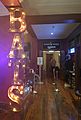
BATS Theatre foyer
-
Circa Theatre
.jpg)

See also
 In Spanish: Wellington para niños
