
Werrington County, New South Wales facts for kids
Quick facts for kids Werrington CountySydney, New South Wales |
|||||||||||||||
|---|---|---|---|---|---|---|---|---|---|---|---|---|---|---|---|

Werrington County Shopping Village on Dunheved Road
|
|||||||||||||||

Werrington County
Location in New South Wales
|
|||||||||||||||
| Population | 3,645 (2016 census) | ||||||||||||||
| • Density | 1,744/km2 (4,520/sq mi) | ||||||||||||||
| Postcode(s) | 2747 | ||||||||||||||
| Elevation | 40 m (131 ft) | ||||||||||||||
| Area | 2.09 km2 (0.8 sq mi) | ||||||||||||||
| Location | 50 km (31 mi) west of Sydney CBD | ||||||||||||||
| LGA(s) | Penrith City Council | ||||||||||||||
| State electorate(s) | Londonderry | ||||||||||||||
| Federal Division(s) | Lindsay | ||||||||||||||
|
|||||||||||||||
Werrington County is a suburb of Sydney, in the state of New South Wales, Australia. It is 50 kilometres (31 mi) west of the Sydney central business district, in the local government area of the City of Penrith and is part of the Greater Western Sydney region. The suburb is entirely residential with a high proportion of individual separate dwellings.
Werrington County is part of the Indigenous Australian, Darug nation and is located in the Deerubbin Local Aboriginal Land Council Area
History
Werrington County was part of the area of the Darug people in pre-European times. In 1806, Werrington County was part of a land grant to Mary King, the youngest daughter of Governor Philip Gidley King. Werrington County was then farm land until the early 1980s when land lots were sold for the present day houses in the suburb.
Geography
Werrington County is geographically at a higher altitude than most other suburbs in the Penrith area. Werrington Creek runs on the eastern border of the suburb. Werrington Lakes lies on the southwestern corner of the suburb.
Demographics
As per the 2016 Census there were 3,645 residents in Werrington County with an average weekly household income of $1,605 compared to the national average of $1,234. 50.2% were males and 49.8% were females. The median age was 36 years. 81.2% of people were born in Australia. The top other countries of birth were England 4.1%, New Zealand 1.4%, Scotland 1.2%, Ireland 0.7% and Philippines 0.6%. The most common ancestries were Australian 32.3%, English 28.2%, Irish 8.4%, Scottish 6.1%, Aboriginal and/or Torres Strait Islander 4.7% and German 2.5%. The top responses for religious affiliation were Catholic 35.8%, Anglican 27.1%, No Religion 16.0%, Presbyterian and Reformed 3.2% and Uniting Church 2.7%. The majority of people (89.2%) only spoke English at home with the other languages spoken being Spanish 0.8%, Greek 0.6%, Arabic 0.6%, Hindi 0.5% and Italian 0.5%.
Parks and reserves
Werrington County has 5 parks covering nearly 29% of the total area which include Shaw Park, Ellison Reserve and Werrington Lakes Flora & Fauna Reserve.
Transport
Werrington County has quick and easy access to Penrith by travelling west on Dunheved Road or along Great Western Highway. The suburb is serviced by the Great Western Highway and is also in close proximity to the M4 Western Motorway which can be accessed via Kent Road for residents travelling towards the Sydney CBD.
The nearest railway station is Werrington railway station on the T1 Western Line which provides direct train services to the Sydney CBD.
Busways provides 3 bus services around the Werrington County area.
- Route 780 travels along Dunheved Road past the Werrington County Shopping Village before travelling to either Penrith or Mount Druitt via Ropes Crossing
- Route 782 travels around Greenbank Drive and Henry Lawson Avenue before travelling to either Penrith or St Marys.
- Route 785 travels via Cambridge Park to Werrington railway station covering parts of Werrington County.
Images for kids
-
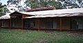
Namatjira Neighbourhood Centre
-
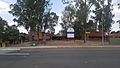
Werrington County Public School


