
West Nanticoke, Pennsylvania facts for kids
Quick facts for kids
West Nanticoke, Pennsylvania
|
|
|---|---|

West Nanticoke, Pennsylvania
Location in Pennsylvania

West Nanticoke, Pennsylvania
Location in the United States
|
|
| Country | United States |
| State | Pennsylvania |
| County | Luzerne |
| Township | Plymouth |
| Area | |
| • Total | 0.7 sq mi (1.8 km2) |
| • Land | 0.6 sq mi (1.5 km2) |
| • Water | 0.1 sq mi (0.3 km2) |
| Population
(2010)
|
|
| • Total | 749 |
| • Density | 1,078/sq mi (416/km2) |
| Time zone | UTC-5 (Eastern (EST)) |
| • Summer (DST) | UTC-4 (EDT) |
| Area code(s) | 570 |
West Nanticoke is a census-designated place (CDP) in Plymouth Township, Luzerne County, Pennsylvania, United States, across the Susquehanna River from the city of Nanticoke. The population of the CDP was 749 at the 2010 census.
Geography
West Nanticoke is located at 41°13′18″N 76°0′54″W / 41.22167°N 76.01500°W, along U.S. Route 11, on the north bank of the Susquehanna River. It is across the river from the city of Nanticoke, to which it is connected by the Lower Broadway Street Bridge. Pennsylvania Route 29 joins U.S. Route 11 in the center of West Nanticoke. To the north, Route 29 leads to Silkworth and Pikes Creek. Just east of West Nanticoke, Route 29 becomes the South Cross Valley Expressway, crossing the Susquehanna River and leading to Interstate 81 south of Wilkes-Barre. U.S. Route 11 heads northeast to Plymouth and Kingston and southwest to Shickshinny and Berwick.
According to the United States Census Bureau, West Nanticoke has a total area of 0.69 square miles (1.8 km2), of which 0.58 square miles (1.5 km2) is land and 0.12 square miles (0.3 km2), or 17.2%, is water.
Images for kids
-
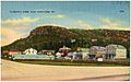
Tilsburys Knob, West Nanticoke
-
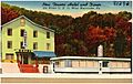
A hotel and diner along U.S. 11 in West Nanticoke
-
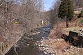
Harveys Creek looking upstream in West Nanticoke
-
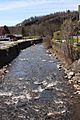
Harveys Creek looking downstream in West Nanticoke
.jpg)
.jpg)


See also
 In Spanish: West Nanticoke para niños
