West Tennessee facts for kids
Quick facts for kids
West Tennessee
|
|
|---|---|
|
Grand Division
|
|
|
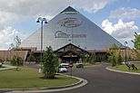
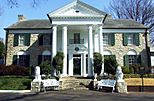
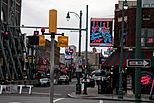
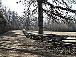
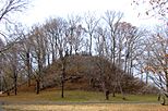
Clockwise, from top left: The Memphis Pyramid, Graceland, Beale Street, Pinson Mounds, Shiloh National Military Park, Reelfoot Lake
|
|
| Nickname(s):
West TN, West Tenn.
|
|

The counties of Tennessee highlighted in red that are designated part of West Tennessee.
|
|
| Country | |
| State | |
| Largest city | Memphis |
| Area | |
| • Land | 27,600 km2 (10,650 sq mi) |
| Population
(2020)
|
1,557,649 |
| • Density | 56.47/km2 (146.26/sq mi) |
| Demonym(s) | West Tennessean |
West Tennessee is one of the three Grand Divisions of the U.S. state of Tennessee that roughly comprises the western quarter of the state. The region includes 21 counties between the Tennessee and Mississippi rivers, delineated by state law. Its geography consists primarily of flat lands with rich soil and vast floodplain areas of the Mississippi River. Of the three regions, West Tennessee is the most sharply defined geographically, and is the lowest-lying. It is both the least populous and smallest, in land area, of the three Grand Divisions. Its largest city is Memphis, the state's second most populous city.
West Tennessee was originally inhabited by the Chickasaw, and was the last of the three Grand Divisions to be settled by Europeans. The region officially became part of the United States with the Jackson Purchase in 1818, 22 years after Tennessee's statehood. As part of the Mississippi River basin, West Tennessee enjoys rich soil that led to large-scale cotton farming during the antebellum period that was heavily dependent on slave labor. Today, agriculture still plays a significant role in the region's economy.
Contents
History
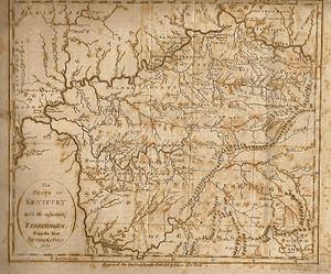
While the region of Tennessee west of the Tennessee River was, on paper, part of Tennessee at its statehood in 1796, it had been recognized as Chickasaw territory by the 1786 Treaty of Hopewell, and it did not come under actual American control until it was obtained in a series of cessions by the Chickasaw in 1818, an acquisition known as the Jackson Purchase, and named for Andrew Jackson, one of the officials involved. The purchase also included the westernmost area of Kentucky as well as a part of northern Mississippi. Although the vast majority of the purchases lie in Tennessee, the term "Jackson Purchase" is used today mostly to refer solely to the Kentuckian portion of the acquisition. This term is also somewhat misleading. Jackson, a military officer at the time, was one of several federal treaty commissioners. He did not personally negotiate the whole land cession, nor was it done in a single treaty.
Geography
West Tennessee is located within the Mississippi Embayment, part of the Gulf Coastal Plain. Because of this, the terrain is flatter than the eastern parts of the state. Areas right along the Mississippi River are located within the alluvial floodplain. However, much of the western counties of the region are protected from flooding by the Chickasaw Bluffs, ridges of loess rising 50–200 feet above the floodplain. Although the land is lower and flatter than Middle and East Tennessee, some hilly terrain exists, especially along the bluffs bordering the Mississippi River and the land bordering the Tennessee River (known as the West Tennessee Highlands). Hilly land in these areas is forested. Otherwise, most of the land in West Tennessee is used as farmland. The soil in this part of the state comes from when a prehistoric sea dried up and left sediment in its place. Unlike in the rest of the state, bedrock is buried a few thousand feet below the surface.
Hydrology
Several rivers and streams, besides the Mississippi and Tennessee, exist in West Tennessee. All of them were originally slowly moving swamps or low-gradient meandering streams before nearly all of them were channelized in the 20th century. Rivers that empty into the Mississippi River include the Obion River, Forked Deer River, Hatchie River (which has not been channelized), Loosahatchie River, Wolf River, and Nonconnah Creek. Rivers that empty into the Tennessee River include the Big Sandy River and Beech River.
Aquifer
West Tennessee sits on top of an artesian aquifer. This aquifer is the main source of water for Memphis and Shelby County, as well as many other communities. In the Memphis area and areas along the bluffs, the loess and gravel serves as a cap over the sand making up the aquifer. The rest of West Tennessee serves as a recharge area for the aquifer. This aquifer provides some of the cleanest water in the United States.
Earthquake risk
The entire West Tennessee region, especially the area closest to the Mississippi River, lies in a zone of fairly high estimated risk for earthquakes. This area is at the edge of the New Madrid Seismic Zone. In 1811 and 1812, three of the largest quakes in American history hit this region back when it had few European settlers. By some reports, the earthquakes briefly reversed the flow of the Mississippi River. A lasting legacy of the earthquakes is the Reelfoot Lake, a large but shallow body of water in northwestern Tennessee that was created by the earthquakes.
Counties
There are 21 counties in West Tennessee:
Cities
- Cities and towns with 10,000+ population (2010 Census)
Seven of the thirteen cities in West Tennessee with a population greater than 10,000 are located within Shelby County, which comprises Memphis and its six suburbs.
- Memphis (662,897)
- Jackson (65,211)
- Bartlett (54,613)
- Collierville (43,965)
- Germantown (38,844)
- Dyersburg (17,145)
- Lakeland (12,430)
- Arlington (11,517)
- Martin (11,473)
- Union City (10,895)
- Brownsville (10,292)
- Millington (10,176)
- Paris (10,156)
Demographics
| Historical population | |||
|---|---|---|---|
| Census | Pop. | %± | |
| 1820 | 1,852 | — | |
| 1830 | 103,774 | 5,503.3% | |
| 1840 | 185,822 | 79.1% | |
| 1850 | 259,141 | 39.5% | |
| 1860 | 304,309 | 17.4% | |
| 1870 | 367,567 | 20.8% | |
| 1880 | 451,408 | 22.8% | |
| 1890 | 515,640 | 14.2% | |
| 1900 | 602,015 | 16.8% | |
| 1910 | 648,439 | 7.7% | |
| 1920 | 694,721 | 7.1% | |
| 1930 | 787,997 | 13.4% | |
| 1940 | 857,884 | 8.9% | |
| 1950 | 977,980 | 14.0% | |
| 1960 | 1,082,210 | 10.7% | |
| 1970 | 1,191,749 | 10.1% | |
| 1980 | 1,312,464 | 10.1% | |
| 1990 | 1,359,225 | 3.6% | |
| 2000 | 1,499,803 | 10.3% | |
| 2010 | 1,562,641 | 4.2% | |
| 2020 | 1,557,649 | −0.3% | |
| Source: 1910–2020 | |||
West Tennessee is by slight amounts less populous and smaller in land area than the other two Grand Divisions. At the 2020 census, West Tennessee had 1,557,649 inhabitants living in its 21 counties, a decrease of 4,992, or 0.32%, over the 2010 figure of 1,562,650. This was the first recorded net population decrease in any of the state's three Grand Divisions in history. West Tennessee's population was about 22.54 percent of the state's total, and its population density was about 146.26 inhabitants per square mile (56.47/km2). About 60% of the population of West Tennessee resides in Shelby County.
West Tennessee registered a population growth rate significantly below the state and national average (11.5% and 9.7% respectively) from 2000 to 2010, significantly less than that of Middle and East Tennessee (18.0% and 10.4%). West Tennessee's population grew only 4.2 percent during the 10-year period; predominantly black Haywood County was the most rapidly diminishing county in the state, losing 5.1% of its population. Only three counties (Chester, Fayette, and Tipton, all increasingly playing a role as bedroom suburbs of metropolitan areas) recorded a growth rate of more than 10 percent from 2000 to 2010. Many West Tennessee counties are not on the state's major transportation routes (railroads or highways) and have no air transport to speak of; and rely heavily on agriculture. With fewer farms and farmers, and the continuing decline of manufacturing, economic opportunities diminish in these counties, and young residents look outside the area for jobs, leading to substantial out-migration. Thus, the population in West Tennessee is increasingly older, with median ages above the state average in most counties; and the over-65 age group constitutes a larger percentage of the total population than the state average, leading in turn to a below-replacement-rate birth/death ratio, and economic decline, including empty and neglected housing and business structures.
Congressional Districts
West Tennessee is represented by part of the 7th district, and all of the 8th and 9th districts. The 7th district covers Benton, Decatur, Henderson, Hardeman, Chester, McNairy, and Hardin counties. The 8th district represents the remaining counties except for Memphis and Millington, which are represented by the 9th district.
Transportation
Roads and highways
Interstate 40 (I-40) is West Tennessee's primary interstate highway, which runs for 134 miles (216 km) from the Mississippi River in Memphis and crosses the Tennessee River in Benton County, passing near Brownsvile and through Jackson in between. Interstate 240 (I-240) is an auxiliary bypass route of I-40 that runs to the south of Memphis. Interstate 55 (I-55) runs for 13 miles (21 km), entirely within southwest Memphis, from the Mississippi state line to the Mississippi River. I-155 is located in the northwestern part of West Tennessee, running from the Mississippi River to Dyersburg. I-269 serves as an outer bypass around Memphis, passing to the east of the city. An extension of I-69 is proposed to run from the Mississippi state line in Memphis to the Kentucky line near South Fulton. The U.S. Highways that travel through West Tennessee are:
- U.S. Route 45
- U.S. Route 51
- U.S. Route 61
- U.S. Route 64
- U.S. Route 70
- U.S. Route 72
- U.S. Route 78
- U.S. Route 79
- U.S. Route 412
- U.S. Route 641
Rail transport
Freight railways crisscross West Tennessee. Norfolk Southern maintains a line running through the southern counties from Memphis to the shoals area of Alabama. They also maintain a line which runs from South Fulton through Martin, Milan, Jackson, and Selmer crossing into Mississippi. Canadian National runs a line from South Fulton, through Union City, Dyersburg and Memphis. From here the line splits into two: one runs through the Mississippi Delta and the other one runs through the center of Mississippi. BNSF runs through Memphis from Mississippi to downtown Memphis, crossing the River on the Frisco Bridge. Union Pacific maintains a short line through Memphis crossing the river on the Harahan Bridge and connects with other lines in the area. CSX runs a line from Memphis through Memphis, Brownsville, Humboldt, Milan, McKenzie, and Camden, then crossing the Tennessee River. Many other short line railroads exist scattered throughout the region.
There are three intermodal facilities around the Memphis area. One is operated by Norfolk Southern in Rossville, one operated by BNSF in Southeast Memphis, and one operated by Canadian National in Southwest Memphis.
Amtrak runs the City of New Orleans passenger rail service along the CN rail line. There are two stops in West Tennessee along this route, which are in Downtown Memphis at Central Station and in Newbern north of Dyersburg.
Airports
West Tennessee has one international airport, Memphis International Airport (MEM). Because it is the hub for FedEx, it is the busiest freight airport in the world. West Tennessee also has two important regional airports. McKellar-Sipes Regional Airport (MKL) is located outside of Jackson and Dyersburg Regional Airport (DYR) is southwest of Dyersburg. In addition to these, several general aviation exist along with two former military airstrips. Arnold Field in Lauderdale County maintains an airstrip and Millington Regional Jetport serves as a backup landing strip for FedEx.
Economy
Agriculture plays the largest role in the economy of West Tennessee out of all of the state's Grand Divisions, and is arguably still the region's largest economic sector. Tennessee ranks seventh in the nation in the production of cotton, nearly all of which is grown in West Tennessee. The northern half of West Tennessee also produces more corn and soybeans than any other region in the state. Other important agricultural commodities cultivated in the region include beef cattle, sorghum, wheat, poultry, and timber and forestry products.
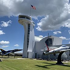
West Tennessee is home to manufacturing establishments which produce such products as automotive components, chemicals, electronics, appliances, and fabricated metal products. On September 27, 2021, it was announced that Ford and SK Innovation would construct a complex at the Memphis Regional Megasite near Stanton called "Blue Oval City" to manufacture electric vehicles and batteries. The facility, which is expected to be operational in 2025, will cost approximately $5.6 billion, making it the most expensive single investment in state history, and employ approximately 5,700. Large corporations based in the region include FedEx, International Paper, First Horizon Corporation, and AutoZone, all based in Memphis. Tourism also plays a major role in the region's economy, especially attractions related to its musical heritage. Major attractions include Graceland, the home of Elvis Presley, Beale Street, Sun Studio, the National Civil Rights Museum, the Memphis Zoo, and the Stax Museum of American Soul Music, all in Memphis; the Casey Jones Home & Railroad Museum in Jackson, the West Tennessee Delta Heritage Center/Tina Turner Museum in Brownsville, and Discovery Park of America in Union City. The National Park Service operates Shiloh National Military Park, and Fort Donelson National Battlefield in West Tennessee.
Images for kids
-
Reelfoot Lake in northwest Tennessee was formed by the 1811–12 New Madrid earthquakes


