
Westfield, Massachusetts facts for kids
Quick facts for kids
Westfield, Massachusetts
|
|||
|---|---|---|---|
|
City
|
|||

Downtown Westfield and Park Square
|
|||
|
|||
| Nickname(s):
The Whip City
|
|||
| Motto(s):
"Community Driven"
|
|||

Location in Hampden County in Massachusetts
|
|||
| Country | United States | ||
| State | Massachusetts | ||
| County | Hampden | ||
| Settled | 1660 | ||
| Incorporated (town) | May 19, 1669 | ||
| Incorporated (city) | November 2, 1920 | ||
| Government | |||
| • Type | Mayor-council city | ||
| Area | |||
| • Total | 47.32 sq mi (122.55 km2) | ||
| • Land | 46.26 sq mi (119.81 km2) | ||
| • Water | 1.05 sq mi (2.73 km2) 2.24% | ||
| Elevation | 148 ft (45 m) | ||
| Population
(2020)
|
|||
| • Total | 40,834 | ||
| • Density | 882.71/sq mi (340.82/km2) | ||
| Time zone | UTC−5 (Eastern) | ||
| • Summer (DST) | UTC−4 (Eastern) | ||
| ZIP Codes |
01085, 01086
|
||
| Area codes | 413 Exchanges: 562,564,568,572 | ||
| FIPS code | 25-76030 | ||
| GNIS feature ID | 0608962 | ||


Westfield is a city in Hampden County, in the Pioneer Valley of western Massachusetts, United States. Westfield was first settled by Europeans in 1660. It is part of the Springfield, Massachusetts Metropolitan Statistical Area. The population was 40,834 at the 2020 census.
Contents
History
The area was originally inhabited by the Pocomtuc tribe, and was called Woronoco (meaning "the winding land"). Trading houses were built in 1639–40 by settlers from the Connecticut Colony. Massachusetts asserted jurisdiction, and prevailed after a boundary survey. In 1647, Massachusetts made Woronoco part of Springfield, Massachusetts. Land was incrementally purchased from the Native Americans and granted by the Springfield town meeting to English settlers, beginning in 1658. The area of Woronoco or "Streamfield" began to be permanently settled in the 1660s. In 1669, "Westfield" was incorporated as an independent town; in 1920, it would be re-incorporated as a city.
From its founding until 1725, Westfield was the westernmost settlement in Massachusetts Colony, and portions of it fell within the Equivalent lands. Town meetings were held in a church meeting house until 1839, when Town Hall was erected on Broad Street. This building also served as City Hall from 1920 to 1958. Due to its alluvial lands, the inhabitants of this area were entirely devoted to agricultural pursuits for about 150 years.
Early in the 19th century, manufacture of bricks, whips, and cigars became economically important. At one point in the 19th century, Westfield was a prominent center of the buggy whip industry, and the city is still known as the "Whip City." Other firms produced bicycles, paper products, pipe organs, boilers and radiators, textile machinery, abrasives, wood products, and precision tools. Westfield transformed itself from an agricultural town into a thriving industrial city in the 19th century, but in the second half of the 20th century its manufacturing base was eroded by wage competition in the U.S. Southeast, then overseas.
Meanwhile, with cheap land and convenient access to east-west and north-south interstate highways, the north side developed into a warehousing center to C & S Wholesale, Home Depot, Lowes and other corporations. South of the river, the intersecting trends of growth of Westfield State University and declining manufacturing changed the city's character. Students comprise some 15% of Westfield's population and the old downtown business district caters increasingly to them while mainstream shopping relocates to a commercial strip called East Main St., actually part of U.S. Route 20. A Home Depot Store and a Price-Rite were recently added to Westfield's wide array of shopping centers. These stores are located along Route 20.
Only four buildings exceed four stories. Until a major fire on January 6, 1952 the Westfield Professional Building covered half a downtown city block and was six stories tall. The entire building was consumed with extensive damage to neighboring buildings because fire department's ladder and snorkel vehicles weren't tall enough and the building did not have a sprinkler system. Subsequent zoning prohibited virtually all new construction over three stories, even after improvements in fire suppression technologies and vehicles became available. No building is allowed to be taller than the town's firetruck ladders.
In the early 20th century, Westfield was at the center of the Pure Food movement, an effort to require stricter standards on the production of food. Lewis B. Allyn, a Westfield resident and pure foods expert for McClure's, lived in Westfield until his murder. In 1906, Congress passed the Pure Food and Drug Act of 1906.
Geography

Westfield is located at 42°7′46″N 72°44′46″W / 42.12944°N 72.74611°W (42.129492, −72.745986). It is bordered on the north by Southampton, on the northeast by Holyoke, on the east by West Springfield, on the southeast by Agawam, on the south by Southwick, on the southwest by Granville, on the west by Russell, and on the northwest by Montgomery. Westfield is split into the "South Side" and the "North Side" by the Westfield River, and the northwestern section of town is known as Wyben.
According to the United States Census Bureau, the city has a total area of 47.3 square miles (123 km2), of which 46.6 square miles (121 km2) is land and 0.7 square miles (1.8 km2) (1.56%) is water.
Westfield is situated at the western edge of the downfaulted Connecticut River Valley where the Westfield River emerges from the Berkshire Hills and flows through the center of the city on its way to the Connecticut River some ten miles (15 km) downstream. Because of its large, steep and rocky upstream watershed the river has a history of severe flood episodes, inundating adjacent parts of Westfield several times. In spite of a complicated system of pumps, dikes, waterways, and upstream dams, Westfield lies in a floodplain zone and is still considered flood prone.
Westfield is bordered on the east by linear cliffs of volcanic trap rock known as East Mountain and Provin Mountain. They are part of the Metacomet Ridge, a mountainous trap rock ridgeline that stretches from Long Island Sound to nearly the Vermont border. Both mountains are traversed by the 114-mile Metacomet-Monadnock Trail, that also crosses the Westfield River with an ill-advised fording or a safer road-walk across the bridge at the junction of Routes 187 and 20. The next road obstacle in

Westfield is the Mass Pike beneath which hikers can safely walk.
Westfield is on the fringe of the greater Northeast megalopolis—the most densely populated region of the United States—and has experienced substantial land development for suburban residential and commercial uses for the past six decades. Yet it borders hilltowns to the west that were depopulated of subsistence farmers in the 19th century as land became readily available on the western frontier. With population dipping below ten per square kilometer in some upland townships, forests are reverting almost to pre-settlement conditions with wild turkey, bears, coyotes and even moose returning after absences perhaps measured in centuries. This transition over a few kilometers from the 21st century urbanization to populations densities nearly as low as early colonial times is notable if not unique.
Westfield is located 10 miles (16 km) away from Springfield, 29 miles (47 km) away from Hartford, 95 miles (153 km) away from Boston, 76 miles (122 km) from Albany, 39 miles (63 km) away from Pittsfield and 144 miles (232 km) from New York City.
Demographics
| Historical population | ||
|---|---|---|
| Year | Pop. | ±% |
| 1790 | 2,204 | — |
| 1800 | 2,185 | −0.9% |
| 1810 | 2,130 | −2.5% |
| 1820 | 2,668 | +25.3% |
| 1830 | 2,940 | +10.2% |
| 1840 | 3,526 | +19.9% |
| 1850 | 4,180 | +18.5% |
| 1860 | 5,055 | +20.9% |
| 1870 | 6,519 | +29.0% |
| 1880 | 7,587 | +16.4% |
| 1890 | 9,805 | +29.2% |
| 1900 | 12,310 | +25.5% |
| 1910 | 16,044 | +30.3% |
| 1920 | 18,604 | +16.0% |
| 1930 | 19,775 | +6.3% |
| 1940 | 18,793 | −5.0% |
| 1950 | 20,962 | +11.5% |
| 1960 | 26,302 | +25.5% |
| 1970 | 31,433 | +19.5% |
| 1980 | 36,465 | +16.0% |
| 1990 | 38,372 | +5.2% |
| 2000 | 40,072 | +4.4% |
| 2010 | 41,094 | +2.6% |
| 2020 | 40,834 | −0.6% |
Source: United States Census records and Population Estimates Program data. Source: |
||
At the 2010 census, there were 41,094 people, 15,335 households and 10,041 families residing in the city. The population density was 860.3 per square mile (332.2/km2). There were 16,075 housing units at an average density of 331.5 per square mile (128.0/km2). The racial makeup of the city was 92.8% White, 1.6% African American, 0.3% Native American, 1.3% Asian, 0.0% Pacific Islander, 2.2% from other races, and 1.8% from two or more races. Hispanic or Latino of any race were 7.5% of the population.
There were 14,797 households, of which 31.5% had children under the age of 18 living with them, 53.0% were married couples living together, 10.6% had a female householder with no husband present, and 32.3% were non-families. Of all households 25.9% were made up of individuals, and 10.9% had someone living alone who was 65 years of age or older. The average household size was 2.54 and the average family size was 3.07.
Age distribution was 23.8% under the age of 18, 12.6% from 18 to 24, 28.0% from 25 to 44, 21.9% from 45 to 64, and 13.7% who were 65 years of age or older. The median age was 36 years. For every 100 females, there were 93.7 males. For every 100 females age 18 and over, there were 90.8 males.
The median household income was $45,240, and the median family income was $55,327. Males had a median income of $38,316 versus $27,459 for females. The per capita income for the city was $20,600. About 6.9% of families and 11.3% of the population were below the poverty line, including 16.2% of those under age 18 and 9.5% of those age 65 or over.
Arts and culture
Points of interest
- Amelia Park Ice Rink and Memorial Garden
- Stanley Park of Westfield
- The Metacomet-Monadnock Trail
- East Mountain
- United States Whip Company Complex
Transportation
Major highways
The Massachusetts Turnpike crosses Westfield just north of Westfield Center. The "Mass Pike" is part of Interstate 90 extending east to Boston and west to Albany and across the United States to Seattle. About 3 miles (5 km) east of Westfield, the turnpike intersects Interstate 91 which generally follows the Connecticut River Valley south to Springfield, Hartford and New Haven or north to Canada (Quebec).
Westfield's main north–south thoroughfare is U.S. 202/Route 10, which includes parts of Southwick Road, S. Maple Street, W. Silver Street, Pleasant Street, Court Street, Broad Street, Elm Street, and Southampton Road. At the intersection of Southampton Road and North Road, Route 10 continues on Southampton Road toward Southampton while U.S. 202 follows North Road toward Holyoke.
Apart from limited-access I-90, the main east–west thoroughfare is U.S. 20, which includes parts of Russell Road, Franklin Street, Elm Street, Main Street, and Springfield Road. Route 187 also ends in Westfield. Other main roads include Western Avenue, Granville Road, Union Street, and Montgomery Road. East Mountain Road is the longest road in Westfield. In November 2016, Massachusetts Governor Charlie Baker announced a $1.93 million grant to the city for upgrades to its segment of U.S. Route 20.
Great River Bridge project

A notable choke point for north–south travel is the Great River Bridge, commonly known as the "Green Bridge", over the Westfield River. This is a three-lane through truss bridge. As of August 2007, there was an active project to create a second bridge just to the east (downstream). The new bridge is a similar through-truss bridge with two spans totaling 368 feet (112.2 m). After the second bridge was completed, the existing bridge was refurbished; each bridge now carries traffic in one direction. Blessed Sacrament Church on North Elm Street was torn down for this project to start. The church was reconstructed on Holyoke Road and was finished in October 2009. The new bridge opened for traffic and the old one was closed for renovations on August 18, 2009. The old bridge reopened in July 2011, with each bridge carrying traffic in one direction.
Rail
Westfield is at the junction of the former east–west Boston and Albany Railroad and a former north–south spur of the New York, New Haven and Hartford Railroad (now a rail trail south of the junction). The town last had eastbound passenger service in 1954, local Albany, New York – Boston, Massachusetts service operated by the New York Central Railroad; and Westfield last had local westbound service in 1953. But Pioneer Valley Railroad, a short line, and CSX, provide freight service. More than 35 motor freight carriers with nearby terminals provide competitive freight service locally and to all distant points. Amtrak's Lake Shore Limited, Vermonter and Connecticut Valley service continue to operate in Springfield, Massachusetts, 9.6 miles to the east.
Bus
The city is presently served by multiple Pioneer Valley Transit Authority (PVTA) bus routes:
- R10: Westfield / Westfield State University / West Springfield via Route 20
- Provides service between Westfield and Springfield via Route 20 and West Springfield.
- All trips extend to Westfield State University when school is not in session. When school is in session, service to Westfield State University is provided by the 10s between 7:45am and 4:45pm.
- Connects with many other public transit services at Springfield Union Station:
- Most Springfield-area PVTA routes, for service to Holyoke, Chicopee, Agawam, Ludlow, Longmeadow, East Longmeadow, and other areas of Springfield.
- Amtrak Northeast Regional, Lake Shore Limited, and Vermonter passenger rail service.
- Peter Pan and Greyhound intercity bus service.
- The Hartford Line, a regional rail service to Hartford and New Haven, CT operated by CTrail.
- 10s: Westfield Center / Westfield State University
- Provides service between Westfield Center and Westfield State University when school is in session.
- B23: Holyoke / Westfield via Holyoke Community College
- Provides service between Westfield Center and Holyoke Transportation Center via Holyoke Community College.
- OWL: Westfield State University Shuttle
- Provides service between South Lot, 333 Western Ave, and Scanlon Hall on the Westfield State University campus.
- Connects with R10/10s at Scanlon Hall for service to Westfield Center.
Air
Barnes Municipal Airport in Westfield has charter passenger services.
Bradley International Airport at Windsor Locks, Connecticut, 18 miles (29 km) (40 minutes drive) to the south, has scheduled flights by most airlines.
Education
Westfield's public school system consists of one preschool, seven elementary schools, two middle schools and two high schools.
Preschools
- Fort Meadow Early Childhood Center
- Westfield Area Head Start. Head Start is no longer referenced on the Westfield schools' website.
Elementary schools
- Abner Gibbs Elementary School
- Franklin Avenue Elementary School
- Highland Elementary School
- Munger Hill Elementary School
- Paper Mill Elementary School
- Southampton Road Elementary School
- (Juniper Park Elementary School – before the 2009 school year, Juniper Park ES was reduced to kindergarten through 3rd grade. Fourth and 5th graders now attend Highland Elementary School. As of the 2015–2016 school year, Juniper Park ES is no longer listed among Westfield schools' campuses; the link for Juniper Park ES now redirects to Russell Elementary School.)
- (Moseley Elementary School was closed before the 2009 school year. Students now attend either Southampton Road ES or Paper Mill ES, depending on where they live.)
Intermediate schools
- Westfield Intermediate School (On former grounds of the North Middle School)
Middle schools
- Westfield Middle School (Formerly, there were 2 middle schools, North and South. But for the 2018-19 school year thanks to the closing of Russell Elementary, 5th grade students were admitted to a new Intermediate school located on the former North Middle site, while the former South Middle site is now the Westfield Middle School.)
High schools
- Westfield High School
- Westfield Technical Academy
Private schools
- St. Mary Preschool and Pre-K
- St. Mary Elementary School
- St. Mary Middle School
- St. Mary High School
- The White Oak School
Higher education
The city is home to Westfield State University.
Notable people
- Edward Bancroft (1744–1821), physician and double-agent spy during the American Revolution
- Lou Barlow (born 1966), American alternative rock musician and songwriter
- Kacey Bellamy (born 1987), Olympian, 2010 Winter Olympics, Women's Ice Hockey Silver Medalist
- Sybil Moseley Bingham (1792–1848) teacher, missionary in Hawaiian Islands
- Emma Helen Blair (1851–1911) historian, journalist and editor who attended high school in town
- Asahel Bush (1824–1913), printer and publisher the Oregon Statesman newspaper; His estate is now preserved as Bush's Pasture Park and his home, Asahel Bush House, is on the National Register of Historic Places
- Joseph Buell Ely (1881–1956), 52nd Governor of Massachusetts
- Richard Falley Jr. (1740–1808) an ensign at the Battle of Bunker Hill and armorer during the American Revolutionary War
- Ray Fitzgerald (1904–1977), Major League Baseball player who died in town
- Frederick H. Gillett (1851–1935), U.S. Congressman, Speaker of the U.S. House of Representatives
- Manuel Gonzales (1913–1993), comics artist
- James H. Gray Sr. (1916–1986), Georgia politician
- Ferdinand Vandeveer Hayden (1829–1887) pioneering geologist
- Thomas Ingersoll (1749–1812), early settler of Ingersoll, Ontario, and for whom that town is named
- Neil Jenney, artist
- William Allen Johnson, organ builder; Johnson Organs
- Jackie French Koller, author and painter
- Walt Kowalczyk (born 1935), professional football player with the Philadelphia Eagles, Dallas Cowboys and Oakland Raiders
- Jesse Leach, rock singer and musician
- Grey Lock (1670–1750), Abenaki warrior chieftain
- Jim Matheos (born 1962), guitarist, best known of Fates Warning
- Mary L. Moreland (1859–1918), minister, evangelist, suffragist, author
- Gilbert Clifford Noble (1860–1936), Founder of Barnes and Noble Book Stores
- Ralph E. Van Norstrand, minority leader of the Connecticut General Assembly, 1979—1985; Speaker of the Connecticut House of Representatives, 1985—1987
- Don Pardo, longtime Saturday Night Live announcer
- Gorham Parks, U.S. Congressman from Maine and American Consul in Rio de Janeiro
- Rufus Parks, Wisconsin politician
- Dale Quarterly, part-time ARCA Menards Series West racecar driver
- Frederic Rzewski, composer
- William Shepard, Revolutionary War general
- Walter Scott Story (1879–1955), author
- Clara Harrison Stranahan (1831–1905), author; founder of Barnard College
- Rick Sullivan, current Secretary of Energy and Environmental Affairs for the Commonwealth of Massachusetts and the former Mayor of Westfield
- Edward Taylor (c. 1642–1729) poet, physician, and pastor
- Adonis Terry (1864–1915), former MLB pitcher for four teams
- Alfred Topliff (1799–1879), Wisconsin State Assemblyman and surveyor
- Mark Trafton, U.S. congressman
- Daniel P. Trant, NBA player (Boston Celtics), killed on September 11, 2001 in the World Trade Center attack
- Jon Wysocki, former drummer for the alternative metal band Staind
Images for kids
-
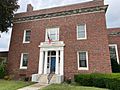
Westfield Athenaeum Children's Library Entrance

See also
 In Spanish: Westfield (Massachusetts) para niños
