
Wood County, Ohio facts for kids
Quick facts for kids
Wood County
|
|||
|---|---|---|---|
.jpg)
Wood County Courthouse and Jail in Bowling Green, Ohio
|
|||
|
|||

Location within the U.S. state of Ohio
|
|||
 Ohio's location within the U.S. |
|||
| Country | |||
| State | |||
| Founded | April 1, 1820 | ||
| Named for | Captain Eleazer D. Wood | ||
| Seat | Bowling Green | ||
| Largest city | Bowling Green | ||
| Area | |||
| • Total | 620 sq mi (1,600 km2) | ||
| • Land | 617 sq mi (1,600 km2) | ||
| • Water | 3.3 sq mi (9 km2) 0.5%% | ||
| Population
(2020)
|
|||
| • Total | 132,248 | ||
| • Density | 213.3/sq mi (82.4/km2) | ||
| Time zone | UTC−5 (Eastern) | ||
| • Summer (DST) | UTC−4 (EDT) | ||
| Congressional district | 5th | ||


Wood County is a county located in the U.S. state of Ohio. As of the 2020 census, the population was 132,248. Its county seat is Bowling Green. The county was named for Captain Eleazer D. Wood, the engineer for General William Henry Harrison's army, who built Fort Meigs in the War of 1812.
Wood County is part of the Toledo, OH Metropolitan Statistical Area. Its diagonal northwest border is formed by the Maumee River, which has its mouth at Maumee Bay on Lake Erie.
Contents
Geography
According to the U.S. Census Bureau, the county has a total area of 620 square miles (1,600 km2), of which 617 square miles (1,600 km2) is land and 3.3 square miles (8.5 km2) (0.5%) is water.
Adjacent counties
- Lucas County (north)
- Ottawa County (northeast)
- Sandusky County (east)
- Seneca County (southeast)
- Hancock County (south)
- Putnam County (southwest)
- Henry County (west)
Demographics
| Historical population | |||
|---|---|---|---|
| Census | Pop. | %± | |
| 1820 | 733 | — | |
| 1830 | 1,102 | 50.3% | |
| 1840 | 5,357 | 386.1% | |
| 1850 | 9,157 | 70.9% | |
| 1860 | 17,886 | 95.3% | |
| 1870 | 24,596 | 37.5% | |
| 1880 | 34,022 | 38.3% | |
| 1890 | 44,392 | 30.5% | |
| 1900 | 51,555 | 16.1% | |
| 1910 | 46,330 | −10.1% | |
| 1920 | 44,892 | −3.1% | |
| 1930 | 50,320 | 12.1% | |
| 1940 | 51,796 | 2.9% | |
| 1950 | 59,605 | 15.1% | |
| 1960 | 72,596 | 21.8% | |
| 1970 | 89,722 | 23.6% | |
| 1980 | 107,372 | 19.7% | |
| 1990 | 113,269 | 5.5% | |
| 2000 | 121,065 | 6.9% | |
| 2010 | 125,488 | 3.7% | |
| 2020 | 132,248 | 5.4% | |
| U.S. Decennial Census 1790-1960 1900-1990 1990-2000 2020 |
|||
2010 census
As of the 2010 United States Census, there were 125,488 people, 49,043 households, and 30,923 families living in the county. The population density was 203.3 inhabitants per square mile (78.5/km2). There were 53,376 housing units at an average density of 86.5 per square mile (33.4/km2). The racial makeup of the county was 92.8% white, 2.4% black or African American, 1.5% Asian, 0.2% American Indian, 1.3% from other races, and 1.7% from two or more races. Those of Hispanic or Latino origin made up 4.5% of the population. In terms of ancestry, 40.8% were German, 14.4% were Irish, 10.4% were English, 6.7% were Polish, and 5.2% were American.
Of the 49,043 households, 29.5% had children under the age of 18 living with them, 50.1% were married couples living together, 9.0% had a female householder with no husband present, 36.9% were non-families, and 27.5% of all households were made up of individuals. The average household size was 2.43 and the average family size was 2.98. The median age was 35.3 years.
The median income for a household in the county was $53,298 and the median income for a family was $69,768. Males had a median income of $51,038 versus $35,472 for females. The per capita income for the county was $26,671. About 6.4% of families and 12.2% of the population were below the poverty line, including 10.5% of those under age 18 and 6.3% of those age 65 or over.
Library
The Wood County District Public Library serves the county from its administrative offices in Bowling Green and a branch in Walbridge. In 2006, the library loaned 547,422 items and provided 1,121 programs to its patrons. Total holdings in 2006 were nearly 155,000 volumes with over 250 periodical subscriptions.
Communities

Cities
- Bowling Green (county seat)
- Fostoria
- Northwood
- Perrysburg
- Rossford
Villages
Townships
- Bloom
- Center
- Freedom
- Grand Rapids
- Henry
- Jackson
- Lake
- Liberty
- Middleton
- Milton
- Montgomery
- Perry
- Perrysburg
- Plain
- Portage
- Troy
- Washington
- Webster
- Weston
Census-designated places
Unincorporated communities
- Bates
- Bays
- Blake
- Bloom Center
- Christy
- Cloverdale
- Denver
- Digby
- Dowling
- Ducat
- Dunbridge
- Eagleville
- Five Points
- Galatea
- Hammansburg
- Hatton
- Hull Prairie
- Latcha
- Lemoyne
- Lime City
- Mermill
- Moline
- Mungen
- New Rochester
- Otsego
- Perry Center
- Roachton
- Scotch Ridge
- Six Points
- Stanley
- Sugar Ridge
- Trombley
- Wingston
- Woodside
Economy
According to the 2019 Wood County Comprehensive annual report, these were the largest employers in the county.
| # | Employer | # of employees |
|---|---|---|
| 1 | Bowling Green State University | 3,300 |
| 2 | Magna | 2,200 |
| 3 | First Solar, Inc | 1,200 |
| 4 | Owens Community College | 1,000 |
| 5 | Waltrust/Walgreen Company | 1,000 |
| 6 | Wood County Hospital | 875 |
| 7 | Wood County | 842 |
| 8 | FedEx Ground | 800 |
| 9 | Fiat Chrysler Automobiles | 800 |
| 10 | Home Depot | 750 |
Images for kids
-
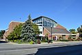
The main branch of the Wood County District Public Library

See also
 In Spanish: Condado de Wood (Ohio) para niños
